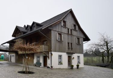
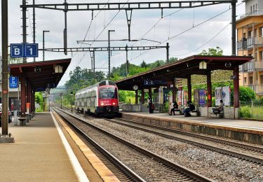
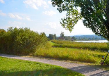
Trail Walking Uster - Uster - Fällander Tobel - Elefantenbachtobel - Zürich-Stadelhofen - Photo

Uster - Fällander Tobel - Elefantenbachtobel - Zürich-Stadelhofen

© OpenStreetMap contributors
Length
Length
24 km
Max alt
Max alt
679 m
Uphill gradient
Uphill gradient
465 m
Km-Effort
Km-Effort  
30 km
Min alt
Min alt
413 m
Downhill gradient
Downhill gradient
517 m
Boucle
Boucle
No
Creation date :
2016-11-13 00:00:00.0
Updated on :
2016-11-13 00:00:00.0

(0 Reviews)

Walking
Walking
5h24
Difficulty : Easy

Scan this QR Code to open this trail in the SityTrail application

FREE GPS app for hiking

Logo SityTrail SityTrail

IGN / Geographical institutes

Download SityTrail from the App Store Download SityTrail from Google Play

Logo SityTrail SityTrail World

The world is yours!

Download SityTrail from the App Store Download SityTrail from Google Play Download SityTrail on Huawei AppGallery

About

Trail Walking of 24 km to be discovered at Zurich, Bezirk Uster, Uster. This trail is proposed by NicolasEngelke.

Description

Die Wanderung fand am 12.Nov.2016 statt. Start war in Uster am Bahnhof. Von dort aus sind Sandro und Ich in Richtung des Greifensee Ufers gewandert. Dann ging es entlang des Sees über den Ort Greifensee nach Fällanden. Durch das Fällander Tobel ging es hinauf zum Blitzstein. Durch Pfannenstein liefen wir weiter zur Ruine Dübelstein. Das nächste Ziel war Geeren. Von dort aus wanderten wir über den Chatzenschwanz zum Elefantenbachtobel. Das Tobel ist sehenswert und der Elefant lädt zum Draufsitzen ein: Gibt ein tolles FB Titelbild. Das Ziel der Wanderung war Bahnhof Zürich-Stadelhofen.

Elevation profile

Positioning

Country:
Switzerland
Region :
Zurich
Department/Province :
Bezirk Uster
Municipality :
Uster
Location:
Unknown
Start:(UTM)
478652 ; 5244185 (32T) N.

Trails nearby

Trail On foot Gossau (ZH) - Wetzikon - Grüningen Haufland - Photo
On foot
GUIDE+

On foot

Easy
Gossau (ZH), Zurich, Bezirk Hinwil, Switzerland
4.2 km | 5.2 km-effort
1h 11min
No
Trail On foot Fehraltorf - Fehraltorf - Nänikon-Greifensee - Photo
On foot
GUIDE+

On foot

Easy
Fehraltorf, Zurich, Bezirk Pfäffikon, Switzerland
7.5 km | 9.2 km-effort
2h 5min
No
Trail On foot Fehraltorf - Fehraltorf - Pfäffikon - Photo
On foot
GUIDE+

On foot

Easy
Fehraltorf, Zurich, Bezirk Pfäffikon, Switzerland
4.1 km | 4.5 km-effort
1h 1min
No
Trail On foot Uster - Niederuster - Wetzikon - Photo
On foot
GUIDE+

On foot

Easy
Uster, Zurich, Bezirk Uster, Switzerland
12.7 km | 15.5 km-effort
3h 31min
No
Trail On foot Uster - Uster - Bubikon - Photo
On foot
GUIDE+

On foot

Easy
Uster, Zurich, Bezirk Uster, Switzerland
14.6 km | 17.9 km-effort
4h 4min
No
Trail On foot Gossau (ZH) - Gossau - Wetzikon - Photo
On foot
GUIDE+

On foot

Easy
Gossau (ZH), Zurich, Bezirk Hinwil, Switzerland
4.5 km | 6.4 km-effort
1h 27min
No
Trail On foot Mönchaltorf - Aaspitz - Grüningen Haufland - Photo
On foot
GUIDE+

On foot

Easy
Mönchaltorf, Zurich, Bezirk Uster, Switzerland
7.5 km | 8.5 km-effort
1h 55min
No
Trail On foot Uster - Uster - Pfannenstil Hochwacht - Photo
On foot
GUIDE+

On foot

Easy
Uster, Zurich, Bezirk Uster, Switzerland
12.2 km | 16.5 km-effort
3h 44min
No
Trail On foot Maur - Maur Schifflände - Pfannenstil Hochwacht - Photo
On foot
GUIDE+

On foot

Easy
Maur, Zurich, Bezirk Uster, Switzerland
4.8 km | 8 km-effort
1h 48min
No


Close
My subscriptions