


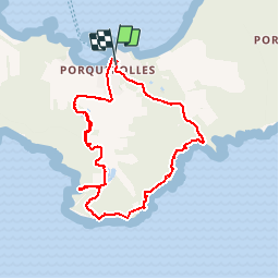


11,9 km | 14,2 km-effort

Benutzer


Kostenlosegpshiking-Anwendung
 SityTrail
IGN / Geografische Institute
SityTrail World
Die Welt öffnet sich für Sie
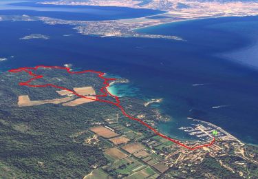
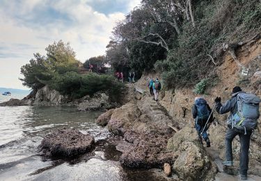
Tour Wandern von 9,5 km verfügbar auf Provence-Alpes-Côte d'Azur, Var, Hyères. Diese Tour wird von henriantoine vorgeschlagen.
Une des ombreuses possibilités de randonnée accessible en distance et en efforts a tout marcheurs normal. superbe boucles mettant en valeur la nature et les cotes maritimes superbes et sauvages de cette île attirante


Wandern

Wandern

Mountainbike

Wandern

Wandern
Zu Fuß
Wandern
Wandern
Wandern