


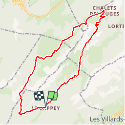

12,6 km | 21 km-effort

Benutzer GUIDE


Kostenlosegpshiking-Anwendung
 SityTrail
IGN / Geografische Institute
SityTrail World
Die Welt öffnet sich für Sie
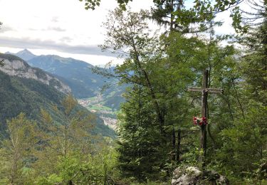
Tour Wandern von 19,1 km verfügbar auf Auvergne-Rhone-Alpen, Hochsavoyen, Thônes. Diese Tour wird von Kargil vorgeschlagen.
A démarrer par Le Sappey ou Le Crêt. Le sens importe peu mais le sens horaire est plus agréable.
Pas de difficulté particulière si ce n'est en amont du Col de la Buffaz très légèrement exposé.


Wandern

Wandern

Schneeschuhwandern

Wandern
Wandern
Wandern
Wandern

Wandern
Wandern