![](/images/other/stat-length.png)
![Tour Nordic Walking Senlisse - Vaux de Cernay - 02 06 2018 - Photo](https://media.geolcdn.com/t/1900/400/ext.pjpeg?maxdim=2&url=https%3A%2F%2Fservices.sitytrail.com%2FGeolivesWS%2FDownloadMedia.ashx%3FTrailID%3D978863%26Media%3D20180602132228.jpg)
Vaux de Cernay - 02 06 2018
olivier732
Benutzer
![Länge](/images/other/stat-length.png)
Länge
15 km
![Maximale Höhe](https://static1.geolcdn.com/siteimages/upload/files/1508320355ic_sort_altitude_max_24dp.png)
Maximale Höhe
189 m
![Positive Höhendifferenz](https://static1.geolcdn.com/siteimages/upload/files/1508320355ic_sort_den_pos_24dp.png)
Positive Höhendifferenz
306 m
![Km-Effort](/images/other/stat-length.png)
Km-Effort
19,1 km
![Min. Höhe](https://static1.geolcdn.com/siteimages/upload/files/1508320355ic_sort_altitude_min_24dp.png)
Min. Höhe
124 m
![Negative Höhendifferenz](https://static1.geolcdn.com/siteimages/upload/files/1508320355ic_sort_den_neg_24dp.png)
Negative Höhendifferenz
309 m
![Boucle](https://static1.geolcdn.com/siteimages/upload/files/16400158638029165_repeat_loop_refresh_sync_direction_icon.png)
Boucle
Ja
Erstellungsdatum :
2018-06-26 15:27:11.234
Letzte Änderung :
2018-06-26 15:27:11.234
![Nordic Walking](https://static1.geolcdn.com/sitytour/trail-icons/102.png)
3h11
Schwierigkeit : Medium
![Scannen Sie diesen QR-Code, um die Tour in der SityTrail-Anwendung zu öffnen](https://capi.geolives.com/qq0zvz2zws4bq2lad0pu/sitytour/trails/978863/qr.png?size=200)
Kostenlosegpshiking-Anwendung
Über SityTrail
Tour Nordic Walking von 15 km verfügbar auf Île-de-France, Yvelines, Senlisse. Diese Tour wird von olivier732 vorgeschlagen.
Beschreibung
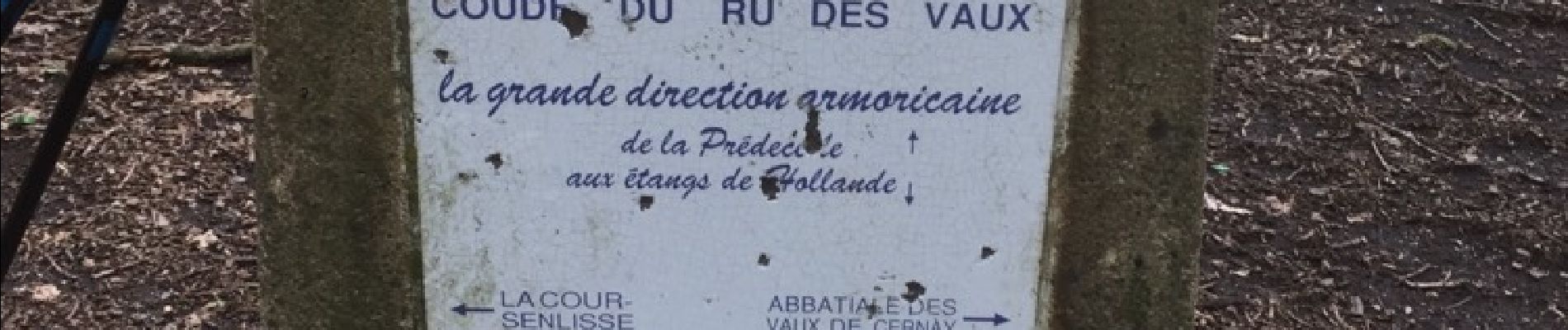
Une ballade dans la forêt. De très beaux chênes. D'autres parties plantées en pin avec sol sableux qui vous transportent dans le sud de la France.
Quelques bonnes montées et descentes.
Ort
Land:
France
Region :
Île-de-France
Abteilung/Provinz :
Yvelines
Kommune :
Senlisse
Standort:
Unknown
Gehen Sie:(Dec)
Gehen Sie:(UTM)
423862 ; 5393460 (31U) N.
Kommentare
Touren in der Umgebung
![Tour Wandern Dampierre-en-Yvelines - _La Genèse - Photo](https://media.geolcdn.com/t/375/260/ext.jpg?maxdim=2&url=https%3A%2F%2Fservices.sitytrail.com%2FGeolivesWS%2FDownloadMedia.ashx%3FTrailID%3D746353%26Media%3D852eb799-755d-4473-ad2a-667c4a68a14c.jpg)
![Wandern Wandern](https://static1.geolcdn.com/sitytour/trail-icons/101.png)
_La Genèse
Wandern
Einfach
(12)
Dampierre-en-Yvelines,
Île-de-France,
Yvelines,
France
![](/images/other/stat-length.png)
5,7 km | 7,1 km-effort
1h 30min
![](https://static1.geolcdn.com/siteimages/upload/files/16400158638029165_repeat_loop_refresh_sync_direction_icon.png)
Ja
![Tour Wandern Dampierre-en-Yvelines - _Villages par mont et par vaux - Photo](https://media.geolcdn.com/t/375/260/ext.jpg?maxdim=2&url=https%3A%2F%2Fservices.sitytrail.com%2FGeolivesWS%2FDownloadMedia.ashx%3FTrailID%3D172084%26Media%3D1ba0ac7a-e5bc-4661-87da-e3aa68337b06.jpg)
![Wandern Wandern](https://static1.geolcdn.com/sitytour/trail-icons/101.png)
_Villages par mont et par vaux
Wandern
Einfach
(9)
Dampierre-en-Yvelines,
Île-de-France,
Yvelines,
France
![](/images/other/stat-length.png)
5,3 km | 7 km-effort
1h 26min
![](https://static1.geolcdn.com/siteimages/upload/files/16400158638029165_repeat_loop_refresh_sync_direction_icon.png)
Ja
![Tour Wandern Cernay-la-Ville - _Senlisse dans un écrin de verdure - Photo](https://media.geolcdn.com/t/375/260/ext.jpg?maxdim=2&url=https%3A%2F%2Fservices.sitytrail.com%2FGeolivesWS%2FDownloadMedia.ashx%3FTrailID%3D172082%26Media%3D58eba867-baea-4143-80e9-e47f03036c03.jpg)
![Wandern Wandern](https://static1.geolcdn.com/sitytour/trail-icons/101.png)
_Senlisse dans un écrin de verdure
Wandern
Einfach
(12)
Cernay-la-Ville,
Île-de-France,
Yvelines,
France
![](/images/other/stat-length.png)
4,5 km | 5,7 km-effort
1h 30min
![](https://static1.geolcdn.com/siteimages/upload/files/16400158638029165_repeat_loop_refresh_sync_direction_icon.png)
Ja
![Tour Wandern Saint-Forget - _Saint-Forget, fief de Cyrano de Bergerac - Photo](https://media.geolcdn.com/t/375/260/ext.jpg?maxdim=2&url=https%3A%2F%2Fservices.sitytrail.com%2FGeolivesWS%2FDownloadMedia.ashx%3FTrailID%3D172086%26Media%3D7b590dd2-7d00-4099-a55f-664d59f11356.jpg)
![Wandern Wandern](https://static1.geolcdn.com/sitytour/trail-icons/101.png)
_Saint-Forget, fief de Cyrano de Bergerac
Wandern
Medium
(12)
Saint-Forget,
Île-de-France,
Yvelines,
France
![](/images/other/stat-length.png)
8,5 km | 10,9 km-effort
2h 15min
![](https://static1.geolcdn.com/siteimages/upload/files/16400158638029165_repeat_loop_refresh_sync_direction_icon.png)
Ja
![Tour Wandern Cernay-la-Ville - _Moulins des vaux de Cernay - Photo](https://media.geolcdn.com/t/375/260/ext.jpg?maxdim=2&url=https%3A%2F%2Fservices.sitytrail.com%2FGeolivesWS%2FDownloadMedia.ashx%3FTrailID%3D792341%26Media%3D9a8eb0df-2390-435a-866e-b0dd9677df49.JPG)
![Wandern Wandern](https://static1.geolcdn.com/sitytour/trail-icons/101.png)
_Moulins des vaux de Cernay
Wandern
Einfach
(9)
Cernay-la-Ville,
Île-de-France,
Yvelines,
France
![](/images/other/stat-length.png)
6,3 km | 7,8 km-effort
2h 0min
![](https://static1.geolcdn.com/siteimages/upload/files/16400158638029165_repeat_loop_refresh_sync_direction_icon.png)
Ja
![Tour Wandern Lévis-Saint-Nom - _Le Vallon du Pommeret - Photo](https://media.geolcdn.com/t/375/260/ext.jpg?maxdim=2&url=https%3A%2F%2Fservices.sitytrail.com%2FGeolivesWS%2FDownloadMedia.ashx%3FTrailID%3D172087%26Media%3D296168f6-bac5-406d-9015-aae13e393b5e.jpg)
![Wandern Wandern](https://static1.geolcdn.com/sitytour/trail-icons/101.png)
_Le Vallon du Pommeret
Wandern
Einfach
(11)
Lévis-Saint-Nom,
Île-de-France,
Yvelines,
France
![](/images/other/stat-length.png)
6,3 km | 8 km-effort
1h 30min
![](https://static1.geolcdn.com/siteimages/upload/files/16400158638029165_repeat_loop_refresh_sync_direction_icon.png)
Ja
![Tour Wandern Choisel - _Si Choisel m'était conté - Photo](https://media.geolcdn.com/t/375/260/ext.jpg?maxdim=2&url=https%3A%2F%2Fservices.sitytrail.com%2FGeolivesWS%2FDownloadMedia.ashx%3FTrailID%3D172083%26Media%3De60082f0-edf4-45f4-997a-35e9c7c799de.jpg)
![Wandern Wandern](https://static1.geolcdn.com/sitytour/trail-icons/101.png)
_Si Choisel m'était conté
Wandern
Einfach
(8)
Choisel,
Île-de-France,
Yvelines,
France
![](/images/other/stat-length.png)
5,6 km | 6,6 km-effort
1h 27min
![](https://static1.geolcdn.com/siteimages/upload/files/16400158638029165_repeat_loop_refresh_sync_direction_icon.png)
Ja
![Tour Wandern Senlisse - _Sentier découverte des maréchaux - Photo](https://media.geolcdn.com/t/375/260/ext.jpg?maxdim=2&url=https%3A%2F%2Fservices.sitytrail.com%2FGeolivesWS%2FDownloadMedia.ashx%3FTrailID%3D792820%26Media%3D3d8a65e5-a46f-42a3-8cf9-3bcb3c260e3a.png)
![Wandern Wandern](https://static1.geolcdn.com/sitytour/trail-icons/101.png)
_Sentier découverte des maréchaux
Wandern
Einfach
(4)
Senlisse,
Île-de-France,
Yvelines,
France
![](/images/other/stat-length.png)
4,3 km | 5,4 km-effort
1h 12min
![](https://static1.geolcdn.com/siteimages/upload/files/16400158638029165_repeat_loop_refresh_sync_direction_icon.png)
Ja
![Tour Wandern Cernay-la-Ville - _Les Vaux de Cernay - Photo](https://media.geolcdn.com/t/375/260/ext.jpg?maxdim=2&url=https%3A%2F%2Fservices.sitytrail.com%2FGeolivesWS%2FDownloadMedia.ashx%3FTrailID%3D749401%26Media%3Dc6641060-57a7-4acc-af16-2a691ac9313e.JPG)
![Wandern Wandern](https://static1.geolcdn.com/sitytour/trail-icons/101.png)
_Les Vaux de Cernay
Wandern
Medium
(3)
Cernay-la-Ville,
Île-de-France,
Yvelines,
France
![](/images/other/stat-length.png)
8,4 km | 10,4 km-effort
2h 15min
![](https://static1.geolcdn.com/siteimages/upload/files/16400158638029165_repeat_loop_refresh_sync_direction_icon.png)
Ja