Tour Wandern Buhy - Buhy/ Le Vaumion - Photo
 cchantal95
cchantal95

Benutzer

© OpenStreetMap contributors
Länge
Länge
11,9 km
Maximale Höhe
Maximale Höhe
161 m
Positive Höhendifferenz
159 m
Km-Effort
Km-Effort  
14 km
Min. Höhe
Min. Höhe
91 m
Negative Höhendifferenz
158 m
Boucle
Boucle
Ja
Erstellungsdatum :
2019-04-24 11:26:39.629
Letzte Änderung :
2019-04-24 11:26:39.751

(0 Nachricht)

Wandern
Wandern
2h30
Schwierigkeit : Medium

Scannen Sie diesen QR-Code, um die Tour in der SityTrail-Anwendung zu öffnen

Kostenlosegpshiking-Anwendung

Logo SityTrail SityTrail

IGN / Geografische Institute

SityTrail aus dem App Store herunterladen SityTrail von Google Play herunterladen

Logo SityTrail SityTrail World

Die Welt öffnet sich für Sie

SityTrail aus dem App Store herunterladen SityTrail von Google Play herunterladen SityTrail auf Huawei AppGallery herunterladen

Über SityTrail

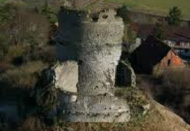
Tour Wandern von 11,9 km verfügbar auf Île-de-France, Val-d'Oise, Buhy. Diese Tour wird von cchantal95 vorgeschlagen.

Beschreibung

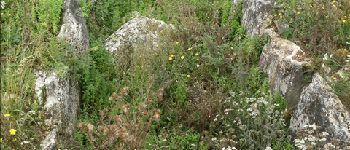
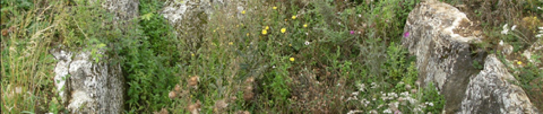
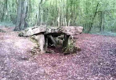
Départ de Buhy, en direction de la Chapelle, le bois Haranger, Le Vaumion, retour par Copierres et son Allée Couverte.

Höhenprofil

Foto-Galerie

POIs

POI Montreuil-sur-Epte - Allée couverte - Photo
cchantal95
MONTREUIL-SUR-EPTE 
POI Montreuil-sur-Epte - Croix penchée - Photo
cchantal95
MONTREUIL-SUR-EPTE 
POI La Chapelle-en-Vexin - Bois des Bouleaux - Photo
cchantal95
LA CHAPELLE-EN-VEXIN 
POI Buhy - Parking - Photo
cchantal95
BUHY 
POI Ambleville - Champ à l'oignon - Photo
cchantal95
AMBLEVILLE 
POI Buhy - BUHY - Photo
cchantal95
BUHY 

Ort

Land:
France
Region :
Île-de-France
Abteilung/Provinz :
Val-d'Oise
Kommune :
Buhy
Standort:
Unknown
Gehen Sie:(Dec)
Gehen Sie:(UTM)
404739 ; 5449769 (31U) N.

Kommentare

Bitte melden Sie sich an, um einen Kommentar oder eine Bewertung zu hinterlassen


tres agreable


Touren in der Umgebung

Tour Wandern Château-sur-Epte - Château sur Epte - Berthenonville - Photo
Wandern
marcel.F

Wandern

Einfach
(1)
Château-sur-Epte, Normandie, Eure, France
7,8 km | 9,5 km-effort
2h 7min
Ja
Tour Wandern Château-sur-Epte - Château sur Epte - Rollon Nord - Photo
Wandern
marcel.F

Wandern

Einfach
(1)
Château-sur-Epte, Normandie, Eure, France
8,4 km | 10,2 km-effort
2h 2min
Ja
Tour Wandern Vaudancourt - Vaudancourt - Breuil et Boury - Photo
Wandern
marcel.F

Wandern

Einfach
(1)
Vaudancourt, Nordfrankreich, Oise, France
11,8 km | 14,3 km-effort
3h 5min
Ja
Tour Wandern Vexin-sur-Epte - Château sur Epte variante par pierre tournante - Photo
Wandern
Fky78

Wandern

Einfach
(1)
Vexin-sur-Epte, Normandie, Eure, France
9,8 km | 12,1 km-effort
2h 30min
Ja
Tour Nordic Walking Authevernes - MN 57 Authevernes - Photo
Nordic Walking
marcel.F

Nordic Walking

Einfach
(1)
Authevernes, Normandie, Eure, France
8,5 km | 10,1 km-effort
1h 30min
Ja
Tour Wandern La Chapelle-en-Vexin - la chapelle  en vexin - Photo
Wandern
LANDRIEU

Wandern

Medium
(1)
La Chapelle-en-Vexin, Île-de-France, Val-d'Oise, France
13,9 km | 16,9 km-effort
3h 35min
Ja
Tour Wandern Guerny - Gisancourt - Notre Dame du Chêne - Photo
Wandern
marcel.F

Wandern

Einfach
(2)
Guerny, Normandie, Eure, France
11,6 km | 13,9 km-effort
3h 2min
Ja
Tour Wandern Parnes - Parnes - La ferme Chaudry - Photo
Wandern
marcel.F

Wandern

Einfach
(2)
Parnes, Nordfrankreich, Oise, France
10,4 km | 13 km-effort
2h 49min
Ja
Tour Wandern Vexin-sur-Epte - Berthenonville Dampsmesni  la côte aux chiens - Photo
Wandern
serge.guerroult

Wandern

Medium
(1)
Vexin-sur-Epte, Normandie, Eure, France
9,5 km | 12,7 km-effort
2h 16min
Ja


Schließen
Meine Abonnements