


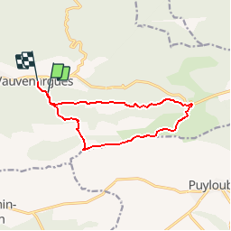

15,8 km | 28 km-effort


Benutzer


Kostenlosegpshiking-Anwendung
 SityTrail
IGN / Geografische Institute
SityTrail World
Die Welt öffnet sich für Sie
Tour Wandern von 12,3 km verfügbar auf Provence-Alpes-Côte d'Azur, Bouches-du-Rhône, Vauvenargues. Diese Tour wird von pourrier vorgeschlagen.
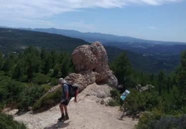
Randonnées sur la crête de la Sainte Victoire depuis Vauvenargues, le Pic des Mouches, le col des Portes.
Chaines pour le passage du Bau de l'aigle bien appréciées car fin novembreles roches restent à l'ombre et sont très glissantes.

Wandern

Wandern

Wandern

Wandern

Zu Fuß

Wandern
Wandern

Wandern

Wandern
moyen