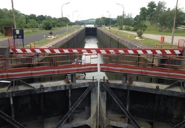
19,9 km | 26 km-effort
Pont A Mousson Habaye Sainte Marie
patrick57
Benutzer
Länge
15,1 km
Maximale Höhe
373 m
Positive Höhendifferenz
304 m
Km-Effort
19,1 km
Min. Höhe
228 m
Negative Höhendifferenz
306 m
Boucle
Ja
Erstellungsdatum :
2014-12-10 00:00:00.0
Letzte Änderung :
2014-12-10 00:00:00.0
--
Schwierigkeit : Medium
Kostenlosegpshiking-Anwendung
Über SityTrail
Tour Fahrrad von 15,1 km verfügbar auf Großer Osten, Mörthe und Mosel, Vilcey-sur-Trey. Diese Tour wird von patrick57 vorgeschlagen.
Ort
Land:
France
Region :
Großer Osten
Abteilung/Provinz :
Mörthe und Mosel
Kommune :
Vilcey-sur-Trey
Standort:
Unknown
Gehen Sie:(Dec)
Gehen Sie:(UTM)
718120 ; 5425307 (31U) N.
Kommentare
Touren in der Umgebung
Pose balises V3
Mountainbike
Medium
(1)
Moselbrück,
Großer Osten,
Mörthe und Mosel,
France
2h 1min
Nein
Pagny sur Moselle
Wandern
Sehr leicht
(1)
Pagny-sur-Moselle,
Großer Osten,
Mörthe und Mosel,
France
18,1 km | 23 km-effort
4h 55min
Ja
essai 4 LEVO SL
Mountainbike
Schwierig
Moselbrück,
Großer Osten,
Mörthe und Mosel,
France
58 km | 77 km-effort
3h 29min
Ja
PAGNY SUR MOSELLE - VAL ET PLATEAU
Wandern
Medium
Pagny-sur-Moselle,
Großer Osten,
Mörthe und Mosel,
France
18,1 km | 23 km-effort
6h 46min
Ja
Forêt de Preny dévastée quelle dommage
Wandern
Medium
Prény,
Großer Osten,
Mörthe und Mosel,
France
7,4 km | 9,7 km-effort
1h 14min
Nein
Marche Prény 2017
Wandern
Medium
(1)
Prény,
Großer Osten,
Mörthe und Mosel,
France
9,5 km | 13 km-effort
2h 41min
Ja
Vélo et Nature 2014 - Pagny sur Moselle
Mountainbike
Medium
Pagny-sur-Moselle,
Großer Osten,
Mörthe und Mosel,
France
34 km | 43 km-effort
2h 0min
Ja
Pagny-sur-Moselle
Wandern
Einfach
Pagny-sur-Moselle,
Großer Osten,
Mörthe und Mosel,
France
11 km | 11,7 km-effort
3h 0min
Ja
Les villages du Saillant de St-Mihiel, aux portes de Pontà-Mousson. - Circuit...
Mountainbike
Schwierig
Vilcey-sur-Trey,
Großer Osten,
Mörthe und Mosel,
France
47 km | 56 km-effort
2h 30min
Ja