![](/images/other/stat-length.png)
![Tour Wandern Die - Ausson - Montagne de Gavet (Diois) - Photo](https://media.geolcdn.com/t/1900/400/3bd4ac67-3332-4334-9725-a04102d54a96.jpg&format=pjpeg&maxdim=2)
Ausson - Montagne de Gavet (Diois)
Philindy26
Benutzer
![Länge](/images/other/stat-length.png)
![Maximale Höhe](https://static1.geolcdn.com/siteimages/upload/files/1508320355ic_sort_altitude_max_24dp.png)
![Positive Höhendifferenz](https://static1.geolcdn.com/siteimages/upload/files/1508320355ic_sort_den_pos_24dp.png)
![Km-Effort](/images/other/stat-length.png)
![Min. Höhe](https://static1.geolcdn.com/siteimages/upload/files/1508320355ic_sort_altitude_min_24dp.png)
![Negative Höhendifferenz](https://static1.geolcdn.com/siteimages/upload/files/1508320355ic_sort_den_neg_24dp.png)
![Boucle](https://static1.geolcdn.com/siteimages/upload/files/16400158638029165_repeat_loop_refresh_sync_direction_icon.png)
![Wandern](https://static1.geolcdn.com/sitytour/trail-icons/101.png)
5h29
Schwierigkeit : Schwierig
![Scannen Sie diesen QR-Code, um die Tour in der SityTrail-Anwendung zu öffnen](https://capi.geolives.com/qq0zvz2zws4bq2lad0pu/sitytour/trails/948233/qr.png?size=200)
Kostenlosegpshiking-Anwendung
Über SityTrail
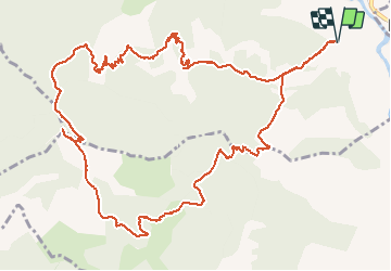
Tour Wandern von 15,7 km verfügbar auf Auvergne-Rhone-Alpen, Drôme, Die. Diese Tour wird von Philindy26 vorgeschlagen.
Beschreibung
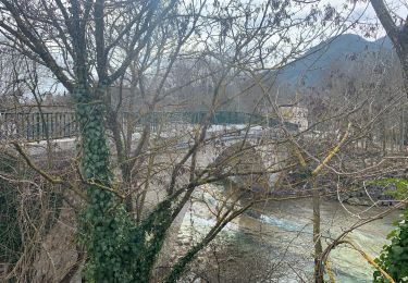
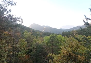
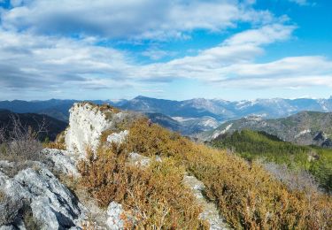
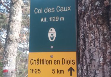
Départ de Ausson route départemental n° 244, montée par les Granges (525m), Beauvoisin (803m), le Pas du Renard (955m), le Pas de Damiane (994m), le Petit Justin (1020m), le Col de Beaufayn (1099m), le Pas du Loup (1230m) et arrivée sur le sommet de Gavet (1244m). Là un magnifique panorama s'offre à nous. Le retour s'effectue par le Pas du Loup puis direction les Quatres Chemins (1150m), la Plaine (1120m), la Combe Obscure (1020m) et la Ferme d'Ausson (491m).
Ort
Kommentare
Touren in der Umgebung
![Tour Wandern Die - 26 belle justine - Photo](https://media.geolcdn.com/t/375/260/5057e97e-3818-4f77-b8e2-efbcea6a0e32.jpg&format=jpg&maxdim=2)
![Wandern Wandern](https://static1.geolcdn.com/sitytour/trail-icons/101.png)
Wandern
![](/images/other/stat-length.png)
![](https://static1.geolcdn.com/siteimages/upload/files/16400158638029165_repeat_loop_refresh_sync_direction_icon.png)
![Tour Wandern Die - Chapia Belle Justine - Photo](https://media.geolcdn.com/t/375/260/ext.jpg?maxdim=2&url=https%3A%2F%2Fstatic1.geolcdn.com%2Fsiteimages%2Fupload%2Ffiles%2F1553511878bg_sport_marche.png)
![Wandern Wandern](https://static1.geolcdn.com/sitytour/trail-icons/101.png)
Wandern
![](/images/other/stat-length.png)
![](https://static1.geolcdn.com/siteimages/upload/files/16400158638029165_repeat_loop_refresh_sync_direction_icon.png)
![Tour sport Die - Val croissant comptoir des moutons - Photo](https://media.geolcdn.com/t/375/260/3b919326-2e50-400f-bc15-c6be506dcde0.jpg&format=jpg&maxdim=2)
sport
![](/images/other/stat-length.png)
![](https://static1.geolcdn.com/siteimages/upload/files/16400158638029165_repeat_loop_refresh_sync_direction_icon.png)
![Tour Wandern Die - Abbaye de Valcroissant - Photo](https://media.geolcdn.com/t/375/260/a9356d67-59c3-4251-97a5-c480f0ff70f4.jpg&format=jpg&maxdim=2)
![Wandern Wandern](https://static1.geolcdn.com/sitytour/trail-icons/101.png)
Wandern
![](/images/other/stat-length.png)
![](https://static1.geolcdn.com/siteimages/upload/files/16400158638029165_repeat_loop_refresh_sync_direction_icon.png)
![Tour sport Die - Croix de Justin , Ausson - Photo](https://media.geolcdn.com/t/375/260/c8090ee5-5a94-4ee1-b2d3-2c37d8bd6d5e.jpg&format=jpg&maxdim=2)
sport
![](/images/other/stat-length.png)
![](https://static1.geolcdn.com/siteimages/upload/files/16400158638029165_repeat_loop_refresh_sync_direction_icon.png)
![Tour Wandern Die - Autour de Die balade - Photo](https://media.geolcdn.com/t/375/260/15325a9b-7fbc-4b3a-b6b0-e43c7d169006.jpg&format=jpg&maxdim=2)
![Wandern Wandern](https://static1.geolcdn.com/sitytour/trail-icons/101.png)
Wandern
![](/images/other/stat-length.png)
![](https://static1.geolcdn.com/siteimages/upload/files/16400158638029165_repeat_loop_refresh_sync_direction_icon.png)
![Tour Wandern Die - Tour Abbaye Val Croissant - Photo](https://media.geolcdn.com/t/375/260/a03f9356-ba67-4c89-83cb-2b5b84968cb8.jpg&format=jpg&maxdim=2)
![Wandern Wandern](https://static1.geolcdn.com/sitytour/trail-icons/101.png)
Wandern
![](/images/other/stat-length.png)
![](https://static1.geolcdn.com/siteimages/upload/files/16400158638029165_repeat_loop_refresh_sync_direction_icon.png)
![Tour Wandern Die - la Belle Justine ( rando Asptt) - Photo](https://media.geolcdn.com/t/375/260/dba17583-f5f7-4abd-b0fb-86b9ff43722e.jpg&format=jpg&maxdim=2)
![Wandern Wandern](https://static1.geolcdn.com/sitytour/trail-icons/101.png)
Wandern
![](/images/other/stat-length.png)
![](https://static1.geolcdn.com/siteimages/upload/files/16400158638029165_repeat_loop_refresh_sync_direction_icon.png)
![Tour Wandern Die - Abbaye Val croissant - Chatillon en diois - Photo](https://media.geolcdn.com/t/375/260/decff8a0-8389-400f-be19-ef575d278e3e.jpg&format=jpg&maxdim=2)
![Wandern Wandern](https://static1.geolcdn.com/sitytour/trail-icons/101.png)
Wandern
![](/images/other/stat-length.png)
![](https://static1.geolcdn.com/siteimages/upload/files/16400158638029165_repeat_loop_refresh_sync_direction_icon.png)