![](/images/other/stat-length.png)
![Tour Schneeschuhwandern Railleu - Maximale Col de Creu - Photo](https://media.geolcdn.com/t/1900/400/ext.pjpeg?maxdim=2&url=https%3A%2F%2Fservices.sitytrail.com%2FGeolivesWS%2FDownloadMedia.ashx%3FTrailID%3D922253%26Media%3Dfix__20180313153146.jpg)
Maximale Col de Creu
MarieFrancoise
Benutzer
![Länge](/images/other/stat-length.png)
Länge
16,7 km
![Maximale Höhe](https://static1.geolcdn.com/siteimages/upload/files/1508320355ic_sort_altitude_max_24dp.png)
Maximale Höhe
1918 m
![Positive Höhendifferenz](https://static1.geolcdn.com/siteimages/upload/files/1508320355ic_sort_den_pos_24dp.png)
Positive Höhendifferenz
644 m
![Km-Effort](/images/other/stat-length.png)
Km-Effort
26 km
![Min. Höhe](https://static1.geolcdn.com/siteimages/upload/files/1508320355ic_sort_altitude_min_24dp.png)
Min. Höhe
1500 m
![Negative Höhendifferenz](https://static1.geolcdn.com/siteimages/upload/files/1508320355ic_sort_den_neg_24dp.png)
Negative Höhendifferenz
748 m
![Boucle](https://static1.geolcdn.com/siteimages/upload/files/16400158638029165_repeat_loop_refresh_sync_direction_icon.png)
Boucle
Nein
Erstellungsdatum :
2019-05-27 16:40:07.95
Letzte Änderung :
2019-05-27 16:40:08.062
![Schneeschuhwandern](https://static1.geolcdn.com/sitytour/trail-icons/504.png)
4h55
Schwierigkeit : Medium
![Scannen Sie diesen QR-Code, um die Tour in der SityTrail-Anwendung zu öffnen](https://capi.geolives.com/qq0zvz2zws4bq2lad0pu/sitytour/trails/922253/qr.png?size=200)
Kostenlosegpshiking-Anwendung
Über SityTrail
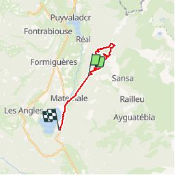
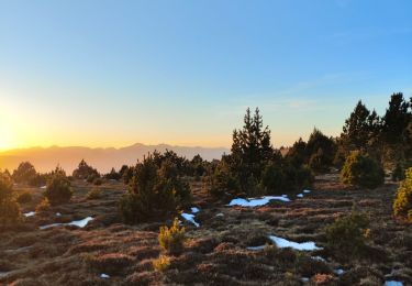
Tour Schneeschuhwandern von 16,7 km verfügbar auf Okzitanien, Ostpyrenäen, Railleu. Diese Tour wird von MarieFrancoise vorgeschlagen.
Beschreibung
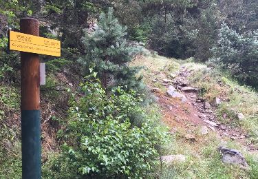
Départ du parking du Col de Creu
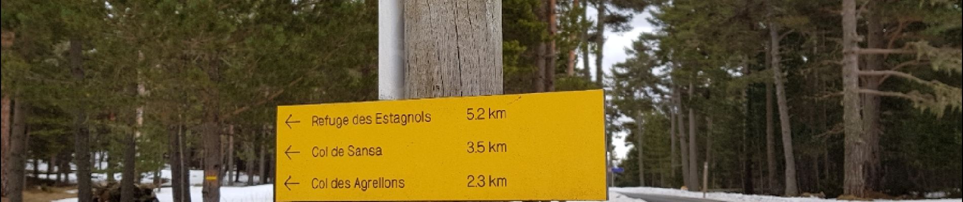
passer par le Puig des Agrellons puis le Col de la Sansa.semi a/R
aller au refuge des Estagnols revenir par les Bergeries du Pla de L Orry
Ort
Land:
France
Region :
Okzitanien
Abteilung/Provinz :
Ostpyrenäen
Kommune :
Railleu
Standort:
Unknown
Gehen Sie:(Dec)
Gehen Sie:(UTM)
429315 ; 4717114 (31T) N.
Kommentare
Touren in der Umgebung
![Tour Schneeschuhwandern Réal - madres - Photo](https://media.geolcdn.com/t/375/260/ext.jpg?maxdim=2&url=https%3A%2F%2Fservices.sitytrail.com%2FGeolivesWS%2FDownloadMedia.ashx%3FTrailID%3D249260%26Media%3Dfix__20140208163554.jpg)
![Schneeschuhwandern Schneeschuhwandern](https://static1.geolcdn.com/sitytour/trail-icons/504.png)
madres
Schneeschuhwandern
Schwierig
(1)
Réal,
Okzitanien,
Ostpyrenäen,
France
![](/images/other/stat-length.png)
13,1 km | 26 km-effort
6h 48min
![](https://static1.geolcdn.com/siteimages/upload/files/16400158638029165_repeat_loop_refresh_sync_direction_icon.png)
Ja
![Tour Wandern Railleu - 20230312 Boucle depuis Railleu - Photo](https://media.geolcdn.com/t/375/260/6ec33acc-251f-45d6-baf5-f5b7fe74b26f.jpg&format=jpg&maxdim=2)
![Wandern Wandern](https://static1.geolcdn.com/sitytour/trail-icons/101.png)
20230312 Boucle depuis Railleu
Wandern
Medium
Railleu,
Okzitanien,
Ostpyrenäen,
France
![](/images/other/stat-length.png)
15,8 km | 25 km-effort
4h 27min
![](https://static1.geolcdn.com/siteimages/upload/files/16400158638029165_repeat_loop_refresh_sync_direction_icon.png)
Ja
![Tour Wandern Formiguères - 20210710 pla del bosc - Foumigueres - Photo](https://media.geolcdn.com/t/375/260/1179261a-6605-4660-a8d9-78a9473ad380.jpg&format=jpg&maxdim=2)
![Wandern Wandern](https://static1.geolcdn.com/sitytour/trail-icons/101.png)
20210710 pla del bosc - Foumigueres
Wandern
Einfach
Formiguères,
Okzitanien,
Ostpyrenäen,
France
![](/images/other/stat-length.png)
12,5 km | 18,3 km-effort
2h 47min
![](https://static1.geolcdn.com/siteimages/upload/files/16400158638029165_repeat_loop_refresh_sync_direction_icon.png)
Ja
![Tour Schneeschuhwandern Formiguères - Formigueres el collet - Photo](https://media.geolcdn.com/t/375/260/fd8d553e-fbbc-4eac-9bcd-8fe4718e94f2.jpg&format=jpg&maxdim=2)
![Schneeschuhwandern Schneeschuhwandern](https://static1.geolcdn.com/sitytour/trail-icons/504.png)
Formigueres el collet
Schneeschuhwandern
Sehr leicht
Formiguères,
Okzitanien,
Ostpyrenäen,
France
![](/images/other/stat-length.png)
6,4 km | 8,7 km-effort
2h 47min
![](https://static1.geolcdn.com/siteimages/upload/files/16400158638029165_repeat_loop_refresh_sync_direction_icon.png)
Ja
![Tour Schneeschuhwandern Matemale - Tour lac mattemale neige - Photo](https://media.geolcdn.com/t/375/260/46aed13f-af74-4409-96af-d8ee48a8d1a0.jpg&format=jpg&maxdim=2)
![Schneeschuhwandern Schneeschuhwandern](https://static1.geolcdn.com/sitytour/trail-icons/504.png)
Tour lac mattemale neige
Schneeschuhwandern
Sehr leicht
Matemale,
Okzitanien,
Ostpyrenäen,
France
![](/images/other/stat-length.png)
9,1 km | 10,4 km-effort
3h 5min
![](https://static1.geolcdn.com/siteimages/upload/files/16400158638029165_repeat_loop_refresh_sync_direction_icon.png)
Ja
![Tour Wandern Réal - Madres depuis Odeillo-Real - Photo](https://media.geolcdn.com/t/375/260/ext.jpg?maxdim=2&url=https%3A%2F%2Fservices.sitytrail.com%2FGeolivesWS%2FDownloadMedia.ashx%3FTrailID%3D609128%26Media%3D20160805083857.jpg)
![Wandern Wandern](https://static1.geolcdn.com/sitytour/trail-icons/101.png)
Madres depuis Odeillo-Real
Wandern
Medium
Réal,
Okzitanien,
Ostpyrenäen,
France
![](/images/other/stat-length.png)
18,1 km | 32 km-effort
6h 10min
![](https://static1.geolcdn.com/siteimages/upload/files/16400158638029165_repeat_loop_refresh_sync_direction_icon.png)
Ja
![Tour Schneeschuhwandern Réal - PIC MADRES - Photo](https://media.geolcdn.com/t/375/260/ext.jpg?maxdim=2&url=https%3A%2F%2Fservices.sitytrail.com%2FGeolivesWS%2FDownloadMedia.ashx%3FTrailID%3D333310%26Media%3Dfix__20140208163554.jpg)
![Schneeschuhwandern Schneeschuhwandern](https://static1.geolcdn.com/sitytour/trail-icons/504.png)
PIC MADRES
Schneeschuhwandern
Schwierig
Réal,
Okzitanien,
Ostpyrenäen,
France
![](/images/other/stat-length.png)
13,1 km | 26 km-effort
6h 48min
![](https://static1.geolcdn.com/siteimages/upload/files/16400158638029165_repeat_loop_refresh_sync_direction_icon.png)
Ja
![Tour Mountainbike Railleu - la couillue - Photo](https://media.geolcdn.com/t/375/260/ext.jpg?maxdim=2&url=https%3A%2F%2Fservices.sitytrail.com%2FGeolivesWS%2FDownloadMedia.ashx%3FTrailID%3D330610%26Media%3Dfix__20140803145941.jpg)
![Mountainbike Mountainbike](https://static1.geolcdn.com/sitytour/trail-icons/202.png)
la couillue
Mountainbike
Sehr schwierig
(1)
Railleu,
Okzitanien,
Ostpyrenäen,
France
![](/images/other/stat-length.png)
34 km | 50 km-effort
5h 31min
![](https://static1.geolcdn.com/siteimages/upload/files/16400158638029165_repeat_loop_refresh_sync_direction_icon.png)
Nein
![Tour Wandern Railleu - refuge de la perdrix - Photo](https://media.geolcdn.com/t/375/260/accebc35-7569-48a9-9d1a-c6f2c0c31945.jpg&format=jpg&maxdim=2)
![Wandern Wandern](https://static1.geolcdn.com/sitytour/trail-icons/101.png)
refuge de la perdrix
Wandern
Sehr schwierig
Railleu,
Okzitanien,
Ostpyrenäen,
France
![](/images/other/stat-length.png)
18,1 km | 31 km-effort
5h 29min
![](https://static1.geolcdn.com/siteimages/upload/files/16400158638029165_repeat_loop_refresh_sync_direction_icon.png)
Nein