Tour Rennrad Gap - C18 - Les Trois Cols - Photo

Les Hautes Alpes à découvrir ! GUIDE+

© OpenStreetMap contributors
Länge
Länge
93 km
Maximale Höhe
Maximale Höhe
1720 m
Positive Höhendifferenz
2990 m
Km-Effort
Km-Effort  
132 km
Min. Höhe
Min. Höhe
619 m
Negative Höhendifferenz
2989 m
Boucle
Boucle
Ja
Erstellungsdatum :
2018-03-23 05:39:49.209
Letzte Änderung :
2019-05-13 13:16:05.466

(0 Nachricht)

Rennrad
Rennrad
7h07
Schwierigkeit : Sehr schwierig

Scannen Sie diesen QR-Code, um die Tour in der SityTrail-Anwendung zu öffnen

Kostenlosegpshiking-Anwendung

Logo SityTrail SityTrail

IGN / Geografische Institute

SityTrail aus dem App Store herunterladen SityTrail von Google Play herunterladen

Logo SityTrail SityTrail World

Die Welt öffnet sich für Sie

SityTrail aus dem App Store herunterladen SityTrail von Google Play herunterladen SityTrail auf Huawei AppGallery herunterladen

Über SityTrail

Tour Rennrad von 93 km verfügbar auf Provence-Alpes-Côte d'Azur, Hochalpen, Gap. Diese Tour wird von Camping Les Rives du Lac vorgeschlagen.

Beschreibung

This hike leaves from Gap but of course, it is possible to leave the Rives du Lac, it adds 60 kms. Trains between Gap and Veynes are frequent, fast and it is possible to put the bikes inside (check that the train is not replaced by a bus, because in this case, bicycles are not necessarily accepted). Train schedules are available here .

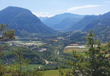
Varied hike offering magnificent views of the Serre Ponçon lake and the Ubaye massif.

The climb of Mont Colombis is an option, do not do it decreases the altitude of 1000m!

Höhenprofil

Foto-Galerie

Ort

Land:
France
Region :
Provence-Alpes-Côte d'Azur
Abteilung/Provinz :
Hochalpen
Kommune :
Gap
Standort:
Gap
Gehen Sie:(Dec)
Gehen Sie:(UTM)
268579 ; 4938605 (32T) N.

Touren in der Umgebung

Tour Wandern Gap - Brèche et croix de Charance - Photo
Wandern
GUIDE
R@ph

Wandern

Einfach
(1)
Gap, Provence-Alpes-Côte d'Azur, Hochalpen, France
8,6 km | 18,5 km-effort
2h 13min
Nein
Tour Wandern Gap - Pic de Charance - Photo
Wandern
GUIDE
Marco05

Wandern

Medium
Gap, Provence-Alpes-Côte d'Azur, Hochalpen, France
8,9 km | 19 km-effort
4h 18min
Ja
Tour Wandern Gap - Cuchon-Pic de Charance - Photo
Wandern
GUIDE
Marco05

Wandern

Schwierig
Gap, Provence-Alpes-Côte d'Azur, Hochalpen, France
12,3 km | 24 km-effort
5h 32min
Ja
Tour Wandern Gap - Col de Guizière - Photo
Wandern
GUIDE
Marco05

Wandern

Medium
Gap, Provence-Alpes-Côte d'Azur, Hochalpen, France
8,7 km | 17,5 km-effort
3h 58min
Ja
Tour Wandern Gap - 7 Chemin GAP - LA MOTTE DU CAIRE - Photo
Wandern
GUIDE
R@ph

Wandern

Sehr schwierig
Gap, Provence-Alpes-Côte d'Azur, Hochalpen, France
41 km | 60 km-effort
11h 0min
Nein
Tour Wandern Gap - R17   la Breche de Charance - Photo
Wandern
GUIDE+

Wandern

Medium
Gap, Provence-Alpes-Côte d'Azur, Hochalpen, France
6,3 km | 14,1 km-effort
2h 48min
Ja
Tour Wandern Gap - R16   Le parc de Charance - Photo
Wandern
GUIDE+

Wandern

Sehr leicht
Gap, Provence-Alpes-Côte d'Azur, Hochalpen, France
3,6 km | 5,2 km-effort
1h 8min
Ja
Tour Wandern Gap - Brèche de Charance - Col de Gleize - Photo
Wandern
GUIDE
R@ph

Wandern

Schwierig
Gap, Provence-Alpes-Côte d'Azur, Hochalpen, France
8 km | 18,1 km-effort
2h 29min
Nein
Tour Wandern Gap - GAP - Photo
Wandern
GUIDE
stef789

Wandern

Sehr leicht
Gap, Provence-Alpes-Côte d'Azur, Hochalpen, France
4 km | 4,3 km-effort
1h 22min
Nein


Schließen
Meine Abonnements