


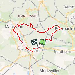

19,9 km | 34 km-effort


Benutzer


Kostenlosegpshiking-Anwendung
 SityTrail
IGN / Geografische Institute
SityTrail World
Die Welt öffnet sich für Sie
Tour Wandern von 12,9 km verfügbar auf Großer Osten, Oberelsass, Au. Diese Tour wird von E.BURCK vorgeschlagen.
De Lauw vers Masevaux en passant par le gros chêne à l'aller et le lac bleu au retour. 270 m de dénivelé et 11.5 km au total.
ACCÈS:
-Sur la D466, par Guewenheim, Sentheim puis Lauw.
PARKING:
-parking sur la gauche de la route principale, peu après l'entrée de Lauw.
47.757657, 7.025073
N 47°45'28" E 7°01'30"
RESTAURATION :
Restaurant: Au Relais de la Poste à Masevaux. Tél. 03 89 38 80 97

Wandern

Wandern

Wandern

Zu Fuß

Zu Fuß

Wandern

Wandern
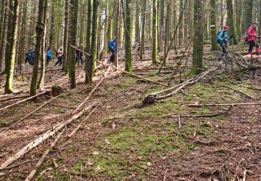
Wandern

Wandern