

la pinède

liocol
Benutzer

Länge
4,5 km

Maximale Höhe
617 m

Positive Höhendifferenz
159 m

Km-Effort
6,7 km

Min. Höhe
457 m

Negative Höhendifferenz
157 m
Boucle
Ja
Erstellungsdatum :
2018-04-17 18:14:49.747
Letzte Änderung :
2018-04-17 18:14:49.747
1h24
Schwierigkeit : Einfach

Kostenlosegpshiking-Anwendung
Über SityTrail
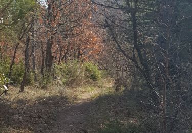
Tour Wandern von 4,5 km verfügbar auf Provence-Alpes-Côte d'Azur, Alpes-de-Haute-Provence, Pierrevert. Diese Tour wird von liocol vorgeschlagen.
Beschreibung
Garez-vous le long du Bd St Georges, attention pas sur l'arrêt de bus. Petite boucle de moins de 5 Kms, sans problème.
Ort
Land:
France
Region :
Provence-Alpes-Côte d'Azur
Abteilung/Provinz :
Alpes-de-Haute-Provence
Kommune :
Pierrevert
Standort:
Unknown
Gehen Sie:(Dec)
Gehen Sie:(UTM)
720940 ; 4856574 (31T) N.
Kommentare
Touren in der Umgebung

Le Val des Chats, avant le col de la Mort d'Imbert.


Wandern
Einfach
(2)
Manosque,
Provence-Alpes-Côte d'Azur,
Alpes-de-Haute-Provence,
France

4,7 km | 6,5 km-effort
1h 23min
Ja

MANOSQUE VOLX PAR LES COLLINES O S


Wandern
Schwierig
Manosque,
Provence-Alpes-Côte d'Azur,
Alpes-de-Haute-Provence,
France

17,7 km | 24 km-effort
4h 15min
Ja

Le tour de la borie '' pain de sucre ''


Wandern
Einfach
(1)
Manosque,
Provence-Alpes-Côte d'Azur,
Alpes-de-Haute-Provence,
France

5,1 km | 7,4 km-effort
1h 43min
Ja

Quartier des Espels, départ Piscine.


Wandern
Einfach
(1)
Manosque,
Provence-Alpes-Côte d'Azur,
Alpes-de-Haute-Provence,
France

4,8 km | 7,3 km-effort
1h 50min
Ja
1Les speels, le relais, le pain de sucre. Depart Crématoriome.


Wandern
Medium
(1)
Manosque,
Provence-Alpes-Côte d'Azur,
Alpes-de-Haute-Provence,
France

6,1 km | 9,7 km-effort
2h 4min
Ja
1Domaine de Bourne


Wandern
Medium
Saint-Martin-les-Eaux,
Provence-Alpes-Côte d'Azur,
Alpes-de-Haute-Provence,
France

5,6 km | 8,3 km-effort
2h 2min
Ja
1Montfuron, Villemus via la Colle et le Moulin.


Wandern
Einfach
Montfuron,
Provence-Alpes-Côte d'Azur,
Alpes-de-Haute-Provence,
France

7,6 km | 9,9 km-effort
2h 4min
Ja
1Gaude, boucle de Montaigu.


Wandern
Medium
Manosque,
Provence-Alpes-Côte d'Azur,
Alpes-de-Haute-Provence,
France

6,6 km | 10,2 km-effort
2h 7min
Ja
1Pélicier, chemin des collines, le Chateau via l'Ausselet


Wandern
Einfach
Manosque,
Provence-Alpes-Côte d'Azur,
Alpes-de-Haute-Provence,
France

7,1 km | 9,7 km-effort
2h 9min
Ja


 SityTrail


