


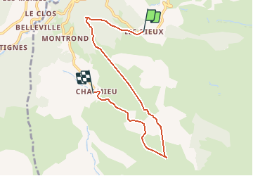

11,3 km | 20 km-effort


Benutzer


Kostenlosegpshiking-Anwendung
 SityTrail
IGN / Geografische Institute
SityTrail World
Die Welt öffnet sich für Sie
Tour Schneeschuhwandern von 6,8 km verfügbar auf Auvergne-Rhone-Alpen, Savoyen, Albiez-Montrond. Diese Tour wird von Jamyfredo vorgeschlagen.
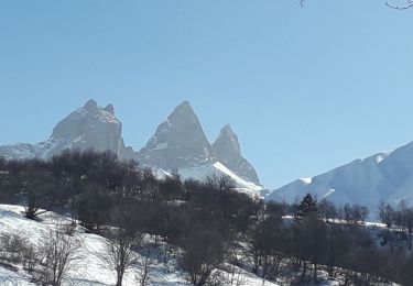
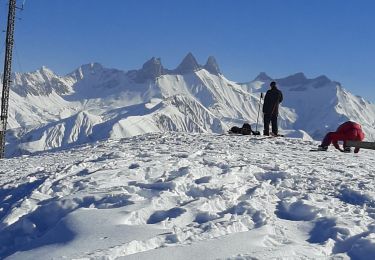
Randonnée magnifique avec des paysages somptueux. Sur Crêt de la Feisse panorama 360 !

Schneeschuhwandern
Schneeschuhwandern

Wandern
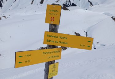
Schneeschuhwandern
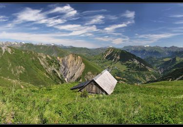
Wandern
Nordic Walking
Nordic Walking
Nordic Walking
Wandern