![](/images/other/stat-length.png)
![Tour Wintersport Manigod - Rando Ski - Photo](https://media.geolcdn.com/t/1900/400/ext.pjpeg?maxdim=2&url=https%3A%2F%2Fstatic1.geolcdn.com%2Fsiteimages%2Fupload%2Ffiles%2F1524743153ski.jpg)
Rando Ski
perlain
Benutzer
![Länge](/images/other/stat-length.png)
Länge
9,5 km
![Maximale Höhe](https://static1.geolcdn.com/siteimages/upload/files/1508320355ic_sort_altitude_max_24dp.png)
Maximale Höhe
1614 m
![Positive Höhendifferenz](https://static1.geolcdn.com/siteimages/upload/files/1508320355ic_sort_den_pos_24dp.png)
Positive Höhendifferenz
514 m
![Km-Effort](/images/other/stat-length.png)
Km-Effort
16,4 km
![Min. Höhe](https://static1.geolcdn.com/siteimages/upload/files/1508320355ic_sort_altitude_min_24dp.png)
Min. Höhe
1112 m
![Negative Höhendifferenz](https://static1.geolcdn.com/siteimages/upload/files/1508320355ic_sort_den_neg_24dp.png)
Negative Höhendifferenz
517 m
![Boucle](https://static1.geolcdn.com/siteimages/upload/files/16400158638029165_repeat_loop_refresh_sync_direction_icon.png)
Boucle
Ja
Erstellungsdatum :
2019-02-27 10:46:00.138
Letzte Änderung :
2019-02-27 10:46:00.149
![Wintersport](https://static1.geolcdn.com/sitytour/trail-icons/500.png)
2h11
Schwierigkeit : Einfach
![Scannen Sie diesen QR-Code, um die Tour in der SityTrail-Anwendung zu öffnen](https://capi.geolives.com/qq0zvz2zws4bq2lad0pu/sitytour/trails/877104/qr.png?size=200)
Kostenlosegpshiking-Anwendung
Über SityTrail
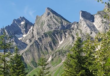
Tour Wintersport von 9,5 km verfügbar auf Auvergne-Rhone-Alpen, Hochsavoyen, Manigod. Diese Tour wird von perlain vorgeschlagen.
Beschreibung
De la croix Fry aux matins clairs descente sur la Clusaz et remontée par les prises
Ort
Land:
France
Region :
Auvergne-Rhone-Alpen
Abteilung/Provinz :
Hochsavoyen
Kommune :
Manigod
Standort:
Unknown
Gehen Sie:(Dec)
Gehen Sie:(UTM)
298560 ; 5083736 (32T) N.
Kommentare
Touren in der Umgebung
![Tour Schneeschuhwandern Manigod - croix de colonban croix de fry - Photo](https://media.geolcdn.com/t/375/260/ext.jpg?maxdim=2&url=https%3A%2F%2Fservices.sitytrail.com%2FGeolivesWS%2FDownloadMedia.ashx%3FTrailID%3D926852%26Media%3Dfix__20180316164408.jpg)
![Schneeschuhwandern Schneeschuhwandern](https://static1.geolcdn.com/sitytour/trail-icons/504.png)
croix de colonban croix de fry
Schneeschuhwandern
Medium
(3)
Manigod,
Auvergne-Rhone-Alpen,
Hochsavoyen,
France
![](/images/other/stat-length.png)
8 km | 11,6 km-effort
3h 5min
![](https://static1.geolcdn.com/siteimages/upload/files/16400158638029165_repeat_loop_refresh_sync_direction_icon.png)
Ja
![Tour Wandern La Clusaz - Les Converses, Le Planet, Beauregard, les Corbassières (boucle) - Photo](https://media.geolcdn.com/t/375/260/fc969c4d-6540-4dae-ad1a-e21a9acad593.jpg&format=jpg&maxdim=2)
![Wandern Wandern](https://static1.geolcdn.com/sitytour/trail-icons/101.png)
Les Converses, Le Planet, Beauregard, les Corbassières (boucle)
Wandern
Schwierig
La Clusaz,
Auvergne-Rhone-Alpen,
Hochsavoyen,
France
![](/images/other/stat-length.png)
10,4 km | 17,7 km-effort
3h 11min
![](https://static1.geolcdn.com/siteimages/upload/files/16400158638029165_repeat_loop_refresh_sync_direction_icon.png)
Ja
![Tour Schneeschuhwandern La Clusaz - col aravis - Photo](https://media.geolcdn.com/t/375/260/ext.jpg?maxdim=2&url=https%3A%2F%2Fservices.sitytrail.com%2FGeolivesWS%2FDownloadMedia.ashx%3FTrailID%3D926860%26Media%3Dfix__20180314155607.jpg)
![Schneeschuhwandern Schneeschuhwandern](https://static1.geolcdn.com/sitytour/trail-icons/504.png)
col aravis
Schneeschuhwandern
Einfach
(2)
La Clusaz,
Auvergne-Rhone-Alpen,
Hochsavoyen,
France
![](/images/other/stat-length.png)
5,7 km | 8,2 km-effort
2h 16min
![](https://static1.geolcdn.com/siteimages/upload/files/16400158638029165_repeat_loop_refresh_sync_direction_icon.png)
Ja
![Tour Schneeschuhwandern Thônes - Mlande Platenet Frassot Mlande - Photo](https://media.geolcdn.com/t/375/260/ext.jpg?maxdim=2&url=https%3A%2F%2Fstatic1.geolcdn.com%2Fsiteimages%2Fupload%2Ffiles%2F1524743153raquette.jpg)
![Schneeschuhwandern Schneeschuhwandern](https://static1.geolcdn.com/sitytour/trail-icons/504.png)
Mlande Platenet Frassot Mlande
Schneeschuhwandern
Sehr leicht
(1)
Thônes,
Auvergne-Rhone-Alpen,
Hochsavoyen,
France
![](/images/other/stat-length.png)
7,3 km | 13,7 km-effort
3h 24min
![](https://static1.geolcdn.com/siteimages/upload/files/16400158638029165_repeat_loop_refresh_sync_direction_icon.png)
Ja
![Tour Mountainbike La Clusaz - VTT Aravis - Photo](https://media.geolcdn.com/t/375/260/ext.jpg?maxdim=2&url=https%3A%2F%2Fstatic1.geolcdn.com%2Fsiteimages%2Fupload%2Ffiles%2F1524743154velo.jpg)
![Mountainbike Mountainbike](https://static1.geolcdn.com/sitytour/trail-icons/202.png)
VTT Aravis
Mountainbike
Medium
(1)
La Clusaz,
Auvergne-Rhone-Alpen,
Hochsavoyen,
France
![](/images/other/stat-length.png)
35 km | 52 km-effort
2h 38min
![](https://static1.geolcdn.com/siteimages/upload/files/16400158638029165_repeat_loop_refresh_sync_direction_icon.png)
Ja
![Tour Mountainbike La Clusaz - Aravis - Photo](https://media.geolcdn.com/t/375/260/ext.jpg?maxdim=2&url=https%3A%2F%2Fstatic1.geolcdn.com%2Fsiteimages%2Fupload%2Ffiles%2F1524743154velo.jpg)
![Mountainbike Mountainbike](https://static1.geolcdn.com/sitytour/trail-icons/202.png)
Aravis
Mountainbike
Sehr leicht
(1)
La Clusaz,
Auvergne-Rhone-Alpen,
Hochsavoyen,
France
![](/images/other/stat-length.png)
43 km | 63 km-effort
3h 46min
![](https://static1.geolcdn.com/siteimages/upload/files/16400158638029165_repeat_loop_refresh_sync_direction_icon.png)
Ja
![Tour Motor La Giettaz - La Giettaz - Col des Aravis - Photo](https://media.geolcdn.com/t/375/260/ext.jpg?maxdim=2&url=https%3A%2F%2Fstatic1.geolcdn.com%2Fsiteimages%2Fupload%2Ffiles%2F15247431544x4.jpg)
![Motor Motor](https://static1.geolcdn.com/sitytour/trail-icons/400.png)
La Giettaz - Col des Aravis
Motor
Sehr leicht
(1)
La Giettaz,
Auvergne-Rhone-Alpen,
Savoyen,
France
![](/images/other/stat-length.png)
15,8 km | 23 km-effort
58min
![](https://static1.geolcdn.com/siteimages/upload/files/16400158638029165_repeat_loop_refresh_sync_direction_icon.png)
Nein
![Tour Wandern La Clusaz - aravis aiguille verte combe borderan 12kms 987m - Photo](https://media.geolcdn.com/t/375/260/2ca18d57-76bb-4f3b-a586-7702b853c860.jpg&format=jpg&maxdim=2)
![Wandern Wandern](https://static1.geolcdn.com/sitytour/trail-icons/101.png)
aravis aiguille verte combe borderan 12kms 987m
Wandern
Medium
La Clusaz,
Auvergne-Rhone-Alpen,
Hochsavoyen,
France
![](/images/other/stat-length.png)
11,6 km | 25 km-effort
7h 14min
![](https://static1.geolcdn.com/siteimages/upload/files/16400158638029165_repeat_loop_refresh_sync_direction_icon.png)
Ja
![Tour Schneeschuhwandern La Clusaz - beauregard via la clusaz - Photo](https://media.geolcdn.com/t/375/260/d630f213-7a0b-404a-965b-04c1564ce3e1.jpg&format=jpg&maxdim=2)
![Schneeschuhwandern Schneeschuhwandern](https://static1.geolcdn.com/sitytour/trail-icons/504.png)
beauregard via la clusaz
Schneeschuhwandern
Sehr leicht
La Clusaz,
Auvergne-Rhone-Alpen,
Hochsavoyen,
France
![](/images/other/stat-length.png)
11 km | 18,6 km-effort
5h 14min
![](https://static1.geolcdn.com/siteimages/upload/files/16400158638029165_repeat_loop_refresh_sync_direction_icon.png)
Ja