![](/images/other/stat-length.png)
![Tour Wandern Saint-Germain-le-Fouilloux - Tour du pays de Laval (Saint Germain le Fouilloux,Laval) - Photo](https://media.geolcdn.com/t/1900/400/ext.pjpeg?maxdim=2&url=https%3A%2F%2Fservices.sitytrail.com%2FGeolivesWS%2FDownloadMedia.ashx%3FTrailID%3D846356%26Media%3Dfix__20171015170105.jpg)
Tour du pays de Laval (Saint Germain le Fouilloux,Laval)
Axelloceane
Benutzer
![Länge](/images/other/stat-length.png)
![Maximale Höhe](https://static1.geolcdn.com/siteimages/upload/files/1508320355ic_sort_altitude_max_24dp.png)
![Positive Höhendifferenz](https://static1.geolcdn.com/siteimages/upload/files/1508320355ic_sort_den_pos_24dp.png)
![Km-Effort](/images/other/stat-length.png)
![Min. Höhe](https://static1.geolcdn.com/siteimages/upload/files/1508320355ic_sort_altitude_min_24dp.png)
![Negative Höhendifferenz](https://static1.geolcdn.com/siteimages/upload/files/1508320355ic_sort_den_neg_24dp.png)
![Boucle](https://static1.geolcdn.com/siteimages/upload/files/16400158638029165_repeat_loop_refresh_sync_direction_icon.png)
![Wandern](https://static1.geolcdn.com/sitytour/trail-icons/101.png)
3h05
Schwierigkeit : Einfach
![Scannen Sie diesen QR-Code, um die Tour in der SityTrail-Anwendung zu öffnen](https://capi.geolives.com/qq0zvz2zws4bq2lad0pu/sitytour/trails/846356/qr.png?size=200)
Kostenlosegpshiking-Anwendung
Über SityTrail
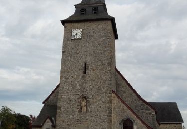
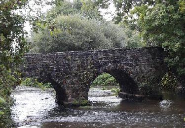
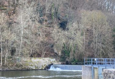
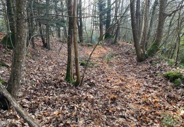
Tour Wandern von 14,1 km verfügbar auf Pays de la Loire, Mayenne, Saint-Germain-le-Fouilloux. Diese Tour wird von Axelloceane vorgeschlagen.
Beschreibung
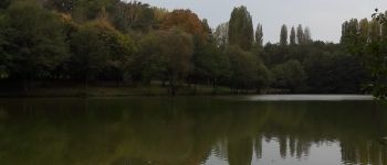
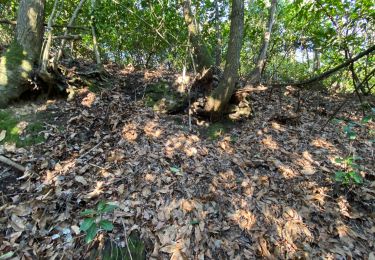
Départ du parking de St Germain le Fouilloux puis tourner à droite et suivre le balisage jusqu'à Changé.Ensuite descendre vers le plan d'eau du chemin vert en direction du centre ville de Changé et longer la Mayenne par le parc.
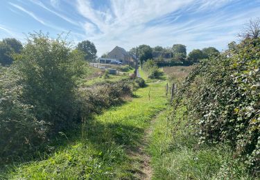
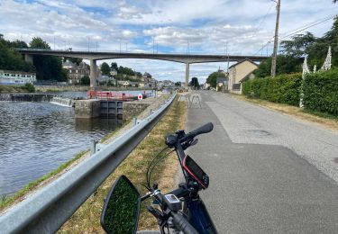
Traverser la route pour rejoindre la zone des montrons puis suivre la piste cyclable et prendre le tunnel direction le quartier des Ribaudières.Traverser l'ancienne caserne et ensuite poursuivre vers le quartier de Ste Catherine pour finir à la poste du centre ville.
Ort
Kommentare
Touren in der Umgebung
![Tour Wandern Andouillé - Base deCoupeau - Photo](https://media.geolcdn.com/t/375/260/55ca150e-75c2-4546-a76e-e4bd14a2b29a.jpg&format=jpg&maxdim=2)
![Wandern Wandern](https://static1.geolcdn.com/sitytour/trail-icons/101.png)
Wandern
![](/images/other/stat-length.png)
![](https://static1.geolcdn.com/siteimages/upload/files/16400158638029165_repeat_loop_refresh_sync_direction_icon.png)
![Tour Wandern Montflours - Tour du pays de Laval (Montflours Saint Germain le Fouilloux) - Photo](https://media.geolcdn.com/t/375/260/ext.jpg?maxdim=2&url=https%3A%2F%2Fservices.sitytrail.com%2FGeolivesWS%2FDownloadMedia.ashx%3FTrailID%3D834664%26Media%3Dfix__20170924173701.jpg)
![Wandern Wandern](https://static1.geolcdn.com/sitytour/trail-icons/101.png)
Wandern
![](/images/other/stat-length.png)
![](https://static1.geolcdn.com/siteimages/upload/files/16400158638029165_repeat_loop_refresh_sync_direction_icon.png)
![Tour Wandern Andouillé - Tour Andouillé - Photo](https://media.geolcdn.com/t/375/260/ext.jpg?maxdim=2&url=https%3A%2F%2Fservices.sitytrail.com%2FGeolivesWS%2FDownloadMedia.ashx%3FTrailID%3D649076%26Media%3Dfix__20161016173952.jpg)
![Wandern Wandern](https://static1.geolcdn.com/sitytour/trail-icons/101.png)
Wandern
![](/images/other/stat-length.png)
![](https://static1.geolcdn.com/siteimages/upload/files/16400158638029165_repeat_loop_refresh_sync_direction_icon.png)
![Tour Wandern Changé - Changé tour du golf - Photo](https://media.geolcdn.com/t/375/260/ext.jpg?maxdim=2&url=https%3A%2F%2Fservices.sitytrail.com%2FGeolivesWS%2FDownloadMedia.ashx%3FTrailID%3D554957%26Media%3Dfix__20160417171039.jpg)
![Wandern Wandern](https://static1.geolcdn.com/sitytour/trail-icons/101.png)
Wandern
![](/images/other/stat-length.png)
![](https://static1.geolcdn.com/siteimages/upload/files/16400158638029165_repeat_loop_refresh_sync_direction_icon.png)
![Tour Wandern Saint-Jean-sur-Mayenne - Le 19 02 2023 - Photo](https://media.geolcdn.com/t/375/260/3bed256a-6082-4013-9a01-bfed23329e82.jpg&format=jpg&maxdim=2)
![Wandern Wandern](https://static1.geolcdn.com/sitytour/trail-icons/101.png)
Wandern
![](/images/other/stat-length.png)
![](https://static1.geolcdn.com/siteimages/upload/files/16400158638029165_repeat_loop_refresh_sync_direction_icon.png)
![Tour Wandern Saint-Jean-sur-Mayenne - Chat meignan - Photo](https://media.geolcdn.com/t/375/260/2ac564fb-f045-4792-a7bb-06a94f786349.jpg&format=jpg&maxdim=2)
![Wandern Wandern](https://static1.geolcdn.com/sitytour/trail-icons/101.png)
Wandern
![](/images/other/stat-length.png)
![](https://static1.geolcdn.com/siteimages/upload/files/16400158638029165_repeat_loop_refresh_sync_direction_icon.png)
![Tour Wandern Saint-Jean-sur-Mayenne - Château Meignan - Photo](https://media.geolcdn.com/t/375/260/0560fdd3-5a58-4bb0-9ce4-7bd23d61c3c5.jpg&format=jpg&maxdim=2)
![Wandern Wandern](https://static1.geolcdn.com/sitytour/trail-icons/101.png)
Wandern
![](/images/other/stat-length.png)
![](https://static1.geolcdn.com/siteimages/upload/files/16400158638029165_repeat_loop_refresh_sync_direction_icon.png)
![Tour Radtourismus Saint-Jean-sur-Mayenne - Saint Jean Mayenne - Photo](https://media.geolcdn.com/t/375/260/a5dd08bc-c437-47b2-82d9-0db74cacb4ba.jpg&format=jpg&maxdim=2)
![Radtourismus Radtourismus](https://static1.geolcdn.com/sitytour/trail-icons/204.png)
Radtourismus
![](/images/other/stat-length.png)
![](https://static1.geolcdn.com/siteimages/upload/files/16400158638029165_repeat_loop_refresh_sync_direction_icon.png)
![Tour Zu Fuß Changé - Sentier de randonnée pédestre #10 - Photo](https://media.geolcdn.com/t/375/260/67db2f05-4ef1-49bc-b8cb-2aabe0b67e8f.jpeg&format=jpg&maxdim=2)
![Zu Fuß Zu Fuß](https://static1.geolcdn.com/sitytour/trail-icons/100.png)
Zu Fuß
![](/images/other/stat-length.png)
![](https://static1.geolcdn.com/siteimages/upload/files/16400158638029165_repeat_loop_refresh_sync_direction_icon.png)