![](/images/other/stat-length.png)
De Rochefort à Han-sur-Lesse
pascalou73
Benutzer GUIDE
![Länge](/images/other/stat-length.png)
Länge
13,3 km
![Maximale Höhe](https://static1.geolcdn.com/siteimages/upload/files/1508320355ic_sort_altitude_max_24dp.png)
Maximale Höhe
326 m
![Positive Höhendifferenz](https://static1.geolcdn.com/siteimages/upload/files/1508320355ic_sort_den_pos_24dp.png)
Positive Höhendifferenz
335 m
![Km-Effort](/images/other/stat-length.png)
Km-Effort
17,8 km
![Min. Höhe](https://static1.geolcdn.com/siteimages/upload/files/1508320355ic_sort_altitude_min_24dp.png)
Min. Höhe
154 m
![Negative Höhendifferenz](https://static1.geolcdn.com/siteimages/upload/files/1508320355ic_sort_den_neg_24dp.png)
Negative Höhendifferenz
334 m
![Boucle](https://static1.geolcdn.com/siteimages/upload/files/16400158638029165_repeat_loop_refresh_sync_direction_icon.png)
Boucle
Ja
Erstellungsdatum :
2018-04-16 23:38:19.611
Letzte Änderung :
2018-04-16 23:38:19.611
![Wandern](https://static1.geolcdn.com/sitytour/trail-icons/101.png)
3h47
Schwierigkeit : Medium
![Scannen Sie diesen QR-Code, um die Tour in der SityTrail-Anwendung zu öffnen](https://capi.geolives.com/qq0zvz2zws4bq2lad0pu/sitytour/trails/836582/qr.png?size=200)
Kostenlosegpshiking-Anwendung
Über SityTrail
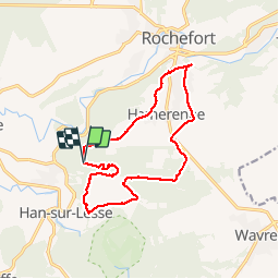
Tour Wandern von 13,3 km verfügbar auf Wallonien, Namur, Rochefort. Diese Tour wird von pascalou73 vorgeschlagen.
Beschreibung
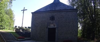
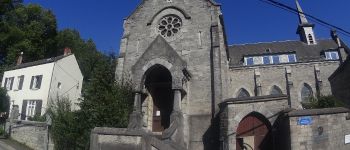
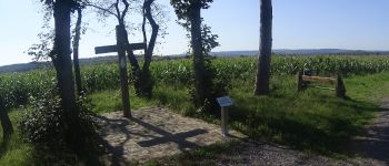
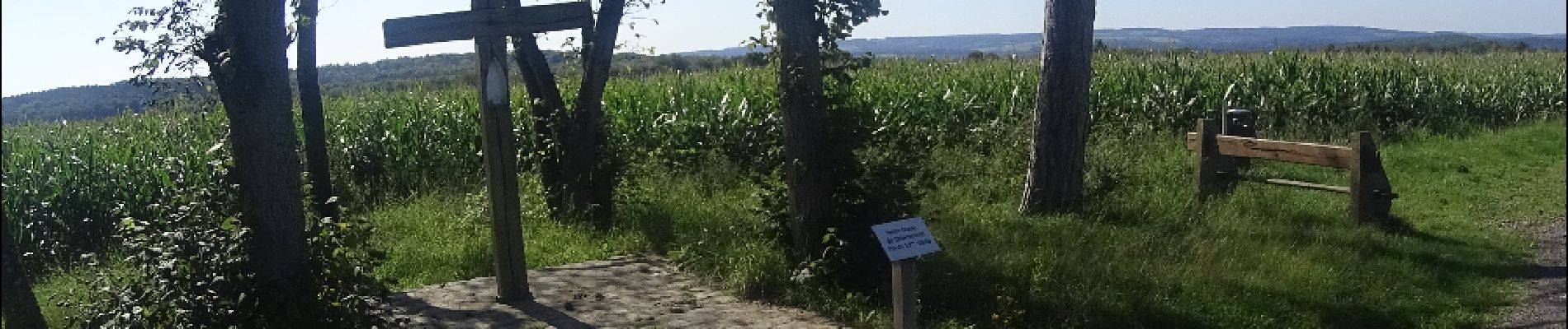
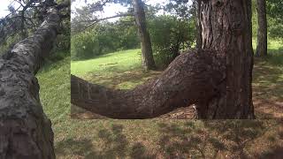
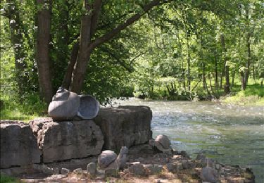
Voilà une randonnée dans la région de Rochefort .Une belle région pour faire de la randonnée . De beau point de vue sur Han sur Lesse..
Ort
Land:
Belgium
Region :
Wallonien
Abteilung/Provinz :
Namur
Kommune :
Rochefort
Standort:
Han-sur-Lesse
Gehen Sie:(Dec)
Gehen Sie:(UTM)
656774 ; 5556016 (31U) N.
Kommentare
Touren in der Umgebung
![Tour Wandern Rochefort - Walk along the river Lesse and through bucolic landscapes - Photo](https://media.geolcdn.com/t/375/260/ext.jpg?maxdim=2&url=https%3A%2F%2Fservices.sitytrail.com%2FGeolivesWS%2FDownloadMedia.ashx%3FTrailID%3D217391%26Media%3Df70ecdda-41e6-4428-8538-20d80ba8d70d.jpg)
![Wandern Wandern](https://static1.geolcdn.com/sitytour/trail-icons/101.png)
Walk along the river Lesse and through bucolic landscapes
Wandern
Einfach
(7)
Rochefort,
Wallonien,
Namur,
Belgium
![](/images/other/stat-length.png)
9,5 km | 11,3 km-effort
2h 28min
![](https://static1.geolcdn.com/siteimages/upload/files/16400158638029165_repeat_loop_refresh_sync_direction_icon.png)
Ja
![Tour Wandern Rochefort - Havrenne & de Saint-Remy Trappist Abbey - Photo](https://media.geolcdn.com/t/375/260/ext.jpg?maxdim=2&url=https%3A%2F%2Fservices.sitytrail.com%2FGeolivesWS%2FDownloadMedia.ashx%3FTrailID%3D215623%26Media%3Db529a95c-404d-4caa-9c09-6087624067bf.tif)
![Wandern Wandern](https://static1.geolcdn.com/sitytour/trail-icons/101.png)
Havrenne & de Saint-Remy Trappist Abbey
Wandern
Einfach
(14)
Rochefort,
Wallonien,
Namur,
Belgium
![](/images/other/stat-length.png)
6 km | 7,1 km-effort
2h 0min
![](https://static1.geolcdn.com/siteimages/upload/files/16400158638029165_repeat_loop_refresh_sync_direction_icon.png)
Ja
![Tour Wandern Rochefort - Nature - The view from the Belvédère in Han-sur-Lesse - Photo](https://media.geolcdn.com/t/375/260/ext.jpg?maxdim=2&url=https%3A%2F%2Fservices.sitytrail.com%2FGeolivesWS%2FDownloadMedia.ashx%3FTrailID%3D193579%26Media%3D5797bc56-5327-4c2b-b581-d88d672bf775.jpg)
![Wandern Wandern](https://static1.geolcdn.com/sitytour/trail-icons/101.png)
Nature - The view from the Belvédère in Han-sur-Lesse
Wandern
Schwierig
(16)
Rochefort,
Wallonien,
Namur,
Belgium
![](/images/other/stat-length.png)
4,8 km | 6,3 km-effort
1h 20min
![](https://static1.geolcdn.com/siteimages/upload/files/16400158638029165_repeat_loop_refresh_sync_direction_icon.png)
Ja
![Tour Motor Rochefort - Car tour - Heritage : churches, chapels and abbeys - Rochefort - Photo](https://media.geolcdn.com/t/375/260/ext.jpg?maxdim=2&url=https%3A%2F%2Fservices.sitytrail.com%2FGeolivesWS%2FDownloadMedia.ashx%3FTrailID%3D153103%26Media%3D05603f1b-9f7c-481f-bc84-6cc819555dbb.jpg)
![Motor Motor](https://static1.geolcdn.com/sitytour/trail-icons/400.png)
Car tour - Heritage : churches, chapels and abbeys - Rochefort
Motor
Einfach
(5)
Rochefort,
Wallonien,
Namur,
Belgium
![](/images/other/stat-length.png)
65 km | 78 km-effort
2h 40min
![](https://static1.geolcdn.com/siteimages/upload/files/16400158638029165_repeat_loop_refresh_sync_direction_icon.png)
Ja
![Tour Wandern Rochefort - RB-Na-07 Raccourci - Ronde au pays des grottes - Photo](https://media.geolcdn.com/t/375/260/ext.jpg?maxdim=2&url=https%3A%2F%2Fservices.sitytrail.com%2FGeolivesWS%2FDownloadMedia.ashx%3FTrailID%3D213757%26Media%3D27dc9085-0323-4669-9df4-56be0512bfe6.jpg)
![Wandern Wandern](https://static1.geolcdn.com/sitytour/trail-icons/101.png)
RB-Na-07 Raccourci - Ronde au pays des grottes
Wandern
Einfach
(9)
Rochefort,
Wallonien,
Namur,
Belgium
![](/images/other/stat-length.png)
18,4 km | 24 km-effort
4h 59min
![](https://static1.geolcdn.com/siteimages/upload/files/16400158638029165_repeat_loop_refresh_sync_direction_icon.png)
Ja
![Tour Wandern Rochefort - Nature : Belvaux -Les Rouges-Gorges (the robins) - Photo](https://media.geolcdn.com/t/375/260/ext.jpg?maxdim=2&url=https%3A%2F%2Fservices.sitytrail.com%2FGeolivesWS%2FDownloadMedia.ashx%3FTrailID%3D262701%26Media%3D8d8e8ae8-731b-4f5d-ad26-e3a028302c41.jpg)
![Wandern Wandern](https://static1.geolcdn.com/sitytour/trail-icons/101.png)
Nature : Belvaux -Les Rouges-Gorges (the robins)
Wandern
Einfach
(8)
Rochefort,
Wallonien,
Namur,
Belgium
![](/images/other/stat-length.png)
6,5 km | 8,4 km-effort
1h 20min
![](https://static1.geolcdn.com/siteimages/upload/files/16400158638029165_repeat_loop_refresh_sync_direction_icon.png)
Ja
![Tour Wandern Rochefort - Nature : Belvaux -Les Rouges-Gorges (the robins) - Photo](https://media.geolcdn.com/t/375/260/ext.jpg?maxdim=2&url=https%3A%2F%2Fservices.sitytrail.com%2FGeolivesWS%2FDownloadMedia.ashx%3FTrailID%3D183910%26Media%3D410abbc6-7c13-4109-b7d7-92f0aeb383e2.jpg)
![Wandern Wandern](https://static1.geolcdn.com/sitytour/trail-icons/101.png)
Nature : Belvaux -Les Rouges-Gorges (the robins)
Wandern
Einfach
(13)
Rochefort,
Wallonien,
Namur,
Belgium
![](/images/other/stat-length.png)
5,8 km | 7,6 km-effort
1h 20min
![](https://static1.geolcdn.com/siteimages/upload/files/16400158638029165_repeat_loop_refresh_sync_direction_icon.png)
Ja
![Tour Wandern Rochefort - Nature - A discovery trail through Han-sur-Lesse - Photo](https://media.geolcdn.com/t/375/260/ext.jpg?maxdim=2&url=https%3A%2F%2Fservices.sitytrail.com%2FGeolivesWS%2FDownloadMedia.ashx%3FTrailID%3D148989%26Media%3D3c202c2f-ee01-4903-bd25-24913ec8637b.jpg)
![Wandern Wandern](https://static1.geolcdn.com/sitytour/trail-icons/101.png)
Nature - A discovery trail through Han-sur-Lesse
Wandern
Sehr leicht
(15)
Rochefort,
Wallonien,
Namur,
Belgium
![](/images/other/stat-length.png)
4,8 km | 5,8 km-effort
1h 15min
![](https://static1.geolcdn.com/siteimages/upload/files/16400158638029165_repeat_loop_refresh_sync_direction_icon.png)
Ja
![Tour Wandern Rochefort - Nature : Belvaux -Les Rouges-Gorges (the robins) - Photo](https://media.geolcdn.com/t/375/260/ext.jpg?maxdim=2&url=https%3A%2F%2Fservices.sitytrail.com%2FGeolivesWS%2FDownloadMedia.ashx%3FTrailID%3D635109%26Media%3D8d8e8ae8-731b-4f5d-ad26-e3a028302c41.jpg)
![Wandern Wandern](https://static1.geolcdn.com/sitytour/trail-icons/101.png)
Nature : Belvaux -Les Rouges-Gorges (the robins)
Wandern
Einfach
(3)
Rochefort,
Wallonien,
Namur,
Belgium
![](/images/other/stat-length.png)
5,8 km | 7,6 km-effort
1h 20min
![](https://static1.geolcdn.com/siteimages/upload/files/16400158638029165_repeat_loop_refresh_sync_direction_icon.png)
Ja