


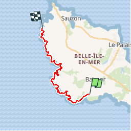

9,4 km | 11,2 km-effort


Benutzer


Kostenlosegpshiking-Anwendung
 SityTrail
IGN / Geografische Institute
SityTrail World
Die Welt öffnet sich für Sie
Tour Wandern von 20 km verfügbar auf Bretagne, Morbihan, Bangor. Diese Tour wird von dfluzin vorgeschlagen.
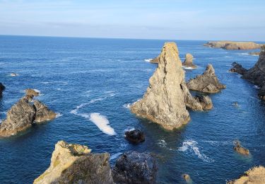
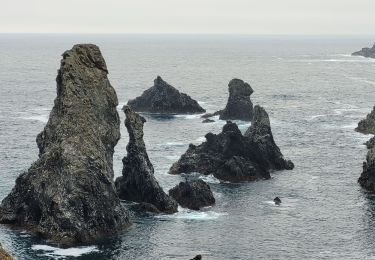
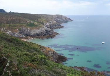
Fin de notre tour de l'île en 5 étapes avec ce splendide parcours. La première partie jusqu'au Port de Donnant est exceptionnelle avec les Aiguilles de Port Coton notamment mais bien d'autres criques admirables
Wandern
Wandern

Wandern
Wandern
Wandern
Wandern
Wandern
Zu Fuß

Pfad