


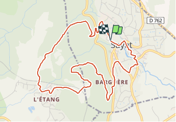


5,5 km | 7,2 km-effort

Benutzer GUIDE


Kostenlosegpshiking-Anwendung
 SityTrail
IGN / Geografische Institute
SityTrail World
Die Welt öffnet sich für Sie
Tour Wandern von 6,1 km verfügbar auf Auvergne-Rhone-Alpen, Puy-de-Dôme, Sayat. Diese Tour wird von jagarnier vorgeschlagen.
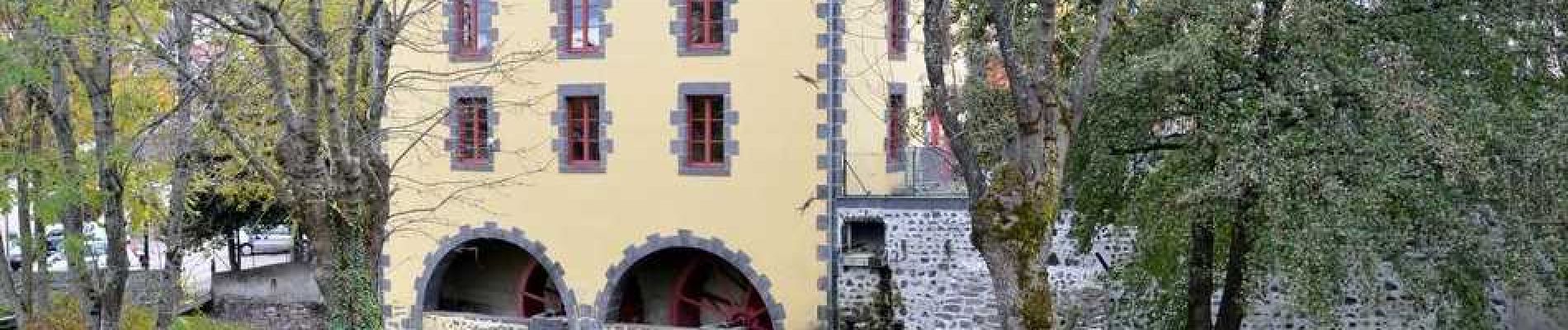
En suivant cette randonnée, vous quitterez le vieux Sayat avec ses nombreuses fontaines, ses moulins et son huilerie. Vous monterez ensuite à travers la châtaigneraie jusqu’au repaire des Gaulois, un belvédère offrant une vue sur la vallée.


Wandern

Wandern

Wandern

Mountainbike

Wandern

Wandern

Wandern

Wandern

Zu Fuß