


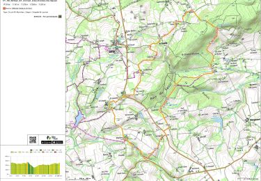
7,8 km | 9,3 km-effort


Benutzer


Kostenlosegpshiking-Anwendung
 SityTrail
IGN / Geografische Institute
SityTrail World
Die Welt öffnet sich für Sie
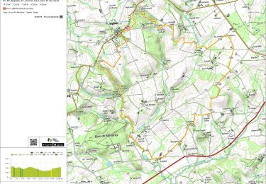
Tour Wandern von 6,4 km verfügbar auf Bretagne, Morbihan, Séglien. Diese Tour wird von gildascb vorgeschlagen.
Départ de Mangoiarec,sur chemin empierré jusqu'à l'étang de Pont Samouel, tour de l'étang, chemin en creux entre 2 champs jusqu'à la chapelle Saint Laurent et retour par la route.
Zu Fuß
Wandern
Wandern

Wandern