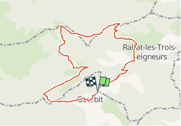
![](/images/other/stat-length.png)
![Tour Wandern Gourbit - Gourbit- rochers Carlong - Photo](https://media.geolcdn.com/t/1900/400/ext.pjpeg?maxdim=2&url=https%3A%2F%2Fservices.sitytrail.com%2FGeolivesWS%2FDownloadMedia.ashx%3FTrailID%3D799021%26Media%3Dfix__20170730141515.jpg)
Gourbit- rochers Carlong
pidjam
Benutzer
![Länge](/images/other/stat-length.png)
![Maximale Höhe](https://static1.geolcdn.com/siteimages/upload/files/1508320355ic_sort_altitude_max_24dp.png)
![Positive Höhendifferenz](https://static1.geolcdn.com/siteimages/upload/files/1508320355ic_sort_den_pos_24dp.png)
![Km-Effort](/images/other/stat-length.png)
![Min. Höhe](https://static1.geolcdn.com/siteimages/upload/files/1508320355ic_sort_altitude_min_24dp.png)
![Negative Höhendifferenz](https://static1.geolcdn.com/siteimages/upload/files/1508320355ic_sort_den_neg_24dp.png)
![Boucle](https://static1.geolcdn.com/siteimages/upload/files/16400158638029165_repeat_loop_refresh_sync_direction_icon.png)
![Wandern](https://static1.geolcdn.com/sitytour/trail-icons/101.png)
4h15
Schwierigkeit : Medium
![Scannen Sie diesen QR-Code, um die Tour in der SityTrail-Anwendung zu öffnen](https://capi.geolives.com/qq0zvz2zws4bq2lad0pu/sitytour/trails/799021/qr.png?size=200)
Kostenlosegpshiking-Anwendung
Über SityTrail
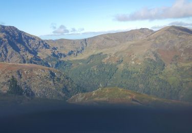
Tour Wandern von 11,1 km verfügbar auf Okzitanien, Ariège, Gourbit. Diese Tour wird von pidjam vorgeschlagen.
Beschreibung
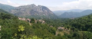
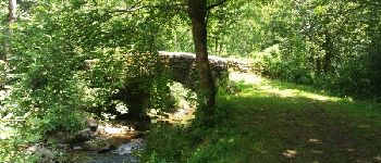
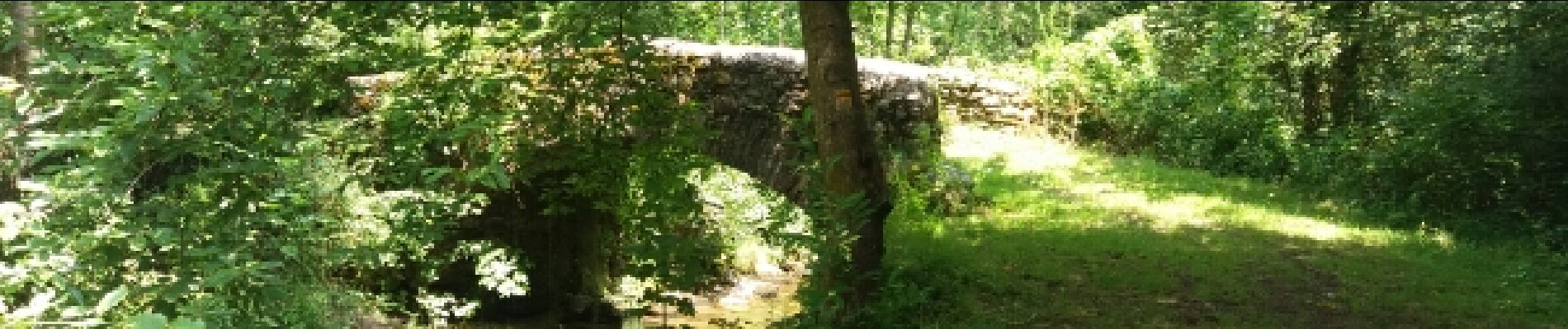
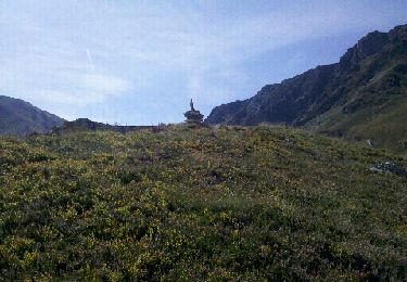
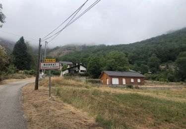
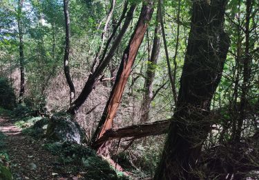
C'est à peu près le même guide que celui de yvessavoy mais avec des corrections nécessaires vu la rando effectuée en juillet 2017. La marche est agréable et souvent dans les bois, la montée est forte (avant la Trajine et jusqu'au GR des 3 seigneurs), le reste passe bien. Il faut se garer à la mairie de Gourbit dès l'entrée du village à gauche(c'est le seul vrai parking et les rues sont très étroites)
Ort
Kommentare
Touren in der Umgebung
![Tour Wandern Rabat-les-Trois-Seigneurs - Pyrénées-120910 - EtangBleu - Photo](https://media.geolcdn.com/t/375/260/ext.jpg?maxdim=2&url=https%3A%2F%2Fservices.sitytrail.com%2FGeolivesWS%2FDownloadMedia.ashx%3FTrailID%3D154212%26Media%3D20120910120731.jpeg)
![Wandern Wandern](https://static1.geolcdn.com/sitytour/trail-icons/101.png)
Wandern
![](/images/other/stat-length.png)
![](https://static1.geolcdn.com/siteimages/upload/files/16400158638029165_repeat_loop_refresh_sync_direction_icon.png)
![Tour Wandern Gourbit - 04/06/2014 Rando Etang d'Artax - Photo](https://media.geolcdn.com/t/375/260/ext.jpg?maxdim=2&url=https%3A%2F%2Fservices.sitytrail.com%2FGeolivesWS%2FDownloadMedia.ashx%3FTrailID%3D308062%26Media%3D20140601132627.jpg)
![Wandern Wandern](https://static1.geolcdn.com/sitytour/trail-icons/101.png)
Wandern
![](/images/other/stat-length.png)
![](https://static1.geolcdn.com/siteimages/upload/files/16400158638029165_repeat_loop_refresh_sync_direction_icon.png)
![Tour Wandern Rabat-les-Trois-Seigneurs - Cirque D'Embans - Photo](https://media.geolcdn.com/t/375/260/ext.jpg?maxdim=2&url=https%3A%2F%2Fstatic1.geolcdn.com%2Fsiteimages%2Fupload%2Ffiles%2F1553511878bg_sport_marche.png)
![Wandern Wandern](https://static1.geolcdn.com/sitytour/trail-icons/101.png)
Wandern
![](/images/other/stat-length.png)
![](https://static1.geolcdn.com/siteimages/upload/files/16400158638029165_repeat_loop_refresh_sync_direction_icon.png)
![Tour Wandern Surba - Tour du roc de Sédour - Photo](https://media.geolcdn.com/t/375/260/0a6f46ec-50b3-4cd7-935e-a334e1ae38c6.jpg&format=jpg&maxdim=2)
![Wandern Wandern](https://static1.geolcdn.com/sitytour/trail-icons/101.png)
Wandern
![](/images/other/stat-length.png)
![](https://static1.geolcdn.com/siteimages/upload/files/16400158638029165_repeat_loop_refresh_sync_direction_icon.png)
![Tour Elektrofahrrad Niaux - Niaux - Photo](https://media.geolcdn.com/t/375/260/2925b5db-f18d-4157-bbef-94a57335fc75.jpg&format=jpg&maxdim=2)
![Elektrofahrrad Elektrofahrrad](https://static1.geolcdn.com/sitytour/trail-icons/205.png)
![Tour Elektrofahrrad Niaux - Château Miglos - Photo](https://media.geolcdn.com/t/375/260/8bba2701-86a9-409d-bc1b-998f1da97a1d.jpg&format=jpg&maxdim=2)
![Elektrofahrrad Elektrofahrrad](https://static1.geolcdn.com/sitytour/trail-icons/205.png)
Elektrofahrrad
![](/images/other/stat-length.png)
![](https://static1.geolcdn.com/siteimages/upload/files/16400158638029165_repeat_loop_refresh_sync_direction_icon.png)
![Tour Zu Fuß Gourbit - Étang d'Artax - Photo](https://media.geolcdn.com/t/375/260/b2f84de2-fa0a-4b97-b201-829b16672ace.jpeg&format=jpg&maxdim=2)
![Zu Fuß Zu Fuß](https://static1.geolcdn.com/sitytour/trail-icons/100.png)
Zu Fuß
![](/images/other/stat-length.png)
![](https://static1.geolcdn.com/siteimages/upload/files/16400158638029165_repeat_loop_refresh_sync_direction_icon.png)
![Tour Wandern Quié - le dolmen de la plagne - Photo](https://media.geolcdn.com/t/375/260/63549979-fc31-49c3-b8f9-739dadcde147.jpg&format=jpg&maxdim=2)
![Wandern Wandern](https://static1.geolcdn.com/sitytour/trail-icons/101.png)
Wandern
![](/images/other/stat-length.png)
![](https://static1.geolcdn.com/siteimages/upload/files/16400158638029165_repeat_loop_refresh_sync_direction_icon.png)
![Tour Wandern Rabat-les-Trois-Seigneurs - pic du Pioulou en boucle - Photo](https://media.geolcdn.com/t/375/260/e8bfc997-31ac-4ff2-b0d1-e43d1083f5c2.jpg&format=jpg&maxdim=2)
![Wandern Wandern](https://static1.geolcdn.com/sitytour/trail-icons/101.png)
Wandern
![](/images/other/stat-length.png)
![](https://static1.geolcdn.com/siteimages/upload/files/16400158638029165_repeat_loop_refresh_sync_direction_icon.png)