![](/images/other/stat-length.png)
![Tour Wandern Minerve - Minerve - gorges du Briant - Photo](https://media.geolcdn.com/t/1900/400/ext.pjpeg?maxdim=2&url=https%3A%2F%2Fstatic1.geolcdn.com%2Fsiteimages%2Fupload%2Ffiles%2F1553511878bg_sport_marche.png)
Minerve - gorges du Briant
vertygo
Benutzer
![Länge](/images/other/stat-length.png)
Länge
9,3 km
![Maximale Höhe](https://static1.geolcdn.com/siteimages/upload/files/1508320355ic_sort_altitude_max_24dp.png)
Maximale Höhe
351 m
![Positive Höhendifferenz](https://static1.geolcdn.com/siteimages/upload/files/1508320355ic_sort_den_pos_24dp.png)
Positive Höhendifferenz
401 m
![Km-Effort](/images/other/stat-length.png)
Km-Effort
14,6 km
![Min. Höhe](https://static1.geolcdn.com/siteimages/upload/files/1508320355ic_sort_altitude_min_24dp.png)
Min. Höhe
158 m
![Negative Höhendifferenz](https://static1.geolcdn.com/siteimages/upload/files/1508320355ic_sort_den_neg_24dp.png)
Negative Höhendifferenz
390 m
![Boucle](https://static1.geolcdn.com/siteimages/upload/files/16400158638029165_repeat_loop_refresh_sync_direction_icon.png)
Boucle
Nein
Erstellungsdatum :
2017-07-17 00:00:00.0
Letzte Änderung :
2017-07-17 00:00:00.0
![Wandern](https://static1.geolcdn.com/sitytour/trail-icons/101.png)
3h03
Schwierigkeit : Einfach
![Scannen Sie diesen QR-Code, um die Tour in der SityTrail-Anwendung zu öffnen](https://capi.geolives.com/qq0zvz2zws4bq2lad0pu/sitytour/trails/791229/qr.png?size=200)
Kostenlosegpshiking-Anwendung
Über SityTrail
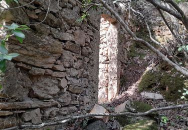
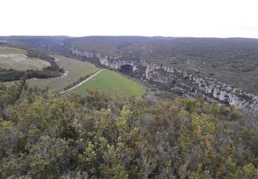
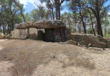
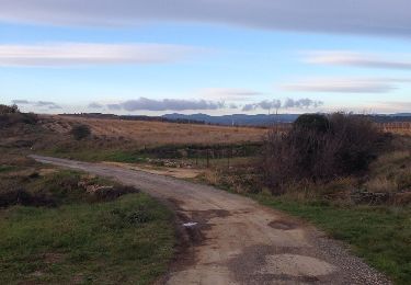
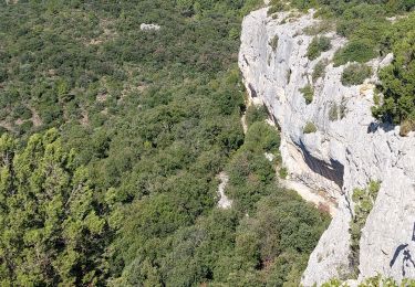
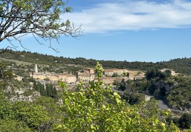
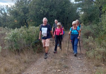
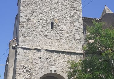
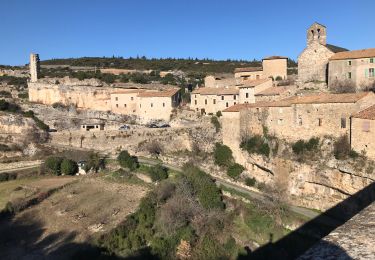
Tour Wandern von 9,3 km verfügbar auf Okzitanien, Hérault, Minerve. Diese Tour wird von vertygo vorgeschlagen.
Beschreibung
cliquer pour <a href=https://photos.app.goo.gl/QuPaasQsQvxiQUjh1 target=_blank>voir des photos</a> - d'autres parcours sur <a href='http://www.vertygo.org' target=_blank> www.vertygo.org</a>
Ort
Land:
France
Region :
Okzitanien
Abteilung/Provinz :
Hérault
Kommune :
Minerve
Standort:
Unknown
Gehen Sie:(Dec)
Gehen Sie:(UTM)
478940 ; 4799864 (31T) N.
Kommentare
Touren in der Umgebung
![Tour Wandern Cesseras - Grotte Aldène Cesseras - Photo](https://media.geolcdn.com/t/375/260/fbc77cc8-93f1-4b6b-b038-073024d6a586.jpg&format=jpg&maxdim=2)
![Wandern Wandern](https://static1.geolcdn.com/sitytour/trail-icons/101.png)
Grotte Aldène Cesseras
Wandern
Einfach
(3)
Cesseras,
Okzitanien,
Hérault,
France
![](/images/other/stat-length.png)
12,6 km | 17,8 km-effort
3h 10min
![](https://static1.geolcdn.com/siteimages/upload/files/16400158638029165_repeat_loop_refresh_sync_direction_icon.png)
Ja
![Tour Wandern Cesseras - 2023-04-08_21h30m21_Cesseras 10kms - Photo](https://media.geolcdn.com/t/375/260/63ef11e1-9828-4e19-8811-ad8eeda1adef.jpg&format=jpg&maxdim=2)
![Wandern Wandern](https://static1.geolcdn.com/sitytour/trail-icons/101.png)
2023-04-08_21h30m21_Cesseras 10kms
Wandern
Medium
(2)
Cesseras,
Okzitanien,
Hérault,
France
![](/images/other/stat-length.png)
11,6 km | 16,3 km-effort
3h 42min
![](https://static1.geolcdn.com/siteimages/upload/files/16400158638029165_repeat_loop_refresh_sync_direction_icon.png)
Ja
![Tour Wandern Aigne - Aigne - Saume Longue - Photo](https://media.geolcdn.com/t/375/260/ext.jpg?maxdim=2&url=https%3A%2F%2Fservices.sitytrail.com%2FGeolivesWS%2FDownloadMedia.ashx%3FTrailID%3D373254%26Media%3D20141229163850.jpg)
![Wandern Wandern](https://static1.geolcdn.com/sitytour/trail-icons/101.png)
Aigne - Saume Longue
Wandern
Sehr leicht
(1)
Aigne,
Okzitanien,
Hérault,
France
![](/images/other/stat-length.png)
4,8 km | 5,7 km-effort
1h 32min
![](https://static1.geolcdn.com/siteimages/upload/files/16400158638029165_repeat_loop_refresh_sync_direction_icon.png)
Ja
![Tour Wandern La Caunette - La Caunette - Photo](https://media.geolcdn.com/t/375/260/18583847-6773-463a-b6f4-5c9be80f48ff.jpg&format=jpg&maxdim=2)
![Wandern Wandern](https://static1.geolcdn.com/sitytour/trail-icons/101.png)
La Caunette
Wandern
Medium
La Caunette,
Okzitanien,
Hérault,
France
![](/images/other/stat-length.png)
16,4 km | 22 km-effort
5h 30min
![](https://static1.geolcdn.com/siteimages/upload/files/16400158638029165_repeat_loop_refresh_sync_direction_icon.png)
Ja
![Tour sport Minerve - Minerve bouclé Hérault - Photo](https://media.geolcdn.com/t/375/260/d578c921-3c99-4e11-b589-7310c0cb7ada.jpg&format=jpg&maxdim=2)
Minerve bouclé Hérault
sport
Sehr leicht
Minerve,
Okzitanien,
Hérault,
France
![](/images/other/stat-length.png)
9,1 km | 14 km-effort
Unbekannt
![](https://static1.geolcdn.com/siteimages/upload/files/16400158638029165_repeat_loop_refresh_sync_direction_icon.png)
Ja
![Tour Wandern Minerve - Les dolmens de Vieulac - Photo](https://media.geolcdn.com/t/375/260/196751be-1369-4baa-8673-7b511991989e.jpg&format=jpg&maxdim=2)
![Wandern Wandern](https://static1.geolcdn.com/sitytour/trail-icons/101.png)
Les dolmens de Vieulac
Wandern
Medium
Minerve,
Okzitanien,
Hérault,
France
![](/images/other/stat-length.png)
16,8 km | 23 km-effort
5h 0min
![](https://static1.geolcdn.com/siteimages/upload/files/16400158638029165_repeat_loop_refresh_sync_direction_icon.png)
Ja
![Tour Wandern Azillanet - Azillanet Minerve - Photo](https://media.geolcdn.com/t/375/260/17a8c3f2-392a-4950-a09a-5c0f5e3f5c78.jpg&format=jpg&maxdim=2)
![Wandern Wandern](https://static1.geolcdn.com/sitytour/trail-icons/101.png)
Azillanet Minerve
Wandern
Schwierig
Azillanet,
Okzitanien,
Hérault,
France
![](/images/other/stat-length.png)
18 km | 25 km-effort
5h 30min
![](https://static1.geolcdn.com/siteimages/upload/files/16400158638029165_repeat_loop_refresh_sync_direction_icon.png)
Ja
![Tour Wandern La Caunette - La Caunette - Photo](https://media.geolcdn.com/t/375/260/023ef97f-7396-4efd-82f5-9f38cf32c62c.jpg&format=jpg&maxdim=2)
![Wandern Wandern](https://static1.geolcdn.com/sitytour/trail-icons/101.png)
La Caunette
Wandern
Schwierig
La Caunette,
Okzitanien,
Hérault,
France
![](/images/other/stat-length.png)
13,1 km | 19,6 km-effort
5h 53min
![](https://static1.geolcdn.com/siteimages/upload/files/16400158638029165_repeat_loop_refresh_sync_direction_icon.png)
Nein
![Tour Mountainbike Minerve - minerve - Photo](https://media.geolcdn.com/t/375/260/99c6c1a4-f768-4c35-9e57-edeb97d705f4.jpg&format=jpg&maxdim=2)
![Mountainbike Mountainbike](https://static1.geolcdn.com/sitytour/trail-icons/202.png)