


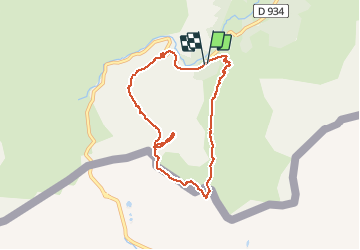

10,6 km | 19,3 km-effort


Benutzer


Kostenlosegpshiking-Anwendung
 SityTrail
IGN / Geografische Institute
SityTrail World
Die Welt öffnet sich für Sie
Tour Wandern von 8,4 km verfügbar auf Neu-Aquitanien, Pyrenäen-Atlantik, Laruns. Diese Tour wird von jysc238 vorgeschlagen.
Départ du pont de Peyrelue. Onsuit le GR108 qui mène au col de Peyrelue. De là, on suit la crête frontière qui passe au-dessus du col du Pourtalet pour aboutir après une rude montée à un petit col sans nom. Puis on grimpe au sommet du Pic d'Estrémère où la vue est assez admirable. Descente technique par le couloir de l'Arrayet.

Wandern

Wandern

Wandern

Zu Fuß
Wandern

Wandern

Wandern

Wandern
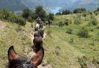
Reiten