![](/images/other/stat-length.png)
![Tour Wandern Les Estables - Rocher Tourte - Photo](https://media.geolcdn.com/t/1900/400/ext.pjpeg?maxdim=2&url=https%3A%2F%2Fstatic1.geolcdn.com%2Fsiteimages%2Fupload%2Ffiles%2F1553511878bg_sport_marche.png)
Rocher Tourte
rigol05
Benutzer
![Länge](/images/other/stat-length.png)
Länge
13,6 km
![Maximale Höhe](https://static1.geolcdn.com/siteimages/upload/files/1508320355ic_sort_altitude_max_24dp.png)
Maximale Höhe
1503 m
![Positive Höhendifferenz](https://static1.geolcdn.com/siteimages/upload/files/1508320355ic_sort_den_pos_24dp.png)
Positive Höhendifferenz
364 m
![Km-Effort](/images/other/stat-length.png)
Km-Effort
18,4 km
![Min. Höhe](https://static1.geolcdn.com/siteimages/upload/files/1508320355ic_sort_altitude_min_24dp.png)
Min. Höhe
1307 m
![Negative Höhendifferenz](https://static1.geolcdn.com/siteimages/upload/files/1508320355ic_sort_den_neg_24dp.png)
Negative Höhendifferenz
363 m
![Boucle](https://static1.geolcdn.com/siteimages/upload/files/16400158638029165_repeat_loop_refresh_sync_direction_icon.png)
Boucle
Ja
Erstellungsdatum :
2017-07-06 00:00:00.0
Letzte Änderung :
2017-07-06 00:00:00.0
![Wandern](https://static1.geolcdn.com/sitytour/trail-icons/101.png)
4h00
Schwierigkeit : Medium
![Scannen Sie diesen QR-Code, um die Tour in der SityTrail-Anwendung zu öffnen](https://capi.geolives.com/qq0zvz2zws4bq2lad0pu/sitytour/trails/779472/qr.png?size=200)
Kostenlosegpshiking-Anwendung
Über SityTrail
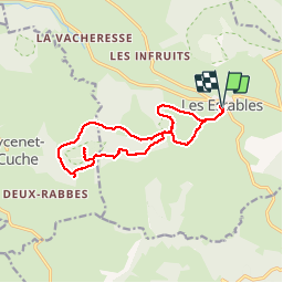
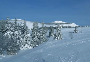
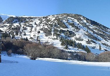
Tour Wandern von 13,6 km verfügbar auf Auvergne-Rhone-Alpen, Haute-Loire, Les Estables. Diese Tour wird von rigol05 vorgeschlagen.
Beschreibung
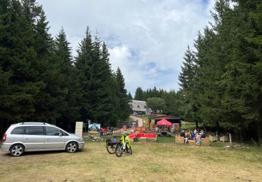
Séjour Ht.Loire sortie du 22/06
Départ les Estables
Circuit d'après tracé Visorando
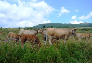
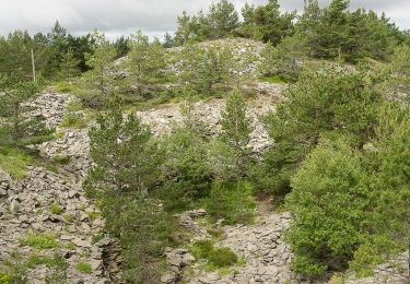
Tentative de monter au sommet, pas de trace visible et beaucoup de végétation.
Ort
Land:
France
Region :
Auvergne-Rhone-Alpen
Abteilung/Provinz :
Haute-Loire
Kommune :
Les Estables
Standort:
Unknown
Gehen Sie:(Dec)
Gehen Sie:(UTM)
591254 ; 4972800 (31T) N.
Kommentare
Touren in der Umgebung
![Tour Mountainbike Les Estables - Site VTT FFC du Mézenc et de la Loire sauvage - Circuit n° 04 - Tour du Mont Alambre - Photo](https://media.geolcdn.com/t/375/260/ext.jpg?maxdim=2&url=https%3A%2F%2Fservices.sitytrail.com%2FGeolivesWS%2FDownloadMedia.ashx%3FTrailID%3D107489%26Media%3D12434_3.jpg)
![Mountainbike Mountainbike](https://static1.geolcdn.com/sitytour/trail-icons/202.png)
Site VTT FFC du Mézenc et de la Loire sauvage - Circuit n° 04 - Tour du Mont ...
Mountainbike
Medium
(1)
Les Estables,
Auvergne-Rhone-Alpen,
Haute-Loire,
France
![](/images/other/stat-length.png)
8,6 km | 11,9 km-effort
1h 0min
![](https://static1.geolcdn.com/siteimages/upload/files/16400158638029165_repeat_loop_refresh_sync_direction_icon.png)
Ja
![Tour Mountainbike Les Estables - Site VTT FFC du Mézenc et de la Loire sauvage - Circuit n° 07 - Boucle en foret domaniale - Photo](https://media.geolcdn.com/t/375/260/ext.jpg?maxdim=2&url=https%3A%2F%2Fservices.sitytrail.com%2FGeolivesWS%2FDownloadMedia.ashx%3FTrailID%3D107492%26Media%3D12437_2.jpg)
![Mountainbike Mountainbike](https://static1.geolcdn.com/sitytour/trail-icons/202.png)
Site VTT FFC du Mézenc et de la Loire sauvage - Circuit n° 07 - Boucle en for...
Mountainbike
Schwierig
(1)
Les Estables,
Auvergne-Rhone-Alpen,
Haute-Loire,
France
![](/images/other/stat-length.png)
19,9 km | 26 km-effort
2h 0min
![](https://static1.geolcdn.com/siteimages/upload/files/16400158638029165_repeat_loop_refresh_sync_direction_icon.png)
Ja
![Tour Wandern Les Estables - Mont Mezenc - Photo](https://media.geolcdn.com/t/375/260/ce0fbf1f-346a-43be-bffd-dfd03dc61c12.jpg&format=jpg&maxdim=2)
![Wandern Wandern](https://static1.geolcdn.com/sitytour/trail-icons/101.png)
Mont Mezenc
Wandern
Medium
(1)
Les Estables,
Auvergne-Rhone-Alpen,
Haute-Loire,
France
![](/images/other/stat-length.png)
13,8 km | 19,9 km-effort
4h 35min
![](https://static1.geolcdn.com/siteimages/upload/files/16400158638029165_repeat_loop_refresh_sync_direction_icon.png)
Ja
![Tour Wandern Borée - Le tour du Mont Mézenc en Ardèche - Photo](https://media.geolcdn.com/t/375/260/970aece0-8ccf-44ea-bc9f-1d6489c7e0aa.jpg&format=jpg&maxdim=2)
![Wandern Wandern](https://static1.geolcdn.com/sitytour/trail-icons/101.png)
Le tour du Mont Mézenc en Ardèche
Wandern
Medium
Borée,
Auvergne-Rhone-Alpen,
Ardèche,
France
![](/images/other/stat-length.png)
16,4 km | 23 km-effort
4h 21min
![](https://static1.geolcdn.com/siteimages/upload/files/16400158638029165_repeat_loop_refresh_sync_direction_icon.png)
Ja
![Tour Wandern La Rochette - Le tour du Mont Signon au départ de la chambre d'hôtes La retrouvade - Photo](https://media.geolcdn.com/t/375/260/a743c4a1-06ad-43d0-8b82-bee213f09387.jpg&format=jpg&maxdim=2)
![Wandern Wandern](https://static1.geolcdn.com/sitytour/trail-icons/101.png)
Le tour du Mont Signon au départ de la chambre d'hôtes La retrouvade
Wandern
Medium
La Rochette,
Auvergne-Rhone-Alpen,
Ardèche,
France
![](/images/other/stat-length.png)
18,8 km | 27 km-effort
4h 47min
![](https://static1.geolcdn.com/siteimages/upload/files/16400158638029165_repeat_loop_refresh_sync_direction_icon.png)
Ja
![Tour Wandern Les Estables - Mont Mezenc Tour et sommet - Photo](https://media.geolcdn.com/t/375/260/fadc45c1-ba83-4e9a-a452-756f5fd46c63.jpg&format=jpg&maxdim=2)
![Wandern Wandern](https://static1.geolcdn.com/sitytour/trail-icons/101.png)
Mont Mezenc Tour et sommet
Wandern
Medium
(1)
Les Estables,
Auvergne-Rhone-Alpen,
Haute-Loire,
France
![](/images/other/stat-length.png)
13,7 km | 20 km-effort
4h 36min
![](https://static1.geolcdn.com/siteimages/upload/files/16400158638029165_repeat_loop_refresh_sync_direction_icon.png)
Ja
![Tour Wandern Sainte-Eulalie - 2023-01-26_11h39m37_Sucs Montfol et La Lauzière 11km.gpx.xml - Photo](https://media.geolcdn.com/t/375/260/23607b52-b0d6-4888-813e-934a0c1347d5.jpg&format=jpg&maxdim=2)
![Wandern Wandern](https://static1.geolcdn.com/sitytour/trail-icons/101.png)
2023-01-26_11h39m37_Sucs Montfol et La Lauzière 11km.gpx.xml
Wandern
Schwierig
Sainte-Eulalie,
Auvergne-Rhone-Alpen,
Ardèche,
France
![](/images/other/stat-length.png)
10 km | 14,6 km-effort
3h 30min
![](https://static1.geolcdn.com/siteimages/upload/files/16400158638029165_repeat_loop_refresh_sync_direction_icon.png)
Ja
![Tour Wandern Borée - 2023-01-26_07h29m20_Tour Mézenc 17km.gpx.xml - Photo](https://media.geolcdn.com/t/375/260/92d24228-4d9c-4ba3-b5e5-3f7d7227fc7d.jpg&format=jpg&maxdim=2)
![Wandern Wandern](https://static1.geolcdn.com/sitytour/trail-icons/101.png)
2023-01-26_07h29m20_Tour Mézenc 17km.gpx.xml
Wandern
Schwierig
Borée,
Auvergne-Rhone-Alpen,
Ardèche,
France
![](/images/other/stat-length.png)
18,2 km | 27 km-effort
6h 5min
![](https://static1.geolcdn.com/siteimages/upload/files/16400158638029165_repeat_loop_refresh_sync_direction_icon.png)
Ja
![Tour Wandern Les Estables - Circuit incluant le sommet du Mezenc - Photo](https://media.geolcdn.com/t/375/260/f9b8e22d-f239-491b-8f20-19a91b900080.jpg&format=jpg&maxdim=2)
![Wandern Wandern](https://static1.geolcdn.com/sitytour/trail-icons/101.png)
Circuit incluant le sommet du Mezenc
Wandern
Medium
Les Estables,
Auvergne-Rhone-Alpen,
Haute-Loire,
France
![](/images/other/stat-length.png)
6,9 km | 10,2 km-effort
2h 52min
![](https://static1.geolcdn.com/siteimages/upload/files/16400158638029165_repeat_loop_refresh_sync_direction_icon.png)
Nein