


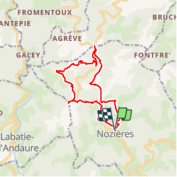

17,7 km | 26 km-effort


Benutzer


Kostenlosegpshiking-Anwendung
 SityTrail
IGN / Geografische Institute
SityTrail World
Die Welt öffnet sich für Sie
Tour Wandern von 13,2 km verfügbar auf Auvergne-Rhone-Alpen, Ardèche, Nozières. Diese Tour wird von claufranck vorgeschlagen.
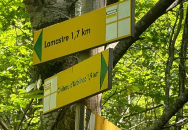
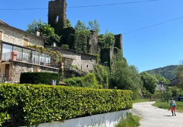
Balade sympathique sur Nozières en allant jusqu'au Col du Buisson et en rentrant par le point culminant de la commune

sport
sport

Wandern

Wandern

Mountainbike

Wandern

Wandern

Wandern
Wandern