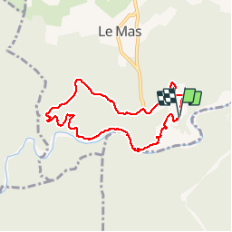
![](/images/other/stat-length.png)
![Tour Wandern Saint-Privat-de-Champclos - Chapelle SAINT-FERREOL - Photo](https://media.geolcdn.com/t/1900/400/ext.pjpeg?maxdim=2&url=https%3A%2F%2Fstatic1.geolcdn.com%2Fsiteimages%2Fupload%2Ffiles%2F1553511878bg_sport_marche.png)
Chapelle SAINT-FERREOL
will83
Benutzer
![Länge](/images/other/stat-length.png)
![Maximale Höhe](https://static1.geolcdn.com/siteimages/upload/files/1508320355ic_sort_altitude_max_24dp.png)
![Positive Höhendifferenz](https://static1.geolcdn.com/siteimages/upload/files/1508320355ic_sort_den_pos_24dp.png)
![Km-Effort](/images/other/stat-length.png)
![Min. Höhe](https://static1.geolcdn.com/siteimages/upload/files/1508320355ic_sort_altitude_min_24dp.png)
![Negative Höhendifferenz](https://static1.geolcdn.com/siteimages/upload/files/1508320355ic_sort_den_neg_24dp.png)
![Boucle](https://static1.geolcdn.com/siteimages/upload/files/16400158638029165_repeat_loop_refresh_sync_direction_icon.png)
![Wandern](https://static1.geolcdn.com/sitytour/trail-icons/101.png)
2h32
Schwierigkeit : Einfach
![Scannen Sie diesen QR-Code, um die Tour in der SityTrail-Anwendung zu öffnen](https://capi.geolives.com/qq0zvz2zws4bq2lad0pu/sitytour/trails/766326/qr.png?size=200)
Kostenlosegpshiking-Anwendung
Über SityTrail
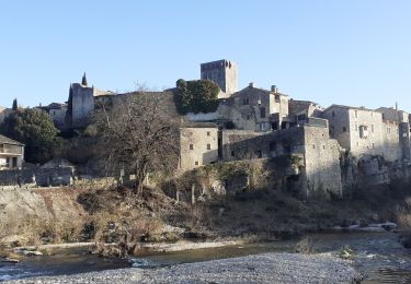
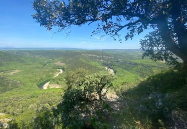
Tour Wandern von 7,6 km verfügbar auf Okzitanien, Gard, Saint-Privat-de-Champclos. Diese Tour wird von will83 vorgeschlagen.
Beschreibung
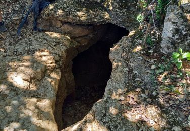
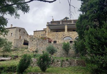
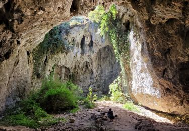
Chapelle de l'Ermitage SAINT- FERREOL au départ du domaine de La sablière par la piste de Combe Longue.
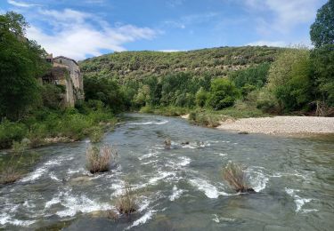
Baignade possible.
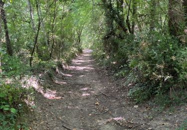
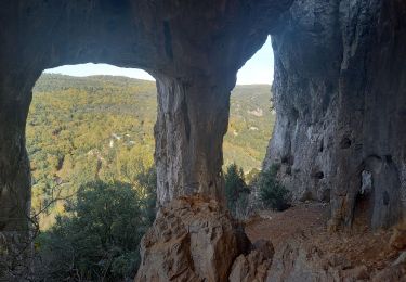
Randonnée sans difficulté physique. Présence d'un passage technique difficile avec main courante lors du retour sur le domaine en bordure de la Ceze.
Attention au soleil sur la piste, pas d'ombre. (variante technique par un sentier à gauche au niveau de l'intersection Serre du Barri mais glissante par temps humide)
Ort
Kommentare
Touren in der Umgebung
![Tour Wandern Saint-Privat-de-Champclos - Château de Ferreyrolle - Photo](https://media.geolcdn.com/t/375/260/6d35cd9d-375d-4f33-83e5-2813e967a743.jpg&format=jpg&maxdim=2)
![Wandern Wandern](https://static1.geolcdn.com/sitytour/trail-icons/101.png)
Wandern
![](/images/other/stat-length.png)
![](https://static1.geolcdn.com/siteimages/upload/files/16400158638029165_repeat_loop_refresh_sync_direction_icon.png)
![Tour Wandern Tharaux - Tharaux - Photo](https://media.geolcdn.com/t/375/260/01bc6044-7c62-4cc1-8831-f55311bb9329.jpg&format=jpg&maxdim=2)
![Wandern Wandern](https://static1.geolcdn.com/sitytour/trail-icons/101.png)
![Tour Wandern Montclus - Montclus - Photo](https://media.geolcdn.com/t/375/260/5b5dca1f-e2f4-40c9-83d1-740385f65a5b.jpg&format=jpg&maxdim=2)
![Wandern Wandern](https://static1.geolcdn.com/sitytour/trail-icons/101.png)
![Tour Wandern Montclus - montclus - Photo](https://media.geolcdn.com/t/375/260/fc92434c-2f04-4c3b-985b-744df58331b6.jpg&format=jpg&maxdim=2)
![Wandern Wandern](https://static1.geolcdn.com/sitytour/trail-icons/101.png)
![Tour Wandern Tharaux - Tharaux la Cèze - Photo](https://media.geolcdn.com/t/375/260/4bdb970c-b0f9-4e30-b3b2-4f135c4250be.jpg&format=jpg&maxdim=2)
![Wandern Wandern](https://static1.geolcdn.com/sitytour/trail-icons/101.png)
![Tour Wandern Méjannes-le-Clap - mejannes le clap - Photo](https://media.geolcdn.com/t/375/260/d0e23ebe-33e3-4300-84fa-90d302ddb272.jpg&format=jpg&maxdim=2)
![Wandern Wandern](https://static1.geolcdn.com/sitytour/trail-icons/101.png)
Wandern
![](/images/other/stat-length.png)
![](https://static1.geolcdn.com/siteimages/upload/files/16400158638029165_repeat_loop_refresh_sync_direction_icon.png)
![Tour Wandern Méjannes-le-Clap - Mejannes le clap par Rocher de l'Aigle - Photo](https://media.geolcdn.com/t/375/260/71c29605-58ee-4bb6-9602-558b471b1323.jpg&format=jpg&maxdim=2)
![Wandern Wandern](https://static1.geolcdn.com/sitytour/trail-icons/101.png)
Wandern
![](/images/other/stat-length.png)
![](https://static1.geolcdn.com/siteimages/upload/files/16400158638029165_repeat_loop_refresh_sync_direction_icon.png)
![Tour Wandern Méjannes-le-Clap - grotte Aven de Peyre haute - Photo](https://media.geolcdn.com/t/375/260/d4f3ec17-14e0-4af7-b0c9-c2d485c47a84.jpg&format=jpg&maxdim=2)
![Wandern Wandern](https://static1.geolcdn.com/sitytour/trail-icons/101.png)
Wandern
![](/images/other/stat-length.png)
![](https://static1.geolcdn.com/siteimages/upload/files/16400158638029165_repeat_loop_refresh_sync_direction_icon.png)
![Tour Wandern Montclus - Montclus petite boucle. - Photo](https://media.geolcdn.com/t/375/260/ca2cf1e7-c5ab-4b22-8db8-d66d12e30ad1.jpg&format=jpg&maxdim=2)
![Wandern Wandern](https://static1.geolcdn.com/sitytour/trail-icons/101.png)
Wandern
![](/images/other/stat-length.png)
![](https://static1.geolcdn.com/siteimages/upload/files/16400158638029165_repeat_loop_refresh_sync_direction_icon.png)