


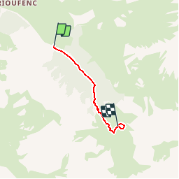

14,5 km | 29 km-effort


Benutzer


Kostenlosegpshiking-Anwendung
 SityTrail
IGN / Geografische Institute
SityTrail World
Die Welt öffnet sich für Sie
Tour Wandern von 2,8 km verfügbar auf Provence-Alpes-Côte d'Azur, Hochalpen, Ceillac. Diese Tour wird von Dervalmarc vorgeschlagen.
Lové sur son promontoire verdoyant qui domine la vallée du Cristillan,le lac de Clausis est propice pour méditer et s' imprégner de l ambiance a cette période de l'année.Distance 6 kilométre aller retour.

Wandern

Wandern

Andere Aktivitäten

Wandern

Wandern
Wandern

Wandern
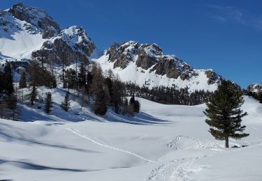
Schneeschuhwandern
Schneeschuhwandern