Tour Wandern Lentillères - de la salamandre a la lande - Photo

de la salamandre a la lande

 Thierry_Garre
Thierry_Garre

Benutzer

© OpenStreetMap contributors
Länge
Länge
6,9 km
Maximale Höhe
Maximale Höhe
579 m
Positive Höhendifferenz
254 m
Km-Effort
Km-Effort  
10,3 km
Min. Höhe
Min. Höhe
349 m
Negative Höhendifferenz
255 m
Boucle
Boucle
Ja
Erstellungsdatum :
2017-04-29 00:00:00.0
Letzte Änderung :
2017-04-29 00:00:00.0

(0 Nachricht)

Wandern
Wandern
2h30
Schwierigkeit : Einfach

Scannen Sie diesen QR-Code, um die Tour in der SityTrail-Anwendung zu öffnen

Kostenlosegpshiking-Anwendung

Logo SityTrail SityTrail

IGN / Geografische Institute

SityTrail aus dem App Store herunterladen SityTrail von Google Play herunterladen

Logo SityTrail SityTrail World

Die Welt öffnet sich für Sie

SityTrail aus dem App Store herunterladen SityTrail von Google Play herunterladen SityTrail auf Huawei AppGallery herunterladen

Über SityTrail

Tour Wandern von 6,9 km verfügbar auf Auvergne-Rhone-Alpen, Ardèche, Lentillères. Diese Tour wird von Thierry_Garre vorgeschlagen.

Beschreibung

-Descendre du hameau des Imberts en direction du sud est
-traverser la piste
longer la rivière vers le sud
au pont romain suivre la rivière sans la traverser.
-rejoindre et suivre la route jusqu'au pont.
-traverser le pont et suivre la rivière jusqu’à une grande prairie (chevaux)
-au bout de la prairie remonter a droite par un chemin jusqu'au Hameau des Ladets.
suivre la route sur la gauche jusqu'au carrefour.
Reprendre à droite la RD335 jusqu'au col de l'Eyrolle.
Au col prendre la route a gauche vers Valsadoul.
prendre le chemin à droite après la cabane des chasseurs.
Suivre le chemin jusqu'au hameau du village.passer sous le porche.
Apres le porche descendre vers les Imberts par un chemin.

Penser a refermer les barrières derrière vous.

Bonne ballade


Höhenprofil

POIs

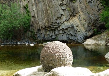
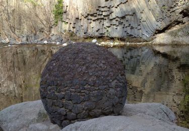
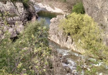
POI Lentillères - La Salamandre - Photo
Thierry_Garre
LENTILLÈRES 
POI Lentillères - La Salamandre - Photo
Thierry_Garre
LENTILLÈRES 
POI Lentillères - Cascade - Photo
Thierry_Garre
LENTILLÈRES 
POI Lentillères - Cascade - Photo
Thierry_Garre
LENTILLÈRES 
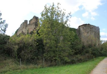
POI Lentillères - Pont Romain - Photo
Thierry_Garre
LENTILLÈRES 
POI Lentillères - Pont Romain - Photo
Thierry_Garre
LENTILLÈRES 
POI Chazeaux - Le gour de la Serre - Photo
Thierry_Garre
POI Chazeaux - Le gour de la Serre - Photo
Thierry_Garre
POI Lentillères - Le chevres l'Eyrolle - Photo
Thierry_Garre
LENTILLÈRES 
POI Lentillères - Le chevres l'Eyrolle - Photo
Thierry_Garre
LENTILLÈRES 
POI Lentillères - Ancienne prison du village - Photo
Thierry_Garre
POI Lentillères - Ancienne prison du village - Photo
Thierry_Garre
POI Lentillères - Point de vue remarquable - Photo
Thierry_Garre
POI Lentillères - Point de vue remarquable - Photo
Thierry_Garre
POI Lentillères - Le moulin - Photo
Thierry_Garre
LENTILLÈRES 
POI Lentillères - Le moulin - Photo
Thierry_Garre
LENTILLÈRES 
POI Lentillères - Le rocher des croix - Photo
Thierry_Garre
LENTILLÈRES 
POI Lentillères - Le fouloir - Photo
Thierry_Garre
LENTILLÈRES 
POI Lentillères - La fabrique - Photo
Thierry_Garre
LENTILLÈRES 
POI Lentillères - Beaume d'oli - Photo
Thierry_Garre
LENTILLÈRES 

Ort

Land:
France
Region :
Auvergne-Rhone-Alpen
Abteilung/Provinz :
Ardèche
Kommune :
Lentillères
Standort:
Unknown
Gehen Sie:(Dec)
Gehen Sie:(UTM)
604189 ; 4940760 (31T) N.

Touren in der Umgebung

Tour Wandern Jaujac - Jaujac Le Ventapet 14km - Photo
Wandern
GUIDE
thonyc

Wandern

Sehr schwierig
(1)
Jaujac, Auvergne-Rhone-Alpen, Ardèche, France
13,6 km | 23 km-effort
5h 18min
Ja
Tour Wandern Fabras - Fabras  - Photo
Wandern
MoiClaude

Wandern

Medium
(1)
Fabras, Auvergne-Rhone-Alpen, Ardèche, France
6,4 km | 9,7 km-effort
1h 49min
Nein
Tour Wandern Jaujac - 07 jaujac rocher de l aigle - Photo
Wandern
GUIDE
randodyssée

Wandern

Einfach
(1)
Jaujac, Auvergne-Rhone-Alpen, Ardèche, France
11,2 km | 19,7 km-effort
6h 23min
Ja
Tour Wandern Ailhon - 2024-09-25_21h25m23_Ailhon 9km - Photo
Wandern
GUIDE
chancha

Wandern

Medium
Ailhon, Auvergne-Rhone-Alpen, Ardèche, France
8,3 km | 11,7 km-effort
2h 39min
Ja
Tour Wandern Jaujac - ARDECHE,  JAUJAC. .PONT DE L ECHELLE O - Photo
Wandern
GUIDE
RobinMicheline

Wandern

Medium
Jaujac, Auvergne-Rhone-Alpen, Ardèche, France
5,1 km | 8,3 km-effort
2h 33min
Nein
Tour Wandern Jaujac - 07_jaujac_Orgues_9km360m - Photo
Wandern
SyMA

Wandern

Medium
Jaujac, Auvergne-Rhone-Alpen, Ardèche, France
9,1 km | 13,8 km-effort
3h 7min
Ja
Tour Wandern Fabras - Fabras Jaujac les orgues basaltiques  - Photo
Wandern
GUIDE
Roger Philippe Wallez

Wandern

Sehr schwierig
Fabras, Auvergne-Rhone-Alpen, Ardèche, France
14,9 km | 22 km-effort
5h 17min
Ja
Tour Wandern Chazeaux - 2023-03-20_16h29m52_Chazeaux 9km.GPX.xml - Photo
Wandern
GUIDE
chancha

Wandern

Schwierig
Chazeaux, Auvergne-Rhone-Alpen, Ardèche, France
8,3 km | 13,4 km-effort
3h 0min
Ja
Tour Wandern Vals-les-Bains - Tesseaux  - Photo
Wandern
Rudy07

Wandern

Einfach
(1)
Vals-les-Bains, Auvergne-Rhone-Alpen, Ardèche, France
4 km | 5,7 km-effort
1h 13min
Ja


Schließen
Meine Abonnements