![](/images/other/stat-length.png)
![Tour Wandern Arbois - Reculée des Planches - Photo](https://media.geolcdn.com/t/1900/400/ext.pjpeg?maxdim=2&url=https%3A%2F%2Fservices.sitytrail.com%2FGeolivesWS%2FDownloadMedia.ashx%3FTrailID%3D722772%26Media%3Dfix__20170329165531.jpg)
Reculée des Planches
Marfee
Benutzer
![Länge](/images/other/stat-length.png)
![Maximale Höhe](https://static1.geolcdn.com/siteimages/upload/files/1508320355ic_sort_altitude_max_24dp.png)
![Positive Höhendifferenz](https://static1.geolcdn.com/siteimages/upload/files/1508320355ic_sort_den_pos_24dp.png)
![Km-Effort](/images/other/stat-length.png)
![Min. Höhe](https://static1.geolcdn.com/siteimages/upload/files/1508320355ic_sort_altitude_min_24dp.png)
![Negative Höhendifferenz](https://static1.geolcdn.com/siteimages/upload/files/1508320355ic_sort_den_neg_24dp.png)
![Boucle](https://static1.geolcdn.com/siteimages/upload/files/16400158638029165_repeat_loop_refresh_sync_direction_icon.png)
![Wandern](https://static1.geolcdn.com/sitytour/trail-icons/101.png)
7h19
Schwierigkeit : Medium
![Scannen Sie diesen QR-Code, um die Tour in der SityTrail-Anwendung zu öffnen](https://capi.geolives.com/qq0zvz2zws4bq2lad0pu/sitytour/trails/722772/qr.png?size=200)
Kostenlosegpshiking-Anwendung
Über SityTrail
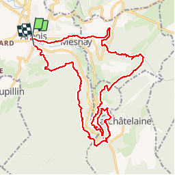
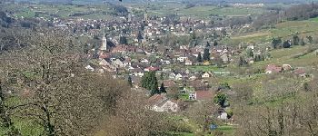
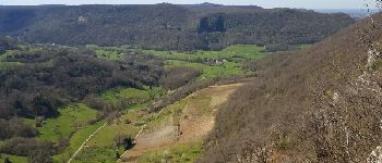
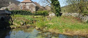
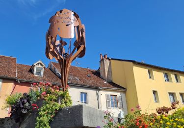
Tour Wandern von 23 km verfügbar auf Burgund und Freigrafschaft, Jura, Arbois. Diese Tour wird von Marfee vorgeschlagen.
Beschreibung
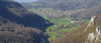
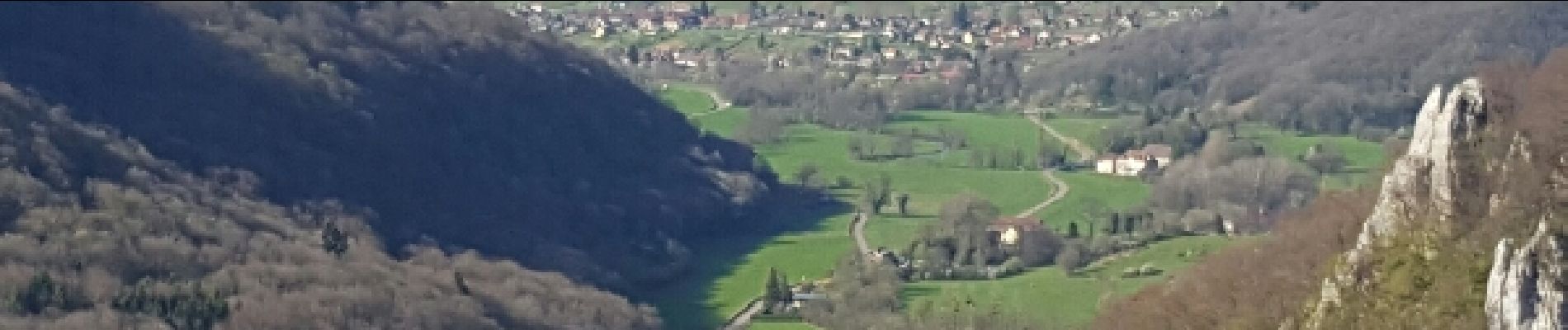
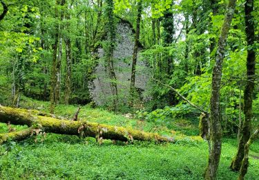
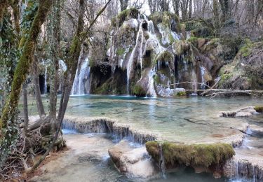
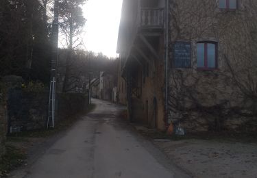
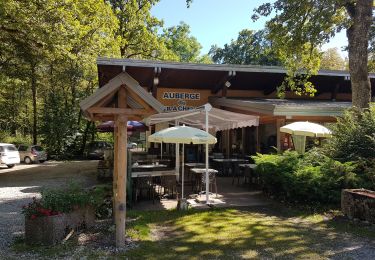
Superbe rando au départ d'Arbois. Aucune réserve sur les 23 kms du parcours. Très belle alternance entre sentiers en sous-bois et très beaux panoramas. La boucle à partir de Les-Planches-près- Arbois, le long de la Cousance et de ses cascades, est vraiment des plus agréables. Quelques passages assez "sportifs". A noter, un petit écart entre le traçage du GR59 sur la carte et le parcours sur le terrain au niveau de la D469 après le belvédère du Fer à cheval. Suivre les marques du GR.
Le cumul de dénivelé me paraît être sous-évalué. Ma montre GPS me donne un résultat nettement supérieur.
Ort
Kommentare
Touren in der Umgebung
![Tour Wandern Arbois - Arbois Église Saint Just / Chapelle Notre Dame de l'Ermitage/ Cascade des Tufs/ Les Planches près d'Arbois / Cirque du Fer à Cheval / Belvédère de la Châtelaine/ La Roche du Feu/ Meslay/ Arbois - Photo](https://media.geolcdn.com/t/375/260/c57ab660-fec2-47a8-a9d2-fa1865f963db.jpg&format=jpg&maxdim=2)
![Wandern Wandern](https://static1.geolcdn.com/sitytour/trail-icons/101.png)
Wandern
![](/images/other/stat-length.png)
![](https://static1.geolcdn.com/siteimages/upload/files/16400158638029165_repeat_loop_refresh_sync_direction_icon.png)
![Tour Wandern Arbois - Arbois Pupillin Arbois - Photo](https://media.geolcdn.com/t/375/260/d8b4c5eb-e163-47d4-aaaf-96dbcfbb358f.jpg&format=jpg&maxdim=2)
![Wandern Wandern](https://static1.geolcdn.com/sitytour/trail-icons/101.png)
Wandern
![](/images/other/stat-length.png)
![](https://static1.geolcdn.com/siteimages/upload/files/16400158638029165_repeat_loop_refresh_sync_direction_icon.png)
![Tour Wandern Arbois - Arbois Belvédère du Fer à Cheval Belvédère Châtelaine Cascade des Tufs Planches près d'Arbois La Roche du Feu Mesnay Arbois - Photo](https://media.geolcdn.com/t/375/260/71353c7e-d6a4-47bd-b061-6c2048e62167.jpg&format=jpg&maxdim=2)
![Wandern Wandern](https://static1.geolcdn.com/sitytour/trail-icons/101.png)
Wandern
![](/images/other/stat-length.png)
![](https://static1.geolcdn.com/siteimages/upload/files/16400158638029165_repeat_loop_refresh_sync_direction_icon.png)
![Tour Wandern Les Planches-près-Arbois - la reculée des planches - Photo](https://media.geolcdn.com/t/375/260/54dcee1d-d6c8-429f-ae87-1dad41ae6b91.jpg&format=jpg&maxdim=2)
![Wandern Wandern](https://static1.geolcdn.com/sitytour/trail-icons/101.png)
Wandern
![](/images/other/stat-length.png)
![](https://static1.geolcdn.com/siteimages/upload/files/16400158638029165_repeat_loop_refresh_sync_direction_icon.png)
![Tour Wandern Arbois - Arbois Reculée des Planches - Photo](https://media.geolcdn.com/t/375/260/3029e893-3181-453d-94ab-d00d63b05373.jpg&format=jpg&maxdim=2)
![Wandern Wandern](https://static1.geolcdn.com/sitytour/trail-icons/101.png)
Wandern
![](/images/other/stat-length.png)
![](https://static1.geolcdn.com/siteimages/upload/files/16400158638029165_repeat_loop_refresh_sync_direction_icon.png)
![Tour Wandern Montigny-lès-Arsures - Montigny les Arsures - Photo](https://media.geolcdn.com/t/375/260/43ca39b3-8483-4e13-bdbd-587ac00b0f2b.jpg&format=jpg&maxdim=2)
![Wandern Wandern](https://static1.geolcdn.com/sitytour/trail-icons/101.png)
Wandern
![](/images/other/stat-length.png)
![](https://static1.geolcdn.com/siteimages/upload/files/16400158638029165_repeat_loop_refresh_sync_direction_icon.png)
![Tour Wandern La Châtelaine - Cirque du Fer à Cheval - cascade des Tufs - Arbois - Photo](https://media.geolcdn.com/t/375/260/ff46c3de-3ecb-478e-8c38-198244ccc0e5.jpg&format=jpg&maxdim=2)
![Wandern Wandern](https://static1.geolcdn.com/sitytour/trail-icons/101.png)
Wandern
![](/images/other/stat-length.png)
![](https://static1.geolcdn.com/siteimages/upload/files/16400158638029165_repeat_loop_refresh_sync_direction_icon.png)
![Tour Wandern La Châtelaine - les planches d'Arbois restaurant le fer à cheval - Photo](https://media.geolcdn.com/t/375/260/e63ffc4f-ef96-4146-b1da-ac690db78307.jpg&format=jpg&maxdim=2)
![Wandern Wandern](https://static1.geolcdn.com/sitytour/trail-icons/101.png)
Wandern
![](/images/other/stat-length.png)
![](https://static1.geolcdn.com/siteimages/upload/files/16400158638029165_repeat_loop_refresh_sync_direction_icon.png)
![Tour Reiten Les Planches-près-Arbois - EQU-INTEGRALE-2021 - Photo](https://media.geolcdn.com/t/375/260/ext.jpg?maxdim=2&url=https%3A%2F%2Fstatic1.geolcdn.com%2Fsiteimages%2Fupload%2Ffiles%2F1524743154cheval.jpg)
![Reiten Reiten](https://static1.geolcdn.com/sitytour/trail-icons/301.png)
Reiten
![](/images/other/stat-length.png)
![](https://static1.geolcdn.com/siteimages/upload/files/16400158638029165_repeat_loop_refresh_sync_direction_icon.png)
super randonnées