


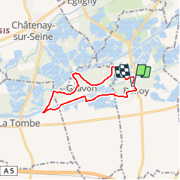

17,2 km | 18,4 km-effort


Benutzer


Kostenlosegpshiking-Anwendung
 SityTrail
IGN / Geografische Institute
SityTrail World
Die Welt öffnet sich für Sie
Tour Wandern von 10,1 km verfügbar auf Île-de-France, Seine-et-Marne, Balloy. Diese Tour wird von gpalazzo vorgeschlagen.
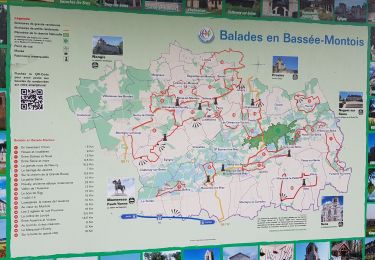
Balade facile, plate mais ennuyeuse, bloqué entre route et grillage (car tous les étangs sont privés)
N'a d'intérêt que pour passé le temps si vous habitez 10km autour.
Reiten
Wandern

Wandern
Wandern

Zu Fuß
Wandern
Nordic Walking
Wandern
Wandern