


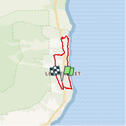

3,8 km | 10,1 km-effort


Benutzer


Kostenlosegpshiking-Anwendung
 SityTrail
IGN / Geografische Institute
SityTrail World
Die Welt öffnet sich für Sie
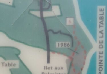
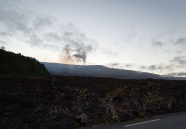
Tour Wandern von 11,9 km verfügbar auf Réunion, Unbekannt, Saint-Philippe. Diese Tour wird von Fdum vorgeschlagen.
Belle balade, avec le littoral pour finir. Eviter les journées pluvieuses, car ça glisse. En avril les herbes sont hautes, sur certains secteurs !!!

Wandern
Wandern
Wandern

Wandern
Wandern

Andere Aktivitäten


sport

Rennrad
Wandern