Tour Wandern Saint-Barthélemy-de-Bussière - Saint Barthelemy de Bussière boucle1 - Photo

Saint Barthelemy de Bussière boucle1

 rougilabuse
rougilabuse

Benutzer

© OpenStreetMap contributors
Länge
Länge
14,5 km
Maximale Höhe
Maximale Höhe
331 m
Positive Höhendifferenz
315 m
Km-Effort
Km-Effort  
18,7 km
Min. Höhe
Min. Höhe
228 m
Negative Höhendifferenz
313 m
Boucle
Boucle
Ja
Erstellungsdatum :
2017-03-19 00:00:00.0
Letzte Änderung :
2017-03-19 00:00:00.0

(0 Nachricht)

Wandern
Wandern
4h03
Schwierigkeit : Medium

Scannen Sie diesen QR-Code, um die Tour in der SityTrail-Anwendung zu öffnen

Kostenlosegpshiking-Anwendung

Logo SityTrail SityTrail

IGN / Geografische Institute

SityTrail aus dem App Store herunterladen SityTrail von Google Play herunterladen

Logo SityTrail SityTrail World

Die Welt öffnet sich für Sie

SityTrail aus dem App Store herunterladen SityTrail von Google Play herunterladen SityTrail auf Huawei AppGallery herunterladen

Über SityTrail

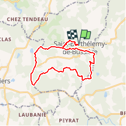
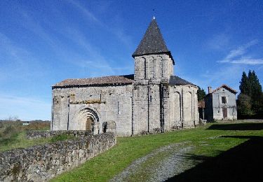
Tour Wandern von 14,5 km verfügbar auf Neu-Aquitanien, Dordogne, Saint-Barthélemy-de-Bussière. Diese Tour wird von rougilabuse vorgeschlagen.

Beschreibung

Je l'ai classé moyenne par son dénivelée.
Cette rando conjugue 3 parcours au départ la boucle du bourg puis la boucle de Lamorinie puis celle du Chatenet on termine avec la boucle du bourg.
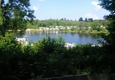
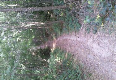
le dénivelé est intéressante. il permet appréciez de jolies panoramas. Cette rando est à conseiller à faire quand les arbres sont feuillés. Beaucoup de parcours en forêt.

Höhenprofil

POIs

POI Saint-Barthélemy-de-Bussière - boucle lamorinie - Photo
rougilabuse
SAINT-BARTHÉLEMY-DE-BUSSIÈRE 
POI Piégut-Pluviers - à gauche - Photo
rougilabuse
PIÉGUT-PLUVIERS 
POI Piégut-Pluviers - tout droit - Photo
rougilabuse
PIÉGUT-PLUVIERS 
POI Saint-Barthélemy-de-Bussière - à gauche - Photo
rougilabuse
SAINT-BARTHÉLEMY-DE-BUSSIÈRE 
POI Saint-Barthélemy-de-Bussière - à droite - Photo
rougilabuse
SAINT-BARTHÉLEMY-DE-BUSSIÈRE 
POI Saint-Barthélemy-de-Bussière - à gauche - Photo
rougilabuse
SAINT-BARTHÉLEMY-DE-BUSSIÈRE 
POI Saint-Barthélemy-de-Bussière - mauvaise direction - Photo
rougilabuse
SAINT-BARTHÉLEMY-DE-BUSSIÈRE 
POI Saint-Barthélemy-de-Bussière - lamaorinie - Photo
rougilabuse
SAINT-BARTHÉLEMY-DE-BUSSIÈRE 
POI Saint-Barthélemy-de-Bussière - à droite - Photo
rougilabuse
SAINT-BARTHÉLEMY-DE-BUSSIÈRE 
POI Saint-Barthélemy-de-Bussière - à droite - Photo
rougilabuse
SAINT-BARTHÉLEMY-DE-BUSSIÈRE 
POI Saint-Barthélemy-de-Bussière - à gauche - Photo
rougilabuse
SAINT-BARTHÉLEMY-DE-BUSSIÈRE 
POI Marval - à gauche - Photo
rougilabuse
MARVAL 
POI Marval - à gauche - Photo
rougilabuse
MARVAL 
POI Saint-Barthélemy-de-Bussière - tout droit - Photo
rougilabuse
SAINT-BARTHÉLEMY-DE-BUSSIÈRE 
POI Saint-Barthélemy-de-Bussière - à droite - Photo
rougilabuse
SAINT-BARTHÉLEMY-DE-BUSSIÈRE 
POI Saint-Barthélemy-de-Bussière - à gauche - Photo
rougilabuse
SAINT-BARTHÉLEMY-DE-BUSSIÈRE 
POI Marval - à gauche - Photo
rougilabuse
MARVAL 
POI Saint-Barthélemy-de-Bussière - tout droit - Photo
rougilabuse
SAINT-BARTHÉLEMY-DE-BUSSIÈRE 
POI Saint-Barthélemy-de-Bussière - tout droit - Photo
rougilabuse
SAINT-BARTHÉLEMY-DE-BUSSIÈRE 
POI Saint-Barthélemy-de-Bussière - tout droit - Photo
rougilabuse
SAINT-BARTHÉLEMY-DE-BUSSIÈRE 
POI Saint-Barthélemy-de-Bussière - à gauche  - Photo
rougilabuse
SAINT-BARTHÉLEMY-DE-BUSSIÈRE 
POI Saint-Barthélemy-de-Bussière - tout droit - Photo
rougilabuse
SAINT-BARTHÉLEMY-DE-BUSSIÈRE 
POI Saint-Barthélemy-de-Bussière - les Suchaux - Photo
rougilabuse
SAINT-BARTHÉLEMY-DE-BUSSIÈRE 
POI Saint-Barthélemy-de-Bussière - à droite - Photo
rougilabuse
SAINT-BARTHÉLEMY-DE-BUSSIÈRE 

Ort

Land:
France
Region :
Neu-Aquitanien
Abteilung/Provinz :
Dordogne
Kommune :
Saint-Barthélemy-de-Bussière
Standort:
Unknown
Gehen Sie:(Dec)
Gehen Sie:(UTM)
324962 ; 5056612 (31T) N.

Touren in der Umgebung

Tour Wandern Marval - milhaguet les hautes forets - Photo
Wandern
rougilabuse

Wandern

Einfach
Marval, Neu-Aquitanien, Haute-Vienne, France
13,5 km | 16,6 km-effort
3h 38min
Ja
Tour Wandern Marval - puy chevalier - Photo
Wandern
rougilabuse

Wandern

Einfach
(1)
Marval, Neu-Aquitanien, Haute-Vienne, France
12,2 km | 14,4 km-effort
3h 35min
Ja
Tour Mountainbike Augignac - Circuit_StEstephe_Bourdeix - Photo
Mountainbike
JeremyBois

Mountainbike

Schwierig
Augignac, Neu-Aquitanien, Dordogne, France
27 km | 33 km-effort
2h 4min
Ja
Tour Wandern Augignac - Augignac Etangs Maison Neuve 12km - Photo
Wandern
YV24

Wandern

Sehr leicht
Augignac, Neu-Aquitanien, Dordogne, France
11,4 km | 13,9 km-effort
3h 4min
Ja
Tour Wandern Champniers-et-Reilhac - champniers - Photo
Wandern
rougilabuse

Wandern

Medium
Champniers-et-Reilhac, Neu-Aquitanien, Dordogne, France
14,8 km | 18,5 km-effort
4h 50min
Ja
Tour Mountainbike Augignac - Circuit_Piégut  vers Bussière - Photo
Mountainbike
JeremyBois

Mountainbike

Sehr leicht
Augignac, Neu-Aquitanien, Dordogne, France
36 km | 45 km-effort
Unbekannt
Ja
Tour Mountainbike Augignac - Circuit_StEstèphe vers Piégut - Photo
Mountainbike
JeremyBois

Mountainbike

Sehr leicht
Augignac, Neu-Aquitanien, Dordogne, France
28 km | 34 km-effort
1h 25min
Ja
Tour Mountainbike Augignac - Circuit_Augignac_1 - Photo
Mountainbike
JeremyBois

Mountainbike

Einfach
Augignac, Neu-Aquitanien, Dordogne, France
13,5 km | 16,8 km-effort
1h 6min
Ja
Tour Mountainbike Augignac - Circuit_SaintBarthelemy1 - Photo
Mountainbike
JeremyBois

Mountainbike

Medium
Augignac, Neu-Aquitanien, Dordogne, France
27 km | 34 km-effort
2h 25min
Ja


Schließen
Meine Abonnements