


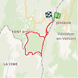

9,2 km | 14,2 km-effort


Benutzer


Kostenlosegpshiking-Anwendung
 SityTrail
IGN / Geografische Institute
SityTrail World
Die Welt öffnet sich für Sie
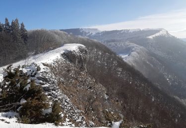
Tour Schneeschuhwandern von 12,4 km verfügbar auf Auvergne-Rhone-Alpen, Drôme, Bouvante. Diese Tour wird von guyzinz vorgeschlagen.
Depart du col de la chau le puy de la gagere les crète de fond'urle paturage de fond'urle retour col de la chau (5h-12,5km-695m)

Schneeschuhwandern

Wandern
Schneeschuhwandern

Wandern
Wandern

Wandern
Wandern

Wandern
Wandern