


30 km | 45 km-effort


Benutzer


Kostenlosegpshiking-Anwendung
 SityTrail
IGN / Geografische Institute
SityTrail World
Die Welt öffnet sich für Sie
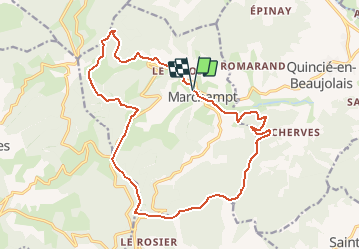
Tour Wandern von 19,2 km verfügbar auf Auvergne-Rhone-Alpen, Rhône, Marchampt. Diese Tour wird von Thomasdanielle vorgeschlagen.
Départ parking de l'école.
La Pallud - Le Rebois - Le Chopins - Les Palais - Le Ruisseau des loups - Bonnevay (à droite) 3,9 km Alt 695 m - Crox de Bonnevay (suivre le GR) - Santailler 1 (descendre à gauche à la ferme, ne pas prendre à droite le chemin qui monte, suivre le GR en traversant la ferme, le 2ème panneau Santailler est à droite derrière la ferme) - Pied de Soubran Alt. 700 m et 6 km _ 1 km plus loin à l'intersection de 4 chemin se trouve sur la gauche un panneau jaune indiquant directions les Meures, notre panneau se trouve à 50 m plus loin : Plateau de Fay Alt. 685 m nous suivons le GR _ pieds du bois Alt. 620 m - Les Meures Alt. 550 m - Col de la Crox Marchampt (il y a une cabane avec à l'intérieur table et bancs, nous pouvons y déjeuner mais il y a après une côte très importante, nous avons préféré continuer sur le GR - Roche Charmante Alt. 750 m - Roche Derveaux 779 m, nous avons pu déjeuner a cet endroit après la grande montée, (nous sommes à moitié du parcours environ) - Roche du Point perdu Alt. 755 m - Roche de la croix Rozier (à gauche sur la carte au point Alt. 777, suivre le Crêt de l'oiseau, nous quittons le GR Alt. 752 m - Hayes de Barnoux au point Alt. 710 m sur la carte, tout droit nous quittons le GR Alt. 752 m - Traverser la route - Taulauzière direction Crêt de l'oiseau tout droit Alt. 712 m - Crêt David Alt. 723 m (attention prendre à gauche VTT9 sentier Estelle ensuite nous trouvons sur l'arbre poste 13) - Crêt de l'oiseau Alt. 587 m suivre Cherfeux la Salle - La place aux filles (tables et bancs mais pas de fille !!!) - Dans le bois 5 il y a un autre panneau indiquant : Bois de Mautoux, sur notre panneau la direction indiquée est Cherfeux la salle, attention ne pas monter le chemin à droite VTT9 - Panneau la salle le Bourg, aller tout droit et ne pas prendre à droite la boucle - Place de
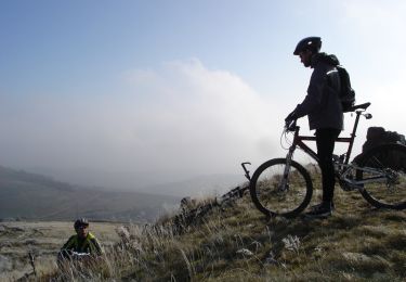
Mountainbike

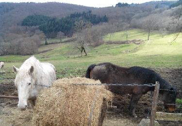
Reiten
Reiten
Reiten

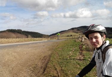
Wandern
Wandern
Mountainbike
Wandern

Wandern