


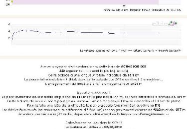
10,7 km | 14 km-effort


Benutzer


Kostenlosegpshiking-Anwendung
 SityTrail
IGN / Geografische Institute
SityTrail World
Die Welt öffnet sich für Sie
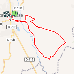
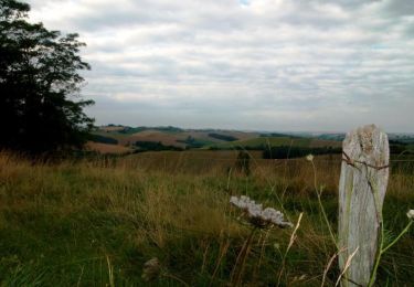
Tour Wandern von 8,8 km verfügbar auf Okzitanien, Ariège, Lézat-sur-Lèze. Diese Tour wird von pidjam vorgeschlagen.
Petite rando vers les moulins de Lézat (première section à vérifier pour le passage du coté du "château", sinon elle ne ferait que 7.5km. parcours en cours de validation)

Wandern
Wandern
Pferd
Wandern

Wandern

Wandern
Wandern

Wandern

Wandern