![](/images/other/stat-length.png)
![Tour Wandern Épannes - Epannes_Le Bourdet_8,8km - Photo](https://media.geolcdn.com/t/1900/400/ext.pjpeg?maxdim=2&url=https%3A%2F%2Fstatic1.geolcdn.com%2Fsiteimages%2Fupload%2Ffiles%2F1553511878bg_sport_marche.png)
Epannes_Le Bourdet_8,8km
olaze
Benutzer
![Länge](/images/other/stat-length.png)
Länge
8,8 km
![Maximale Höhe](https://static1.geolcdn.com/siteimages/upload/files/1508320355ic_sort_altitude_max_24dp.png)
Maximale Höhe
22 m
![Positive Höhendifferenz](https://static1.geolcdn.com/siteimages/upload/files/1508320355ic_sort_den_pos_24dp.png)
Positive Höhendifferenz
39 m
![Km-Effort](/images/other/stat-length.png)
Km-Effort
9,3 km
![Min. Höhe](https://static1.geolcdn.com/siteimages/upload/files/1508320355ic_sort_altitude_min_24dp.png)
Min. Höhe
11 m
![Negative Höhendifferenz](https://static1.geolcdn.com/siteimages/upload/files/1508320355ic_sort_den_neg_24dp.png)
Negative Höhendifferenz
38 m
![Boucle](https://static1.geolcdn.com/siteimages/upload/files/16400158638029165_repeat_loop_refresh_sync_direction_icon.png)
Boucle
Ja
Erstellungsdatum :
2017-01-10 00:00:00.0
Letzte Änderung :
2017-01-10 00:00:00.0
![Wandern](https://static1.geolcdn.com/sitytour/trail-icons/101.png)
2h04
Schwierigkeit : Einfach
![Scannen Sie diesen QR-Code, um die Tour in der SityTrail-Anwendung zu öffnen](https://capi.geolives.com/qq0zvz2zws4bq2lad0pu/sitytour/trails/682736/qr.png?size=200)
Kostenlosegpshiking-Anwendung
Über SityTrail
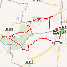
Tour Wandern von 8,8 km verfügbar auf Neu-Aquitanien, Deux-Sèvres, Épannes. Diese Tour wird von olaze vorgeschlagen.
Beschreibung
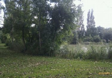
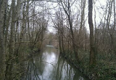
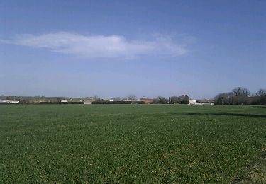
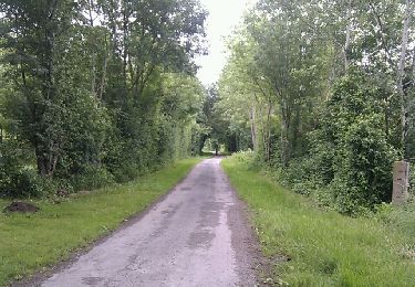
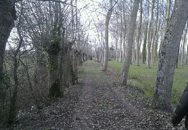
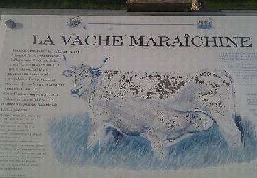
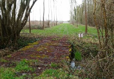
Agréable randonnée autour du Bourdet et Epannes.Marais et chemins et petites routes .Ne pas faire en période de grandes pluies (inondations)!
Ort
Land:
France
Region :
Neu-Aquitanien
Abteilung/Provinz :
Deux-Sèvres
Kommune :
Épannes
Standort:
Unknown
Gehen Sie:(Dec)
Gehen Sie:(UTM)
686236 ; 5122692 (30T) N.
Kommentare
Touren in der Umgebung
![Tour Wandern Épannes - Epannes. plan d'eau .(9km) - Photo](https://media.geolcdn.com/t/375/260/ext.jpg?maxdim=2&url=https%3A%2F%2Fservices.sitytrail.com%2FGeolivesWS%2FDownloadMedia.ashx%3FTrailID%3D225178%26Media%3Dfix__20131003145346.jpg)
![Wandern Wandern](https://static1.geolcdn.com/sitytour/trail-icons/101.png)
Epannes. plan d'eau .(9km)
Wandern
Sehr leicht
Épannes,
Neu-Aquitanien,
Deux-Sèvres,
France
![](/images/other/stat-length.png)
10,2 km | 10,9 km-effort
2h 12min
![](https://static1.geolcdn.com/siteimages/upload/files/16400158638029165_repeat_loop_refresh_sync_direction_icon.png)
Ja
![Tour Wandern Épannes - Epannes . (fougerit) - Photo](https://media.geolcdn.com/t/375/260/ext.jpg?maxdim=2&url=https%3A%2F%2Fservices.sitytrail.com%2FGeolivesWS%2FDownloadMedia.ashx%3FTrailID%3D179448%26Media%3D20130312150829.jpeg)
![Wandern Wandern](https://static1.geolcdn.com/sitytour/trail-icons/101.png)
Epannes . (fougerit)
Wandern
Einfach
Épannes,
Neu-Aquitanien,
Deux-Sèvres,
France
![](/images/other/stat-length.png)
9,7 km | 10,3 km-effort
2h 18min
![](https://static1.geolcdn.com/siteimages/upload/files/16400158638029165_repeat_loop_refresh_sync_direction_icon.png)
Ja
![Tour Wandern Sansais - Sansais (9,6km) - Photo](https://media.geolcdn.com/t/375/260/ext.jpg?maxdim=2&url=https%3A%2F%2Fservices.sitytrail.com%2FGeolivesWS%2FDownloadMedia.ashx%3FTrailID%3D133522%26Media%3D20120612160108.jpeg)
![Wandern Wandern](https://static1.geolcdn.com/sitytour/trail-icons/101.png)
Sansais (9,6km)
Wandern
Einfach
Sansais,
Neu-Aquitanien,
Deux-Sèvres,
France
![](/images/other/stat-length.png)
9,6 km | 10,5 km-effort
2h 25min
![](https://static1.geolcdn.com/siteimages/upload/files/16400158638029165_repeat_loop_refresh_sync_direction_icon.png)
Ja
![Tour Wandern La Rochénard - La Rochenard - Photo](https://media.geolcdn.com/t/375/260/ext.jpg?maxdim=2&url=https%3A%2F%2Fservices.sitytrail.com%2FGeolivesWS%2FDownloadMedia.ashx%3FTrailID%3D115979%26Media%3D20120309152941.jpeg)
![Wandern Wandern](https://static1.geolcdn.com/sitytour/trail-icons/101.png)
La Rochenard
Wandern
Sehr leicht
La Rochénard,
Neu-Aquitanien,
Deux-Sèvres,
France
![](/images/other/stat-length.png)
3 km | 3,3 km-effort
1h 18min
![](https://static1.geolcdn.com/siteimages/upload/files/16400158638029165_repeat_loop_refresh_sync_direction_icon.png)
Ja
![Tour Wandern Le Bourdet - Le Bourdet - 10km - Photo](https://media.geolcdn.com/t/375/260/ext.jpg?maxdim=2&url=https%3A%2F%2Fservices.sitytrail.com%2FGeolivesWS%2FDownloadMedia.ashx%3FTrailID%3D197620%26Media%3D20130611144155.jpeg)
![Wandern Wandern](https://static1.geolcdn.com/sitytour/trail-icons/101.png)
Le Bourdet - 10km
Wandern
Einfach
Le Bourdet,
Neu-Aquitanien,
Deux-Sèvres,
France
![](/images/other/stat-length.png)
10,5 km | 11,1 km-effort
2h 28min
![](https://static1.geolcdn.com/siteimages/upload/files/16400158638029165_repeat_loop_refresh_sync_direction_icon.png)
Ja
![Tour Wandern Épannes - Epannes (plan d'eau). 6,8km - Photo](https://media.geolcdn.com/t/375/260/ext.jpg?maxdim=2&url=https%3A%2F%2Fservices.sitytrail.com%2FGeolivesWS%2FDownloadMedia.ashx%3FTrailID%3D115830%26Media%3D20120308151220.jpeg)
![Wandern Wandern](https://static1.geolcdn.com/sitytour/trail-icons/101.png)
Epannes (plan d'eau). 6,8km
Wandern
Einfach
Épannes,
Neu-Aquitanien,
Deux-Sèvres,
France
![](/images/other/stat-length.png)
6,8 km | 7,2 km-effort
1h 49min
![](https://static1.geolcdn.com/siteimages/upload/files/16400158638029165_repeat_loop_refresh_sync_direction_icon.png)
Ja
![Tour Wandern Épannes - Epannes (Le Bourdet). 9,3km - Photo](https://media.geolcdn.com/t/375/260/ext.jpg?maxdim=2&url=https%3A%2F%2Fservices.sitytrail.com%2FGeolivesWS%2FDownloadMedia.ashx%3FTrailID%3D100036%26Media%3D20120131145145.jpeg)
![Wandern Wandern](https://static1.geolcdn.com/sitytour/trail-icons/101.png)
Epannes (Le Bourdet). 9,3km
Wandern
Einfach
Épannes,
Neu-Aquitanien,
Deux-Sèvres,
France
![](/images/other/stat-length.png)
9,3 km | 9,8 km-effort
2h 22min
![](https://static1.geolcdn.com/siteimages/upload/files/16400158638029165_repeat_loop_refresh_sync_direction_icon.png)
Ja
![Tour Wandern Prin-Deyrançon - Prin Deyrançon 2 - Photo](https://media.geolcdn.com/t/375/260/ext.jpg?maxdim=2&url=https%3A%2F%2Fservices.sitytrail.com%2FGeolivesWS%2FDownloadMedia.ashx%3FTrailID%3D934840%26Media%3Dfix__20180327150849.jpg)
![Wandern Wandern](https://static1.geolcdn.com/sitytour/trail-icons/101.png)
Prin Deyrançon 2
Wandern
Einfach
Prin-Deyrançon,
Neu-Aquitanien,
Deux-Sèvres,
France
![](/images/other/stat-length.png)
8,4 km | 9,1 km-effort
2h 9min
![](https://static1.geolcdn.com/siteimages/upload/files/16400158638029165_repeat_loop_refresh_sync_direction_icon.png)
Ja
![Tour Wandern Amuré - Amuré 7.4 km - Photo](https://media.geolcdn.com/t/375/260/ext.jpg?maxdim=2&url=https%3A%2F%2Fstatic1.geolcdn.com%2Fsiteimages%2Fupload%2Ffiles%2F1553511878bg_sport_marche.png)
![Wandern Wandern](https://static1.geolcdn.com/sitytour/trail-icons/101.png)
Amuré 7.4 km
Wandern
Einfach
Amuré,
Neu-Aquitanien,
Deux-Sèvres,
France
![](/images/other/stat-length.png)
7,4 km | 7,8 km-effort
1h 46min
![](https://static1.geolcdn.com/siteimages/upload/files/16400158638029165_repeat_loop_refresh_sync_direction_icon.png)
Ja