


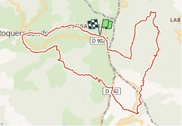

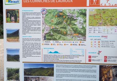
9,3 km | 12,5 km-effort


Benutzer


Kostenlosegpshiking-Anwendung
 SityTrail
IGN / Geografische Institute
SityTrail World
Die Welt öffnet sich für Sie
Tour Wandern von 13,7 km verfügbar auf Okzitanien, Hérault, Roqueredonde. Diese Tour wird von RandoVal vorgeschlagen.
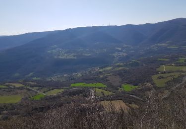
oucle sur le plateau de l'Escandorgue, départ : parking du temple bouddhiste, sens anti-horaire, version 14km 336m

Nordic Walking

Wandern

Wandern

Wandern
Wandern
Wandern
Wandern
Wandern
Nordic Walking