![](/images/other/stat-length.png)
![Tour Wandern Allons - puy de rent, descente par la colle - Photo](https://media.geolcdn.com/t/1900/400/ext.pjpeg?maxdim=2&url=https%3A%2F%2Fservices.sitytrail.com%2FGeolivesWS%2FDownloadMedia.ashx%3FTrailID%3D658591%26Media%3Dfix__20160920124101.jpg)
puy de rent, descente par la colle
daniel256
Benutzer
![Länge](/images/other/stat-length.png)
Länge
22 km
![Maximale Höhe](https://static1.geolcdn.com/siteimages/upload/files/1508320355ic_sort_altitude_max_24dp.png)
Maximale Höhe
1996 m
![Positive Höhendifferenz](https://static1.geolcdn.com/siteimages/upload/files/1508320355ic_sort_den_pos_24dp.png)
Positive Höhendifferenz
1142 m
![Km-Effort](/images/other/stat-length.png)
Km-Effort
38 km
![Min. Höhe](https://static1.geolcdn.com/siteimages/upload/files/1508320355ic_sort_altitude_min_24dp.png)
Min. Höhe
957 m
![Negative Höhendifferenz](https://static1.geolcdn.com/siteimages/upload/files/1508320355ic_sort_den_neg_24dp.png)
Negative Höhendifferenz
1146 m
![Boucle](https://static1.geolcdn.com/siteimages/upload/files/16400158638029165_repeat_loop_refresh_sync_direction_icon.png)
Boucle
Ja
Erstellungsdatum :
2016-11-10 00:00:00.0
Letzte Änderung :
2016-11-10 00:00:00.0
![Wandern](https://static1.geolcdn.com/sitytour/trail-icons/101.png)
5h40
Schwierigkeit : Medium
![Scannen Sie diesen QR-Code, um die Tour in der SityTrail-Anwendung zu öffnen](https://capi.geolives.com/qq0zvz2zws4bq2lad0pu/sitytour/trails/658591/qr.png?size=200)
Kostenlosegpshiking-Anwendung
Über SityTrail
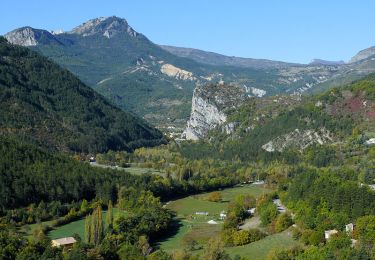
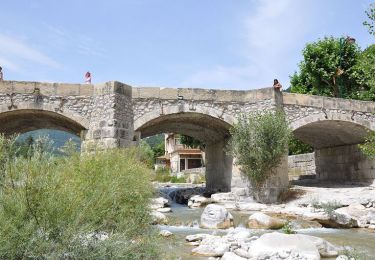
Tour Wandern von 22 km verfügbar auf Provence-Alpes-Côte d'Azur, Alpes-de-Haute-Provence, Allons. Diese Tour wird von daniel256 vorgeschlagen.
Beschreibung
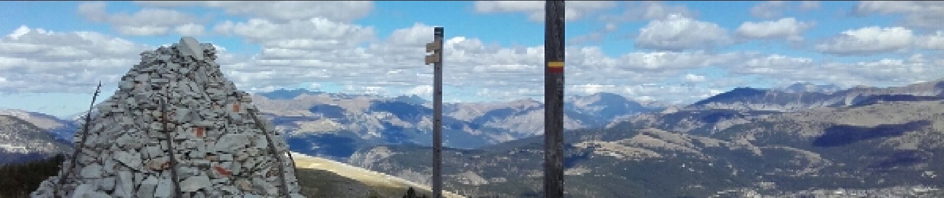
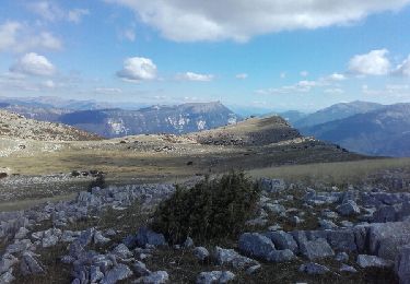
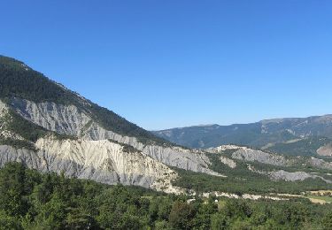
montée en zigzag très bien faite, donc possible d'y maintenir un bon rythme, vue panoramique de tlut côté une fois arrivé au puit.
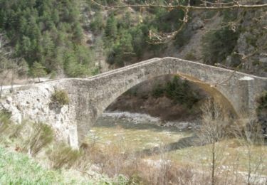
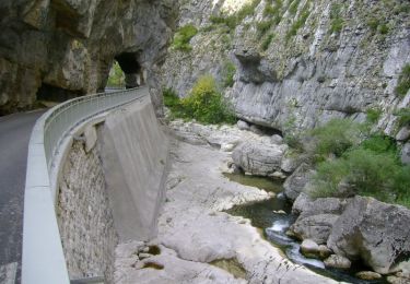
Descente un peu longue mais très variée
Ort
Land:
France
Region :
Provence-Alpes-Côte d'Azur
Abteilung/Provinz :
Alpes-de-Haute-Provence
Kommune :
Allons
Standort:
Unknown
Gehen Sie:(Dec)
Gehen Sie:(UTM)
304555 ; 4875715 (32T) N.
Kommentare
Touren in der Umgebung
![Tour Fahrrad Saint-André-les-Alpes - Le tour des Thorames - Saint André les Alpes - Photo](https://media.geolcdn.com/t/375/260/ext.jpg?maxdim=2&url=https%3A%2F%2Fservices.sitytrail.com%2FGeolivesWS%2FDownloadMedia.ashx%3FTrailID%3D112777%26Media%3D12327_6.jpg)
![Fahrrad Fahrrad](https://static1.geolcdn.com/sitytour/trail-icons/200.png)
Le tour des Thorames - Saint André les Alpes
Fahrrad
Medium
(2)
Saint-André-les-Alpes,
Provence-Alpes-Côte d'Azur,
Alpes-de-Haute-Provence,
France
![](/images/other/stat-length.png)
40 km | 48 km-effort
2h 30min
![](https://static1.geolcdn.com/siteimages/upload/files/16400158638029165_repeat_loop_refresh_sync_direction_icon.png)
Ja
![Tour Wandern Allons - 2024-11-29 Pic de Chamatte par Allons - Photo](https://media.geolcdn.com/t/375/260/97311ce2-81b2-4947-a084-db12309544ec.jpg&format=jpg&maxdim=2)
![Wandern Wandern](https://static1.geolcdn.com/sitytour/trail-icons/101.png)
2024-11-29 Pic de Chamatte par Allons
Wandern
Sehr schwierig
Allons,
Provence-Alpes-Côte d'Azur,
Alpes-de-Haute-Provence,
France
![](/images/other/stat-length.png)
15,6 km | 27 km-effort
6h 8min
![](https://static1.geolcdn.com/siteimages/upload/files/16400158638029165_repeat_loop_refresh_sync_direction_icon.png)
Ja
![Tour Wandern La Mure-Argens - Montagne de Maurel - Photo](https://media.geolcdn.com/t/375/260/72f74087-2e56-4042-8755-c65eca535272.jpg&format=jpg&maxdim=2)
![Wandern Wandern](https://static1.geolcdn.com/sitytour/trail-icons/101.png)
Montagne de Maurel
Wandern
Sehr schwierig
La Mure-Argens,
Provence-Alpes-Côte d'Azur,
Alpes-de-Haute-Provence,
France
![](/images/other/stat-length.png)
13,6 km | 20 km-effort
4h 32min
![](https://static1.geolcdn.com/siteimages/upload/files/16400158638029165_repeat_loop_refresh_sync_direction_icon.png)
Ja
![Tour Wandern Saint-André-les-Alpes - sommet de l'Aup - Photo](https://media.geolcdn.com/t/375/260/ext.jpg?maxdim=2&url=https%3A%2F%2Fservices.sitytrail.com%2FGeolivesWS%2FDownloadMedia.ashx%3FTrailID%3D658593%26Media%3Dfix__20161010125600.jpg)
![Wandern Wandern](https://static1.geolcdn.com/sitytour/trail-icons/101.png)
sommet de l'Aup
Wandern
Medium
Saint-André-les-Alpes,
Provence-Alpes-Côte d'Azur,
Alpes-de-Haute-Provence,
France
![](/images/other/stat-length.png)
26 km | 40 km-effort
5h 21min
![](https://static1.geolcdn.com/siteimages/upload/files/16400158638029165_repeat_loop_refresh_sync_direction_icon.png)
Ja
![Tour Fahrrad Saint-André-les-Alpes - Le Col des Champs - St André les Alpes - Photo](https://media.geolcdn.com/t/375/260/ext.jpg?maxdim=2&url=https%3A%2F%2Fservices.sitytrail.com%2FGeolivesWS%2FDownloadMedia.ashx%3FTrailID%3D316949%26Media%3D16062_5.jpg)
![Fahrrad Fahrrad](https://static1.geolcdn.com/sitytour/trail-icons/200.png)
Le Col des Champs - St André les Alpes
Fahrrad
Schwierig
Saint-André-les-Alpes,
Provence-Alpes-Côte d'Azur,
Alpes-de-Haute-Provence,
France
![](/images/other/stat-length.png)
119 km | 159 km-effort
7h 0min
![](https://static1.geolcdn.com/siteimages/upload/files/16400158638029165_repeat_loop_refresh_sync_direction_icon.png)
Ja
![Tour Fahrrad Saint-André-les-Alpes - Le Col des Lecques - St André-les-Alpes - Photo](https://media.geolcdn.com/t/375/260/ext.jpg?maxdim=2&url=https%3A%2F%2Fservices.sitytrail.com%2FGeolivesWS%2FDownloadMedia.ashx%3FTrailID%3D316938%26Media%3D16048_5.jpg)
![Fahrrad Fahrrad](https://static1.geolcdn.com/sitytour/trail-icons/200.png)
Le Col des Lecques - St André-les-Alpes
Fahrrad
Schwierig
Saint-André-les-Alpes,
Provence-Alpes-Côte d'Azur,
Alpes-de-Haute-Provence,
France
![](/images/other/stat-length.png)
57 km | 72 km-effort
4h 30min
![](https://static1.geolcdn.com/siteimages/upload/files/16400158638029165_repeat_loop_refresh_sync_direction_icon.png)
Ja
![Tour Fahrrad Saint-André-les-Alpes - La clue de St Auban - St André-les-Alpes - Photo](https://media.geolcdn.com/t/375/260/ext.jpg?maxdim=2&url=https%3A%2F%2Fservices.sitytrail.com%2FGeolivesWS%2FDownloadMedia.ashx%3FTrailID%3D316824%26Media%3D15881_5.jpg)
![Fahrrad Fahrrad](https://static1.geolcdn.com/sitytour/trail-icons/200.png)
La clue de St Auban - St André-les-Alpes
Fahrrad
Schwierig
Saint-André-les-Alpes,
Provence-Alpes-Côte d'Azur,
Alpes-de-Haute-Provence,
France
![](/images/other/stat-length.png)
83 km | 111 km-effort
5h 0min
![](https://static1.geolcdn.com/siteimages/upload/files/16400158638029165_repeat_loop_refresh_sync_direction_icon.png)
Ja
![Tour Fahrrad Saint-André-les-Alpes - La Colle Saint-Michel - St André les Alpes - Photo](https://media.geolcdn.com/t/375/260/ext.jpg?maxdim=2&url=https%3A%2F%2Fservices.sitytrail.com%2FGeolivesWS%2FDownloadMedia.ashx%3FTrailID%3D191564%26Media%3D15182_5.jpg)
![Fahrrad Fahrrad](https://static1.geolcdn.com/sitytour/trail-icons/200.png)
La Colle Saint-Michel - St André les Alpes
Fahrrad
Schwierig
Saint-André-les-Alpes,
Provence-Alpes-Côte d'Azur,
Alpes-de-Haute-Provence,
France
![](/images/other/stat-length.png)
68 km | 88 km-effort
4h 0min
![](https://static1.geolcdn.com/siteimages/upload/files/16400158638029165_repeat_loop_refresh_sync_direction_icon.png)
Ja
![Tour Fahrrad Saint-André-les-Alpes - Le col du Défend - St André les Alpes - Photo](https://media.geolcdn.com/t/375/260/ext.jpg?maxdim=2&url=https%3A%2F%2Fservices.sitytrail.com%2FGeolivesWS%2FDownloadMedia.ashx%3FTrailID%3D191553%26Media%3D15169_5.jpg)
![Fahrrad Fahrrad](https://static1.geolcdn.com/sitytour/trail-icons/200.png)
Le col du Défend - St André les Alpes
Fahrrad
Schwierig
Saint-André-les-Alpes,
Provence-Alpes-Côte d'Azur,
Alpes-de-Haute-Provence,
France
![](/images/other/stat-length.png)
48 km | 59 km-effort
3h 30min
![](https://static1.geolcdn.com/siteimages/upload/files/16400158638029165_repeat_loop_refresh_sync_direction_icon.png)
Ja