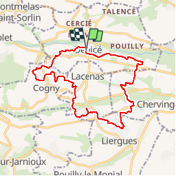


8,1 km | 11,9 km-effort


Benutzer


Kostenlosegpshiking-Anwendung
 SityTrail
IGN / Geografische Institute
SityTrail World
Die Welt öffnet sich für Sie
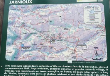
Tour Wandern von 18,1 km verfügbar auf Auvergne-Rhone-Alpen, Rhône, Denicé. Diese Tour wird von Thomasdanielle vorgeschlagen.
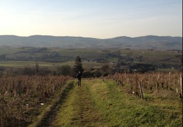
Départ salle des fêtes. 18 km et 330 m de dénivelé. Randonnée facile avec le plus souvent des chemins entre les vignes du Beaujolais.
Pour randonneurs habitués aux longues distances

Wandern
Wandern
Wandern
Wandern
Wandern
Wandern

Wandern
Wandern