


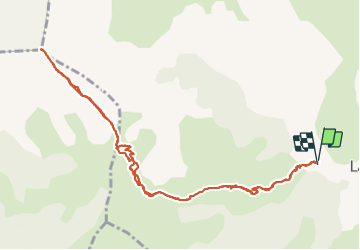

8,5 km | 15,9 km-effort

Benutzer


Kostenlosegpshiking-Anwendung
 SityTrail
IGN / Geografische Institute
SityTrail World
Die Welt öffnet sich für Sie
Tour Wandern von 12,6 km verfügbar auf Provence-Alpes-Côte d'Azur, Hochalpen, Le Dévoluy. Diese Tour wird von Dervalmarc vorgeschlagen.
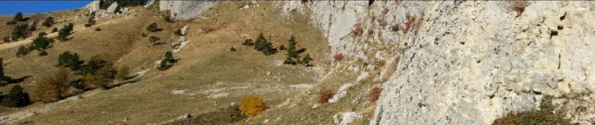
Randonnée vertigineuse après le col de Plate Contier.Deux passages délicats entre le Pas de l'Agneau et la Cime.Superbe vue panoramique sur tout le Devoluy.Efforts soutenus jusqu'à la Cime.
 - Photo 1")
 - Photo 2")
 - Photo 3")
 - Photo 4")
 - Photo 5")
 - Photo 6")
 - Photo 7")
 - Photo 8")
 - Photo 9")
 - Photo 10")
 - Photo 11")
 - Photo 12")
 - Photo 13")
 - Photo 14")
 - Photo 15")
 - Photo 16")
 - Photo 17")
 - Photo 18")
 - Photo 19")
 - Photo 20")

Wandern

Wandern

Wandern

Wandern

Wandern

Wandern

Wandern

Wandern

Wandern