![](/images/other/stat-length.png)
![Tour Wandern La Chapelle-de-Brain - Circuit des rivières et des marais - La Chapelle-de-Brain - Photo](https://media.geolcdn.com/t/1900/400/ext.pjpeg?maxdim=2&url=https%3A%2F%2Fstatic1.geolcdn.com%2Fsiteimages%2Fupload%2Ffiles%2F1553511878bg_sport_marche.png)
Circuit des rivières et des marais - La Chapelle-de-Brain
chasle
Benutzer
![Länge](/images/other/stat-length.png)
Länge
14,1 km
![Maximale Höhe](https://static1.geolcdn.com/siteimages/upload/files/1508320355ic_sort_altitude_max_24dp.png)
Maximale Höhe
62 m
![Positive Höhendifferenz](https://static1.geolcdn.com/siteimages/upload/files/1508320355ic_sort_den_pos_24dp.png)
Positive Höhendifferenz
133 m
![Km-Effort](/images/other/stat-length.png)
Km-Effort
15,9 km
![Min. Höhe](https://static1.geolcdn.com/siteimages/upload/files/1508320355ic_sort_altitude_min_24dp.png)
Min. Höhe
0 m
![Negative Höhendifferenz](https://static1.geolcdn.com/siteimages/upload/files/1508320355ic_sort_den_neg_24dp.png)
Negative Höhendifferenz
133 m
![Boucle](https://static1.geolcdn.com/siteimages/upload/files/16400158638029165_repeat_loop_refresh_sync_direction_icon.png)
Boucle
Ja
Erstellungsdatum :
2014-12-10 00:00:00.0
Letzte Änderung :
2014-12-10 00:00:00.0
![Wandern](https://static1.geolcdn.com/sitytour/trail-icons/101.png)
3h30
Schwierigkeit : Schwierig
![Scannen Sie diesen QR-Code, um die Tour in der SityTrail-Anwendung zu öffnen](https://capi.geolives.com/qq0zvz2zws4bq2lad0pu/sitytour/trails/652717/qr.png?size=200)
Kostenlosegpshiking-Anwendung
Über SityTrail
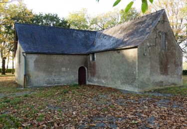
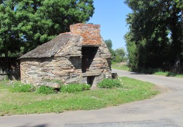
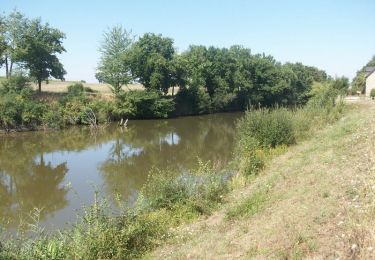
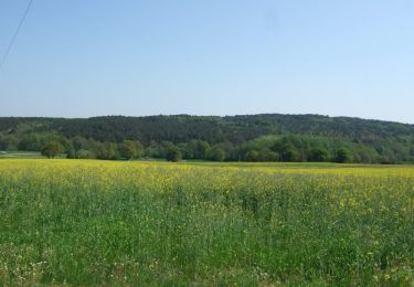
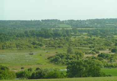
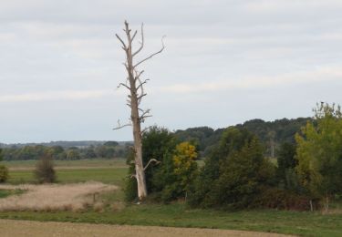
Tour Wandern von 14,1 km verfügbar auf Bretagne, Ille-et-Vilaine, La Chapelle-de-Brain. Diese Tour wird von chasle vorgeschlagen.
Beschreibung
Circuit proposé par la maison du tourisme du Pays de Redon. Départ de la place de l’église de La Chapelle-de-Brain Retrouvez ICI le circuit sur le site du Pays de Redon.
Ort
Land:
France
Region :
Bretagne
Abteilung/Provinz :
Ille-et-Vilaine
Kommune :
La Chapelle-de-Brain
Standort:
Unknown
Gehen Sie:(Dec)
Gehen Sie:(UTM)
579915 ; 5283405 (30T) N.
Kommentare
Touren in der Umgebung
![Tour Zu Fuß Sainte-Marie - Les Ardoisières - Photo](https://media.geolcdn.com/t/375/260/bd0bc078-ecb9-4ba1-88a5-43d278ab6879.jpeg&format=jpg&maxdim=2)
![Zu Fuß Zu Fuß](https://static1.geolcdn.com/sitytour/trail-icons/100.png)
Les Ardoisières
Zu Fuß
Einfach
Sainte-Marie,
Bretagne,
Ille-et-Vilaine,
France
![](/images/other/stat-length.png)
14,3 km | 16,3 km-effort
3h 42min
![](https://static1.geolcdn.com/siteimages/upload/files/16400158638029165_repeat_loop_refresh_sync_direction_icon.png)
Ja
![Tour Wandern La Chapelle-de-Brain - Crêtes et Rivière - La Chapelle de Brain - Photo](https://media.geolcdn.com/t/375/260/ext.jpg?maxdim=2&url=https%3A%2F%2Fservices.sitytrail.com%2FGeolivesWS%2FDownloadMedia.ashx%3FTrailID%3D317661%26Media%3D16948_4.jpg)
![Wandern Wandern](https://static1.geolcdn.com/sitytour/trail-icons/101.png)
Crêtes et Rivière - La Chapelle de Brain
Wandern
Medium
(1)
La Chapelle-de-Brain,
Bretagne,
Ille-et-Vilaine,
France
![](/images/other/stat-length.png)
12,6 km | 15,1 km-effort
3h 10min
![](https://static1.geolcdn.com/siteimages/upload/files/16400158638029165_repeat_loop_refresh_sync_direction_icon.png)
Ja
![Tour Fahrrad Renac - Circuit de Renac n°10 - Photo](https://media.geolcdn.com/t/375/260/ext.jpg?maxdim=2&url=https%3A%2F%2Fservices.sitytrail.com%2FGeolivesWS%2FDownloadMedia.ashx%3FTrailID%3D317626%26Media%3D16895_5.jpg)
![Fahrrad Fahrrad](https://static1.geolcdn.com/sitytour/trail-icons/200.png)
Circuit de Renac n°10
Fahrrad
Schwierig
Renac,
Bretagne,
Ille-et-Vilaine,
France
![](/images/other/stat-length.png)
37 km | 42 km-effort
2h 30min
![](https://static1.geolcdn.com/siteimages/upload/files/16400158638029165_repeat_loop_refresh_sync_direction_icon.png)
Ja
![Tour Pferd Langon - Entre chapelles, rivières et marais, de Langon à Bains sur Oust - Photo](https://media.geolcdn.com/t/375/260/ext.jpg?maxdim=2&url=https%3A%2F%2Fservices.sitytrail.com%2FGeolivesWS%2FDownloadMedia.ashx%3FTrailID%3D317581%26Media%3D16842_5.jpg)
![Pferd Pferd](https://static1.geolcdn.com/sitytour/trail-icons/300.png)
Entre chapelles, rivières et marais, de Langon à Bains sur Oust
Pferd
Schwierig
Langon,
Bretagne,
Ille-et-Vilaine,
France
![](/images/other/stat-length.png)
30 km | 34 km-effort
3h 0min
![](https://static1.geolcdn.com/siteimages/upload/files/16400158638029165_repeat_loop_refresh_sync_direction_icon.png)
Nein
![Tour Pferd Langon - Vallées, landes et mégalithes entre Langon et Cournon - Photo](https://media.geolcdn.com/t/375/260/ext.jpg?maxdim=2&url=https%3A%2F%2Fservices.sitytrail.com%2FGeolivesWS%2FDownloadMedia.ashx%3FTrailID%3D317577%26Media%3D16836_5.jpg)
![Pferd Pferd](https://static1.geolcdn.com/sitytour/trail-icons/300.png)
Vallées, landes et mégalithes entre Langon et Cournon
Pferd
Schwierig
Langon,
Bretagne,
Ille-et-Vilaine,
France
![](/images/other/stat-length.png)
33 km | 39 km-effort
3h 0min
![](https://static1.geolcdn.com/siteimages/upload/files/16400158638029165_repeat_loop_refresh_sync_direction_icon.png)
Nein
![Tour Wandern La Chapelle-de-Brain - Circuit des rivières et des marais - La Chapelle-de-Brain - Photo](https://media.geolcdn.com/t/375/260/ext.jpg?maxdim=2&url=https%3A%2F%2Fservices.sitytrail.com%2FGeolivesWS%2FDownloadMedia.ashx%3FTrailID%3D112242%26Media%3D10171_3.jpg)
![Wandern Wandern](https://static1.geolcdn.com/sitytour/trail-icons/101.png)
Circuit des rivières et des marais - La Chapelle-de-Brain
Wandern
Schwierig
La Chapelle-de-Brain,
Bretagne,
Ille-et-Vilaine,
France
![](/images/other/stat-length.png)
14,1 km | 15,9 km-effort
3h 30min
![](https://static1.geolcdn.com/siteimages/upload/files/16400158638029165_repeat_loop_refresh_sync_direction_icon.png)
Ja
![Tour Wandern Massérac - Circuit des Marais - Massérac - Photo](https://media.geolcdn.com/t/375/260/ext.jpg?maxdim=2&url=https%3A%2F%2Fservices.sitytrail.com%2FGeolivesWS%2FDownloadMedia.ashx%3FTrailID%3D111720%26Media%3D8046_4.jpg)
![Wandern Wandern](https://static1.geolcdn.com/sitytour/trail-icons/101.png)
Circuit des Marais - Massérac
Wandern
Schwierig
Massérac,
Pays de la Loire,
Loire-Atlantique,
France
![](/images/other/stat-length.png)
15,3 km | 16,9 km-effort
3h 49min
![](https://static1.geolcdn.com/siteimages/upload/files/16400158638029165_repeat_loop_refresh_sync_direction_icon.png)
Ja
![Tour Wandern Avessac - 190- les 2 rives par Painfaut - Photo](https://media.geolcdn.com/t/375/260/3b903a05-a335-4865-8779-e18d44ba0b2f.jpg&format=jpg&maxdim=2)
![Wandern Wandern](https://static1.geolcdn.com/sitytour/trail-icons/101.png)
190- les 2 rives par Painfaut
Wandern
Einfach
Avessac,
Pays de la Loire,
Loire-Atlantique,
France
![](/images/other/stat-length.png)
14,7 km | 16,3 km-effort
3h 24min
![](https://static1.geolcdn.com/siteimages/upload/files/16400158638029165_repeat_loop_refresh_sync_direction_icon.png)
Ja
![Tour Wandern Avessac - Avessac 5 km - Photo](https://media.geolcdn.com/t/375/260/ext.jpg?maxdim=2&url=https%3A%2F%2Fstatic1.geolcdn.com%2Fsiteimages%2Fupload%2Ffiles%2F1553511878bg_sport_marche.png)
![Wandern Wandern](https://static1.geolcdn.com/sitytour/trail-icons/101.png)
Avessac 5 km
Wandern
Einfach
Avessac,
Pays de la Loire,
Loire-Atlantique,
France
![](/images/other/stat-length.png)
5,1 km | 5,7 km-effort
1h 40min
![](https://static1.geolcdn.com/siteimages/upload/files/16400158638029165_repeat_loop_refresh_sync_direction_icon.png)
Ja