![](/images/other/stat-length.png)
VTT du Val joly
pascalou73
Benutzer GUIDE
![Länge](/images/other/stat-length.png)
Länge
42 km
![Maximale Höhe](https://static1.geolcdn.com/siteimages/upload/files/1508320355ic_sort_altitude_max_24dp.png)
Maximale Höhe
245 m
![Positive Höhendifferenz](https://static1.geolcdn.com/siteimages/upload/files/1508320355ic_sort_den_pos_24dp.png)
Positive Höhendifferenz
677 m
![Km-Effort](/images/other/stat-length.png)
Km-Effort
51 km
![Min. Höhe](https://static1.geolcdn.com/siteimages/upload/files/1508320355ic_sort_altitude_min_24dp.png)
Min. Höhe
165 m
![Negative Höhendifferenz](https://static1.geolcdn.com/siteimages/upload/files/1508320355ic_sort_den_neg_24dp.png)
Negative Höhendifferenz
681 m
![Boucle](https://static1.geolcdn.com/siteimages/upload/files/16400158638029165_repeat_loop_refresh_sync_direction_icon.png)
Boucle
Ja
Erstellungsdatum :
2016-10-03 00:00:00.0
Letzte Änderung :
2020-03-13 11:43:09.694
![Mountainbike](https://static1.geolcdn.com/sitytour/trail-icons/202.png)
3h18
Schwierigkeit : Medium
![Scannen Sie diesen QR-Code, um die Tour in der SityTrail-Anwendung zu öffnen](https://capi.geolives.com/qq0zvz2zws4bq2lad0pu/sitytour/trails/640599/qr.png?size=200)
Kostenlosegpshiking-Anwendung
Über SityTrail
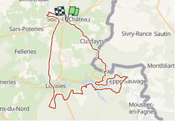
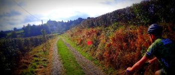
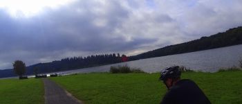
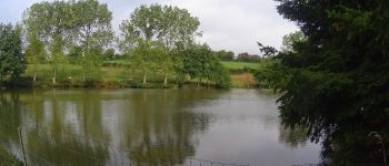
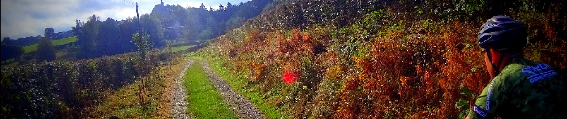
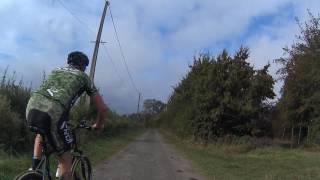
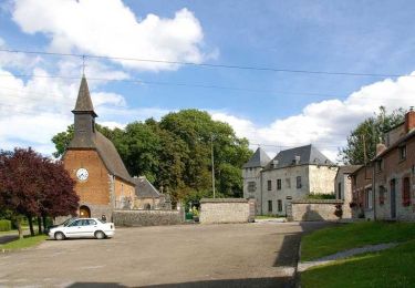
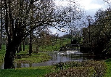
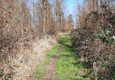
Tour Mountainbike von 42 km verfügbar auf Nordfrankreich, Nord, Solre-le-Château. Diese Tour wird von pascalou73 vorgeschlagen.
Beschreibung
Un vtt dans le nord de la France dans la région du Val Joly qui va vous faire voyager entre les forêts du nord et les vues sur le lac Le retour se fait par Solre le Château et ses champs Un petit passage par la frontière Belge pour enfin rentrer
Ort
Land:
France
Region :
Nordfrankreich
Abteilung/Provinz :
Nord
Kommune :
Solre-le-Château
Standort:
Unknown
Gehen Sie:(Dec)
Gehen Sie:(UTM)
577934 ; 5558569 (31U) N.
Kommentare
Touren in der Umgebung
![Tour Wandern Solre-le-Château - Circuit du Biau Ri - Solre le Château - Photo](https://media.geolcdn.com/t/375/260/ext.jpg?maxdim=2&url=https%3A%2F%2Fservices.sitytrail.com%2FGeolivesWS%2FDownloadMedia.ashx%3FTrailID%3D109897%26Media%3D4904_2.jpg)
![Wandern Wandern](https://static1.geolcdn.com/sitytour/trail-icons/101.png)
Circuit du Biau Ri - Solre le Château
Wandern
Medium
(2)
Solre-le-Château,
Nordfrankreich,
Nord,
France
![](/images/other/stat-length.png)
10 km | 11,5 km-effort
2h 30min
![](https://static1.geolcdn.com/siteimages/upload/files/16400158638029165_repeat_loop_refresh_sync_direction_icon.png)
Ja
![Tour Wandern Felleries - felleries 17,5 km - Photo](https://media.geolcdn.com/t/375/260/ext.jpg?maxdim=2&url=https%3A%2F%2Fservices.sitytrail.com%2FGeolivesWS%2FDownloadMedia.ashx%3FTrailID%3D1138111%26Media%3D20190422153901.jpg)
![Wandern Wandern](https://static1.geolcdn.com/sitytour/trail-icons/101.png)
felleries 17,5 km
Wandern
Einfach
Felleries,
Nordfrankreich,
Nord,
France
![](/images/other/stat-length.png)
17,7 km | 19,9 km-effort
4h 43min
![](https://static1.geolcdn.com/siteimages/upload/files/16400158638029165_repeat_loop_refresh_sync_direction_icon.png)
Ja
![Tour Wandern Hestrud - Hestrud douane 5,4km 25012019 - Photo](https://media.geolcdn.com/t/375/260/ext.jpg?maxdim=2&url=https%3A%2F%2Fstatic1.geolcdn.com%2Fsiteimages%2Fupload%2Ffiles%2F1553511878bg_sport_marche.png)
![Wandern Wandern](https://static1.geolcdn.com/sitytour/trail-icons/101.png)
Hestrud douane 5,4km 25012019
Wandern
Einfach
(1)
Hestrud,
Nordfrankreich,
Nord,
France
![](/images/other/stat-length.png)
5,4 km | 6,6 km-effort
1h 24min
![](https://static1.geolcdn.com/siteimages/upload/files/16400158638029165_repeat_loop_refresh_sync_direction_icon.png)
Ja
![Tour Fahrrad Solre-le-Château - Moulins et kiosques en pays d'Avesnes. (18 kms) - Photo](https://media.geolcdn.com/t/375/260/ext.jpg?maxdim=2&url=https%3A%2F%2Fservices.sitytrail.com%2FGeolivesWS%2FDownloadMedia.ashx%3FTrailID%3D112153%26Media%3D9957_5.jpg)
![Fahrrad Fahrrad](https://static1.geolcdn.com/sitytour/trail-icons/200.png)
Moulins et kiosques en pays d'Avesnes. (18 kms)
Fahrrad
Einfach
Solre-le-Château,
Nordfrankreich,
Nord,
France
![](/images/other/stat-length.png)
18,3 km | 21 km-effort
1h 0min
![](https://static1.geolcdn.com/siteimages/upload/files/16400158638029165_repeat_loop_refresh_sync_direction_icon.png)
Ja
![Tour Fahrrad Solre-le-Château - Moulins et kiosques en pays d'Avesnes. (45 kms) - Photo](https://media.geolcdn.com/t/375/260/ext.jpg?maxdim=2&url=https%3A%2F%2Fservices.sitytrail.com%2FGeolivesWS%2FDownloadMedia.ashx%3FTrailID%3D112152%26Media%3D9956_6.jpg)
![Fahrrad Fahrrad](https://static1.geolcdn.com/sitytour/trail-icons/200.png)
Moulins et kiosques en pays d'Avesnes. (45 kms)
Fahrrad
Medium
Solre-le-Château,
Nordfrankreich,
Nord,
France
![](/images/other/stat-length.png)
46 km | 52 km-effort
2h 30min
![](https://static1.geolcdn.com/siteimages/upload/files/16400158638029165_repeat_loop_refresh_sync_direction_icon.png)
Ja
![Tour Wandern Felleries - Sentier des moulins à eau - Felleries - Photo](https://media.geolcdn.com/t/375/260/ext.jpg?maxdim=2&url=https%3A%2F%2Fservices.sitytrail.com%2FGeolivesWS%2FDownloadMedia.ashx%3FTrailID%3D110414%26Media%3D5885_6.jpg)
![Wandern Wandern](https://static1.geolcdn.com/sitytour/trail-icons/101.png)
Sentier des moulins à eau - Felleries
Wandern
Schwierig
Felleries,
Nordfrankreich,
Nord,
France
![](/images/other/stat-length.png)
17 km | 19,2 km-effort
4h 15min
![](https://static1.geolcdn.com/siteimages/upload/files/16400158638029165_repeat_loop_refresh_sync_direction_icon.png)
Ja
![Tour Wandern Hestrud - Halte à la douane - Hestrud - Photo](https://media.geolcdn.com/t/375/260/ext.jpg?maxdim=2&url=https%3A%2F%2Fservices.sitytrail.com%2FGeolivesWS%2FDownloadMedia.ashx%3FTrailID%3D109918%26Media%3D4933_4.jpg)
![Wandern Wandern](https://static1.geolcdn.com/sitytour/trail-icons/101.png)
Halte à la douane - Hestrud
Wandern
Medium
Hestrud,
Nordfrankreich,
Nord,
France
![](/images/other/stat-length.png)
11,3 km | 13,6 km-effort
2h 49min
![](https://static1.geolcdn.com/siteimages/upload/files/16400158638029165_repeat_loop_refresh_sync_direction_icon.png)
Ja
![Tour Wandern Solre-le-Château - solre le château (France) - Photo](https://media.geolcdn.com/t/375/260/8a7d1738-25c3-48b4-8b54-4da58f10b560.jpg&format=jpg&maxdim=2)
![Wandern Wandern](https://static1.geolcdn.com/sitytour/trail-icons/101.png)
solre le château (France)
Wandern
Medium
Solre-le-Château,
Nordfrankreich,
Nord,
France
![](/images/other/stat-length.png)
6,8 km | 7,7 km-effort
2h 25min
![](https://static1.geolcdn.com/siteimages/upload/files/16400158638029165_repeat_loop_refresh_sync_direction_icon.png)
Ja
![Tour Wandern Lez-Fontaine - Lez Fontaine - Photo](https://media.geolcdn.com/t/375/260/a0ec3d0e-4569-45af-9ea4-44a22119649e.jpg&format=jpg&maxdim=2)
![Wandern Wandern](https://static1.geolcdn.com/sitytour/trail-icons/101.png)
Lez Fontaine
Wandern
Schwierig
Lez-Fontaine,
Nordfrankreich,
Nord,
France
![](/images/other/stat-length.png)
11,6 km | 14,1 km-effort
2h 21min
![](https://static1.geolcdn.com/siteimages/upload/files/16400158638029165_repeat_loop_refresh_sync_direction_icon.png)
Ja