


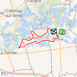

17,2 km | 18,4 km-effort


Benutzer


Kostenlosegpshiking-Anwendung
 SityTrail
IGN / Geografische Institute
SityTrail World
Die Welt öffnet sich für Sie
Tour Wandern von 9,8 km verfügbar auf Île-de-France, Seine-et-Marne, Balloy. Diese Tour wird von micheljannot vorgeschlagen.
PR n°18 de "la Seine-et-Marne à pied"
à 15 km à l'est de Montereau
se garer cent mètres au sud de l'église de Balloy
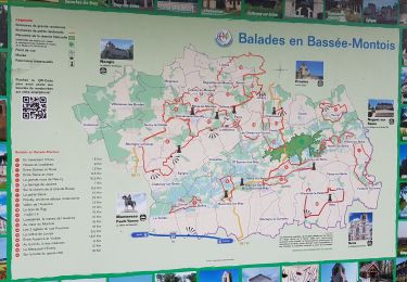
Reiten
Wandern

Wandern
Wandern

Zu Fuß
Wandern
Nordic Walking
Wandern
Wandern
partie en bord de Seine très pittoresque