![](/images/other/stat-length.png)
![Tour Wandern Saint-Flour-l'Étang - St_Flour_Etang_Isle_Dore - Photo](https://media.geolcdn.com/t/1900/400/60312493-d97e-4991-b835-b3b51085f67d.jpg&format=pjpeg&maxdim=2)
St_Flour_Etang_Isle_Dore
jagarnier
Benutzer GUIDE
![Länge](/images/other/stat-length.png)
Länge
10,3 km
![Maximale Höhe](https://static1.geolcdn.com/siteimages/upload/files/1508320355ic_sort_altitude_max_24dp.png)
Maximale Höhe
557 m
![Positive Höhendifferenz](https://static1.geolcdn.com/siteimages/upload/files/1508320355ic_sort_den_pos_24dp.png)
Positive Höhendifferenz
320 m
![Km-Effort](/images/other/stat-length.png)
Km-Effort
14,5 km
![Min. Höhe](https://static1.geolcdn.com/siteimages/upload/files/1508320355ic_sort_altitude_min_24dp.png)
Min. Höhe
344 m
![Negative Höhendifferenz](https://static1.geolcdn.com/siteimages/upload/files/1508320355ic_sort_den_neg_24dp.png)
Negative Höhendifferenz
316 m
![Boucle](https://static1.geolcdn.com/siteimages/upload/files/16400158638029165_repeat_loop_refresh_sync_direction_icon.png)
Boucle
Ja
Erstellungsdatum :
2016-09-09 00:00:00.0
Letzte Änderung :
2024-03-23 08:47:32.538
![Wandern](https://static1.geolcdn.com/sitytour/trail-icons/101.png)
3h00
Schwierigkeit : Medium
![Scannen Sie diesen QR-Code, um die Tour in der SityTrail-Anwendung zu öffnen](https://capi.geolives.com/qq0zvz2zws4bq2lad0pu/sitytour/trails/620217/qr.png?size=200)
Kostenlosegpshiking-Anwendung
Über SityTrail
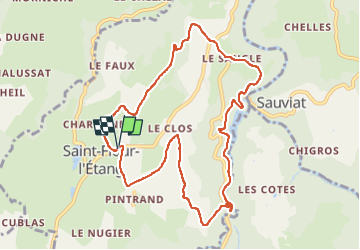
Tour Wandern von 10,3 km verfügbar auf Auvergne-Rhone-Alpen, Puy-de-Dôme, Saint-Flour-l'Étang. Diese Tour wird von jagarnier vorgeschlagen.
Beschreibung
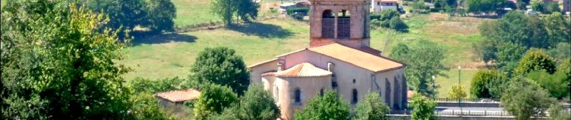
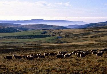
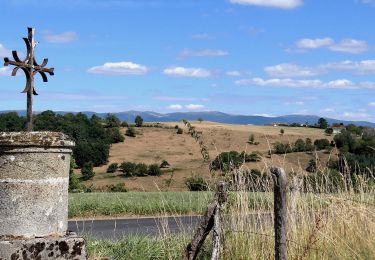
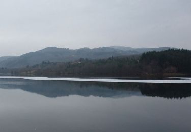
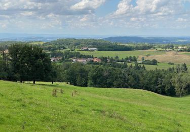
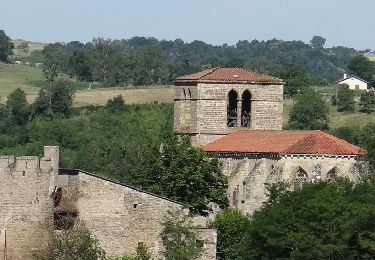
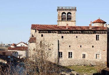
Ce circuit vous offre des vues magnifiques sur la chaine des Puys, le massif du Sancy et les Monts du Forez. Vous découvrirez le barrage de Sauviat et longerez le ruisseau du Miodet.
Ort
Land:
France
Region :
Auvergne-Rhone-Alpen
Abteilung/Provinz :
Puy-de-Dôme
Kommune :
Saint-Flour-l'Étang
Standort:
Unknown
Gehen Sie:(Dec)
Gehen Sie:(UTM)
539356 ; 5061919 (31T) N.
Kommentare
Touren in der Umgebung
![Tour Wandern Courpière - Courpiere_Courtesserre - Photo](https://media.geolcdn.com/t/375/260/374f1faa-e125-4b45-914f-a9adb07813a8.jpg&format=jpg&maxdim=2)
![Wandern Wandern](https://static1.geolcdn.com/sitytour/trail-icons/101.png)
Courpiere_Courtesserre
Wandern
Medium
(1)
Courpière,
Auvergne-Rhone-Alpen,
Puy-de-Dôme,
France
![](/images/other/stat-length.png)
9,7 km | 12,8 km-effort
2h 45min
![](https://static1.geolcdn.com/siteimages/upload/files/16400158638029165_repeat_loop_refresh_sync_direction_icon.png)
Ja
![Tour Wandern Domaize - Domaize_Ronde_Fruits - Photo](https://media.geolcdn.com/t/375/260/f4a9ee34-bc35-4d34-92f2-e24618419a1f.jpg&format=jpg&maxdim=2)
![Wandern Wandern](https://static1.geolcdn.com/sitytour/trail-icons/101.png)
Domaize_Ronde_Fruits
Wandern
Medium
(1)
Domaize,
Auvergne-Rhone-Alpen,
Puy-de-Dôme,
France
![](/images/other/stat-length.png)
10,9 km | 15 km-effort
3h 15min
![](https://static1.geolcdn.com/siteimages/upload/files/16400158638029165_repeat_loop_refresh_sync_direction_icon.png)
Ja
![Tour Wandern Courpière - Les Taillades près Courpière - Photo](https://media.geolcdn.com/t/375/260/ext.jpg?maxdim=2&url=https%3A%2F%2Fservices.sitytrail.com%2FGeolivesWS%2FDownloadMedia.ashx%3FTrailID%3D105959%26Media%3D10032_1.jpg)
![Wandern Wandern](https://static1.geolcdn.com/sitytour/trail-icons/101.png)
Les Taillades près Courpière
Wandern
Schwierig
(1)
Courpière,
Auvergne-Rhone-Alpen,
Puy-de-Dôme,
France
![](/images/other/stat-length.png)
19,9 km | 27 km-effort
5h 0min
![](https://static1.geolcdn.com/siteimages/upload/files/16400158638029165_repeat_loop_refresh_sync_direction_icon.png)
Ja
![Tour Zu Fuß Courpière - Les collines de Courtesserre - Photo](https://media.geolcdn.com/t/375/260/aefce04e-c723-452a-b34e-f8f498f04b38.jpeg&format=jpg&maxdim=2)
![Zu Fuß Zu Fuß](https://static1.geolcdn.com/sitytour/trail-icons/100.png)
Les collines de Courtesserre
Zu Fuß
Einfach
Courpière,
Auvergne-Rhone-Alpen,
Puy-de-Dôme,
France
![](/images/other/stat-length.png)
9,7 km | 12,8 km-effort
2h 54min
![](https://static1.geolcdn.com/siteimages/upload/files/16400158638029165_repeat_loop_refresh_sync_direction_icon.png)
Ja
![Tour Zu Fuß Saint-Dier-d'Auvergne - Des Ribes au Miodet - Photo](https://media.geolcdn.com/t/375/260/3eaf22db-7235-4d7c-b6de-2e786297c48d.jpeg&format=jpg&maxdim=2)
![Zu Fuß Zu Fuß](https://static1.geolcdn.com/sitytour/trail-icons/100.png)
Des Ribes au Miodet
Zu Fuß
Einfach
Saint-Dier-d'Auvergne,
Auvergne-Rhone-Alpen,
Puy-de-Dôme,
France
![](/images/other/stat-length.png)
11,4 km | 14,6 km-effort
3h 19min
![](https://static1.geolcdn.com/siteimages/upload/files/16400158638029165_repeat_loop_refresh_sync_direction_icon.png)
Ja
![Tour Wandern Trézioux - La ronde des Grüns de Trézioux - Photo](https://media.geolcdn.com/t/375/260/fbc36beb-4703-4f16-8ba5-584236f20e9e.jpeg&format=jpg&maxdim=2)
![Wandern Wandern](https://static1.geolcdn.com/sitytour/trail-icons/101.png)
La ronde des Grüns de Trézioux
Wandern
Medium
Trézioux,
Auvergne-Rhone-Alpen,
Puy-de-Dôme,
France
![](/images/other/stat-length.png)
20 km | 26 km-effort
5h 5min
![](https://static1.geolcdn.com/siteimages/upload/files/16400158638029165_repeat_loop_refresh_sync_direction_icon.png)
Ja
![Tour Wandern Sauviat - Sauviat_Plateau - Photo](https://media.geolcdn.com/t/375/260/cd996071-3cf8-4532-b078-fc961fa9d701.jpg&format=jpg&maxdim=2)
![Wandern Wandern](https://static1.geolcdn.com/sitytour/trail-icons/101.png)
Sauviat_Plateau
Wandern
Medium
Sauviat,
Auvergne-Rhone-Alpen,
Puy-de-Dôme,
France
![](/images/other/stat-length.png)
13,4 km | 17,3 km-effort
4h 0min
![](https://static1.geolcdn.com/siteimages/upload/files/16400158638029165_repeat_loop_refresh_sync_direction_icon.png)
Ja
![Tour Wandern Saint-Dier-d'Auvergne - St_Dier_Ribes_Miodet - Photo](https://media.geolcdn.com/t/375/260/1ad077f2-ac13-4fa4-8893-456994b8d19d.jpg&format=jpg&maxdim=2)
![Wandern Wandern](https://static1.geolcdn.com/sitytour/trail-icons/101.png)
St_Dier_Ribes_Miodet
Wandern
Medium
Saint-Dier-d'Auvergne,
Auvergne-Rhone-Alpen,
Puy-de-Dôme,
France
![](/images/other/stat-length.png)
11,4 km | 14,5 km-effort
3h 15min
![](https://static1.geolcdn.com/siteimages/upload/files/16400158638029165_repeat_loop_refresh_sync_direction_icon.png)
Ja
![Tour sport Courpière - COURPIERE Auvergne - Photo](https://media.geolcdn.com/t/375/260/998a6c45-edc4-4a49-93a0-d1f6173e4780.jpg&format=jpg&maxdim=2)
COURPIERE Auvergne
sport
Sehr leicht
Courpière,
Auvergne-Rhone-Alpen,
Puy-de-Dôme,
France
![](/images/other/stat-length.png)
7,5 km | 8,4 km-effort
Unbekannt
![](https://static1.geolcdn.com/siteimages/upload/files/16400158638029165_repeat_loop_refresh_sync_direction_icon.png)
Nein