![](/images/other/stat-length.png)
![Tour Wandern Bourg-Saint-Andéol - boucle chapelle de challon, bourg saint Andeol - Photo](https://media.geolcdn.com/t/1900/400/ext.pjpeg?maxdim=2&url=https%3A%2F%2Fservices.sitytrail.com%2FGeolivesWS%2FDownloadMedia.ashx%3FTrailID%3D619228%26Media%3D20160611113049.jpg)
boucle chapelle de challon, bourg saint Andeol
sandrineh
Benutzer
![Länge](/images/other/stat-length.png)
Länge
21 km
![Maximale Höhe](https://static1.geolcdn.com/siteimages/upload/files/1508320355ic_sort_altitude_max_24dp.png)
Maximale Höhe
405 m
![Positive Höhendifferenz](https://static1.geolcdn.com/siteimages/upload/files/1508320355ic_sort_den_pos_24dp.png)
Positive Höhendifferenz
469 m
![Km-Effort](/images/other/stat-length.png)
Km-Effort
27 km
![Min. Höhe](https://static1.geolcdn.com/siteimages/upload/files/1508320355ic_sort_altitude_min_24dp.png)
Min. Höhe
55 m
![Negative Höhendifferenz](https://static1.geolcdn.com/siteimages/upload/files/1508320355ic_sort_den_neg_24dp.png)
Negative Höhendifferenz
468 m
![Boucle](https://static1.geolcdn.com/siteimages/upload/files/16400158638029165_repeat_loop_refresh_sync_direction_icon.png)
Boucle
Ja
Erstellungsdatum :
2016-08-22 00:00:00.0
Letzte Änderung :
2016-08-22 00:00:00.0
![Wandern](https://static1.geolcdn.com/sitytour/trail-icons/101.png)
8h46
Schwierigkeit : Einfach
![Scannen Sie diesen QR-Code, um die Tour in der SityTrail-Anwendung zu öffnen](https://capi.geolives.com/qq0zvz2zws4bq2lad0pu/sitytour/trails/619228/qr.png?size=200)
Kostenlosegpshiking-Anwendung
Über SityTrail
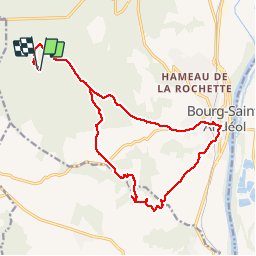
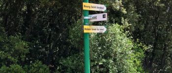
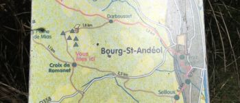
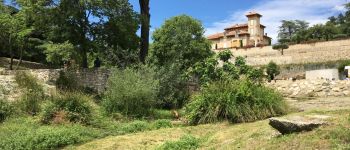
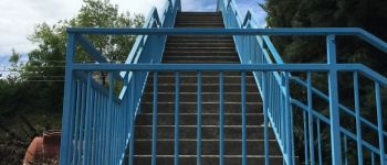
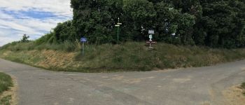
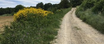
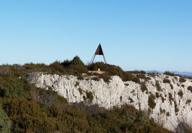
Tour Wandern von 21 km verfügbar auf Auvergne-Rhone-Alpen, Ardèche, Bourg-Saint-Andéol. Diese Tour wird von sandrineh vorgeschlagen.
Beschreibung
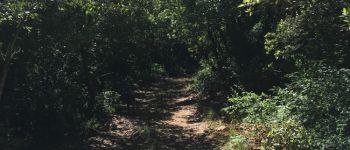
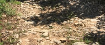
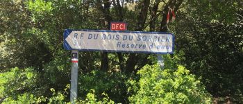
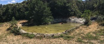
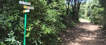
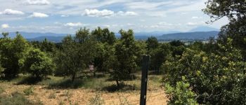
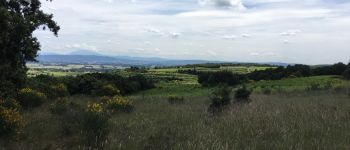
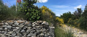
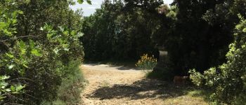
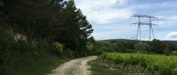
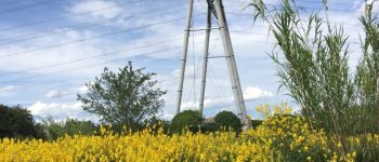
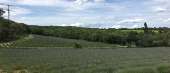
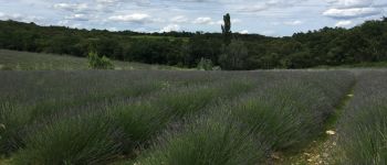
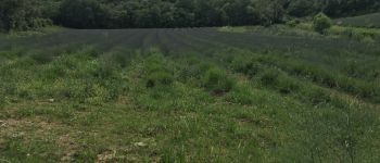
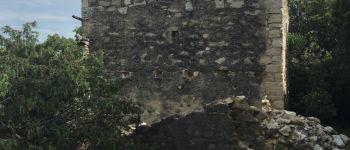
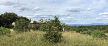
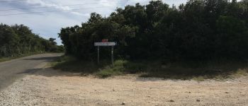
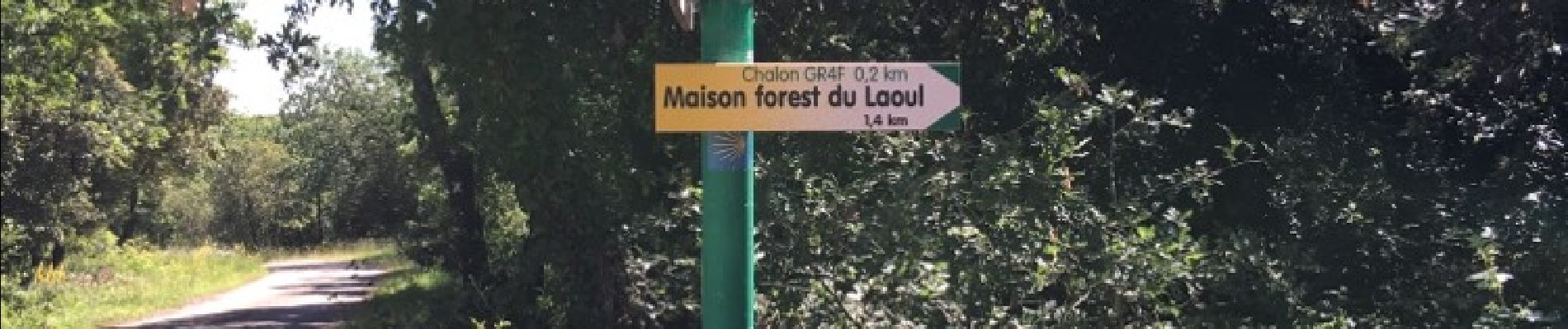
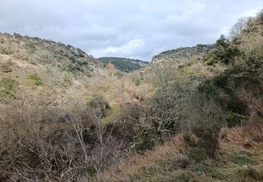
L'allée descend fortement dans un chemin rocailleux. Le retour est en pente plus douce. Prévoir de l'eau pour humain comme animaux. Il fait tres chaud et il n'y a pas de point d'eau.
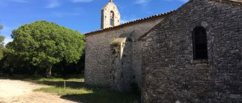
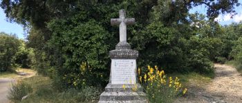
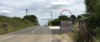
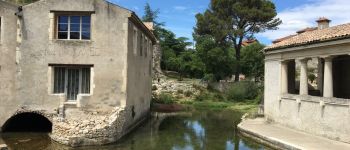
POIs
Ort
Land:
France
Region :
Auvergne-Rhone-Alpen
Abteilung/Provinz :
Ardèche
Kommune :
Bourg-Saint-Andéol
Standort:
Unknown
Gehen Sie:(Dec)
Gehen Sie:(UTM)
626024 ; 4915580 (31T) N.
Kommentare
Touren in der Umgebung
![Tour Mountainbike Bourg-Saint-Andéol - st montan - Photo](https://media.geolcdn.com/t/375/260/ext.jpg?maxdim=2&url=https%3A%2F%2Fstatic1.geolcdn.com%2Fsiteimages%2Fupload%2Ffiles%2F1524743154velo.jpg)
![Mountainbike Mountainbike](https://static1.geolcdn.com/sitytour/trail-icons/202.png)
st montan
Mountainbike
Sehr leicht
(1)
Bourg-Saint-Andéol,
Auvergne-Rhone-Alpen,
Ardèche,
France
![](/images/other/stat-length.png)
29 km | 37 km-effort
2h 16min
![](https://static1.geolcdn.com/siteimages/upload/files/16400158638029165_repeat_loop_refresh_sync_direction_icon.png)
Ja
![Tour Wandern Bourg-Saint-Andéol - laoul - Photo](https://media.geolcdn.com/t/375/260/ext.jpg?maxdim=2&url=https%3A%2F%2Fstatic1.geolcdn.com%2Fsiteimages%2Fupload%2Ffiles%2F1553511878bg_sport_marche.png)
![Wandern Wandern](https://static1.geolcdn.com/sitytour/trail-icons/101.png)
laoul
Wandern
Sehr leicht
(1)
Bourg-Saint-Andéol,
Auvergne-Rhone-Alpen,
Ardèche,
France
![](/images/other/stat-length.png)
13,6 km | 18,8 km-effort
4h 14min
![](https://static1.geolcdn.com/siteimages/upload/files/16400158638029165_repeat_loop_refresh_sync_direction_icon.png)
Ja
![Tour Wandern Gras - La dent de Rez (Les Hellys) - Photo](https://media.geolcdn.com/t/375/260/a34e7eb3-e97f-491f-a12c-78c7f076231a.jpg&format=jpg&maxdim=2)
![Wandern Wandern](https://static1.geolcdn.com/sitytour/trail-icons/101.png)
La dent de Rez (Les Hellys)
Wandern
Medium
Gras,
Auvergne-Rhone-Alpen,
Ardèche,
France
![](/images/other/stat-length.png)
14,3 km | 22 km-effort
3h 45min
![](https://static1.geolcdn.com/siteimages/upload/files/16400158638029165_repeat_loop_refresh_sync_direction_icon.png)
Ja
![Tour Wandern Bourg-Saint-Andéol - boucle chapelle de challon, bourg saint Andeol - Photo](https://media.geolcdn.com/t/375/260/ext.jpg?maxdim=2&url=https%3A%2F%2Fservices.sitytrail.com%2FGeolivesWS%2FDownloadMedia.ashx%3FTrailID%3D583032%26Media%3D20160611113049.jpg)
![Wandern Wandern](https://static1.geolcdn.com/sitytour/trail-icons/101.png)
boucle chapelle de challon, bourg saint Andeol
Wandern
Einfach
Bourg-Saint-Andéol,
Auvergne-Rhone-Alpen,
Ardèche,
France
![](/images/other/stat-length.png)
21 km | 27 km-effort
8h 46min
![](https://static1.geolcdn.com/siteimages/upload/files/16400158638029165_repeat_loop_refresh_sync_direction_icon.png)
Ja
![Tour Wandern Bourg-Saint-Andéol - maison forestière de la laoul - Photo](https://media.geolcdn.com/t/375/260/b54d2cbd-f080-488d-a40a-ef162ab4e070.jpg&format=jpg&maxdim=2)
![Wandern Wandern](https://static1.geolcdn.com/sitytour/trail-icons/101.png)
maison forestière de la laoul
Wandern
Medium
Bourg-Saint-Andéol,
Auvergne-Rhone-Alpen,
Ardèche,
France
![](/images/other/stat-length.png)
13,9 km | 17,1 km-effort
4h 24min
![](https://static1.geolcdn.com/siteimages/upload/files/16400158638029165_repeat_loop_refresh_sync_direction_icon.png)
Ja
![Tour Wandern Bidon - bidon vs2 - Photo](https://media.geolcdn.com/t/375/260/3bc586d6-7b8e-47cb-a4ba-f480411d7832.jpg&format=jpg&maxdim=2)
![Wandern Wandern](https://static1.geolcdn.com/sitytour/trail-icons/101.png)
bidon vs2
Wandern
Sehr schwierig
Bidon,
Auvergne-Rhone-Alpen,
Ardèche,
France
![](/images/other/stat-length.png)
15,9 km | 19,1 km-effort
5h 37min
![](https://static1.geolcdn.com/siteimages/upload/files/16400158638029165_repeat_loop_refresh_sync_direction_icon.png)
Ja
![Tour Wandern Bidon - dolmen de p - Photo](https://media.geolcdn.com/t/375/260/a45e10cb-86de-4ada-b5b8-4554a9969835.jpg&format=jpg&maxdim=2)
![Wandern Wandern](https://static1.geolcdn.com/sitytour/trail-icons/101.png)
dolmen de p
Wandern
Sehr leicht
Bidon,
Auvergne-Rhone-Alpen,
Ardèche,
France
![](/images/other/stat-length.png)
10 km | 12,2 km-effort
2h 55min
![](https://static1.geolcdn.com/siteimages/upload/files/16400158638029165_repeat_loop_refresh_sync_direction_icon.png)
Ja
![Tour Wandern Bidon - St MARCEL Gorgés court8 - Photo](https://media.geolcdn.com/t/375/260/34d8aebe-9439-40cf-8e7a-159c3ccfd2be.jpg&format=jpg&maxdim=2)
![Wandern Wandern](https://static1.geolcdn.com/sitytour/trail-icons/101.png)
St MARCEL Gorgés court8
Wandern
Sehr schwierig
Bidon,
Auvergne-Rhone-Alpen,
Ardèche,
France
![](/images/other/stat-length.png)
15,5 km | 21 km-effort
6h 25min
![](https://static1.geolcdn.com/siteimages/upload/files/16400158638029165_repeat_loop_refresh_sync_direction_icon.png)
Ja
![Tour Wandern Bidon - Dolmen bodon - Photo](https://media.geolcdn.com/t/375/260/0c1d8a24-b24d-4239-a9ff-86415231b61f.jpg&format=jpg&maxdim=2)
![Wandern Wandern](https://static1.geolcdn.com/sitytour/trail-icons/101.png)
Dolmen bodon
Wandern
Medium
Bidon,
Auvergne-Rhone-Alpen,
Ardèche,
France
![](/images/other/stat-length.png)
24 km | 30 km-effort
8h 56min
![](https://static1.geolcdn.com/siteimages/upload/files/16400158638029165_repeat_loop_refresh_sync_direction_icon.png)
Ja