![](/images/other/stat-length.png)
![Tour Wandern Rosières - Les balcons de la Baume - Photo](https://media.geolcdn.com/t/1900/400/ext.pjpeg?maxdim=2&url=https%3A%2F%2Fservices.sitytrail.com%2FGeolivesWS%2FDownloadMedia.ashx%3FTrailID%3D608170%26Media%3Dfix__20160621132107.jpg)
Les balcons de la Baume
Gegetop
Benutzer
![Länge](/images/other/stat-length.png)
Länge
18,4 km
![Maximale Höhe](https://static1.geolcdn.com/siteimages/upload/files/1508320355ic_sort_altitude_max_24dp.png)
Maximale Höhe
253 m
![Positive Höhendifferenz](https://static1.geolcdn.com/siteimages/upload/files/1508320355ic_sort_den_pos_24dp.png)
Positive Höhendifferenz
325 m
![Km-Effort](/images/other/stat-length.png)
Km-Effort
23 km
![Min. Höhe](https://static1.geolcdn.com/siteimages/upload/files/1508320355ic_sort_altitude_min_24dp.png)
Min. Höhe
115 m
![Negative Höhendifferenz](https://static1.geolcdn.com/siteimages/upload/files/1508320355ic_sort_den_neg_24dp.png)
Negative Höhendifferenz
326 m
![Boucle](https://static1.geolcdn.com/siteimages/upload/files/16400158638029165_repeat_loop_refresh_sync_direction_icon.png)
Boucle
Ja
Erstellungsdatum :
2016-08-03 00:00:00.0
Letzte Änderung :
2016-08-03 00:00:00.0
![Wandern](https://static1.geolcdn.com/sitytour/trail-icons/101.png)
4h56
Schwierigkeit : Medium
![Scannen Sie diesen QR-Code, um die Tour in der SityTrail-Anwendung zu öffnen](https://capi.geolives.com/qq0zvz2zws4bq2lad0pu/sitytour/trails/608170/qr.png?size=200)
Kostenlosegpshiking-Anwendung
Über SityTrail
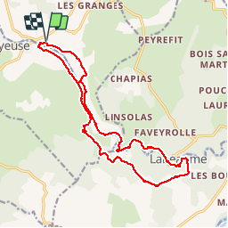
Tour Wandern von 18,4 km verfügbar auf Auvergne-Rhone-Alpen, Ardèche, Rosières. Diese Tour wird von Gegetop vorgeschlagen.
Beschreibung
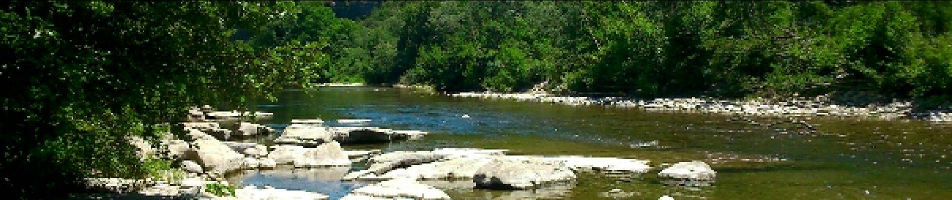
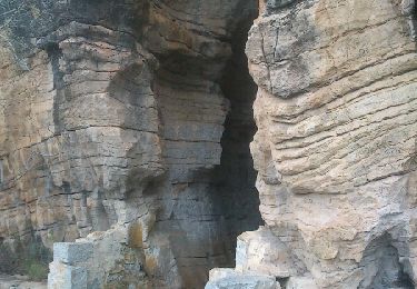
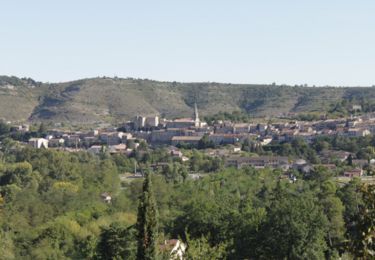
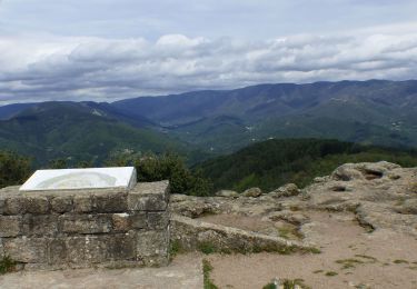
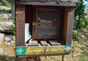
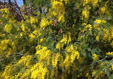
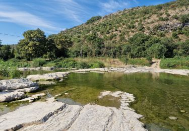
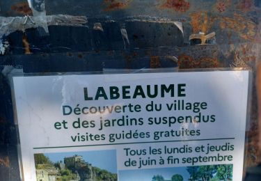
Splendide promenade au long de la rivière la Baume sur un sentier à flanc de falaise qui vous conduit au village classé de Labeaume.Retour à Rosières sur l'autre rive par une petite route.
Ort
Land:
France
Region :
Auvergne-Rhone-Alpen
Abteilung/Provinz :
Ardèche
Kommune :
Rosières
Standort:
Unknown
Gehen Sie:(Dec)
Gehen Sie:(UTM)
599895 ; 4926072 (31T) N.
Kommentare
Touren in der Umgebung
![Tour Wandern Labeaume - Jardins suspendus de Labeaume - Photo](https://media.geolcdn.com/t/375/260/ext.jpg?maxdim=2&url=https%3A%2F%2Fservices.sitytrail.com%2FGeolivesWS%2FDownloadMedia.ashx%3FTrailID%3D339442%26Media%3Dfix__20140402152412.jpg)
![Wandern Wandern](https://static1.geolcdn.com/sitytour/trail-icons/101.png)
Jardins suspendus de Labeaume
Wandern
Medium
(1)
Labeaume,
Auvergne-Rhone-Alpen,
Ardèche,
France
![](/images/other/stat-length.png)
4,7 km | 6,6 km-effort
1h 31min
![](https://static1.geolcdn.com/siteimages/upload/files/16400158638029165_repeat_loop_refresh_sync_direction_icon.png)
Ja
![Tour Nordic Walking Labeaume - labeaume chapias - Photo](https://media.geolcdn.com/t/375/260/ext.jpg?maxdim=2&url=https%3A%2F%2Fstatic1.geolcdn.com%2Fsiteimages%2Fupload%2Ffiles%2F1545311037marcheuse_200dpi.jpg)
![Nordic Walking Nordic Walking](https://static1.geolcdn.com/sitytour/trail-icons/102.png)
labeaume chapias
Nordic Walking
Einfach
(1)
Labeaume,
Auvergne-Rhone-Alpen,
Ardèche,
France
![](/images/other/stat-length.png)
12,7 km | 16,3 km-effort
2h 59min
![](https://static1.geolcdn.com/siteimages/upload/files/16400158638029165_repeat_loop_refresh_sync_direction_icon.png)
Ja
![Tour Wandern Joyeuse - Le balcon du Freyssinet - Joyeuse - Photo](https://media.geolcdn.com/t/375/260/ext.jpg?maxdim=2&url=https%3A%2F%2Fservices.sitytrail.com%2FGeolivesWS%2FDownloadMedia.ashx%3FTrailID%3D191628%26Media%3D15269_1.jpg)
![Wandern Wandern](https://static1.geolcdn.com/sitytour/trail-icons/101.png)
Le balcon du Freyssinet - Joyeuse
Wandern
Medium
(4)
Joyeuse,
Auvergne-Rhone-Alpen,
Ardèche,
France
![](/images/other/stat-length.png)
6,7 km | 9 km-effort
1h 45min
![](https://static1.geolcdn.com/siteimages/upload/files/16400158638029165_repeat_loop_refresh_sync_direction_icon.png)
Ja
![Tour Wandern Vernon - Vernon Tour de Brison 20km - Photo](https://media.geolcdn.com/t/375/260/1d443c17-2f68-4a33-bd33-d422959f5b68.jpg&format=jpg&maxdim=2)
![Wandern Wandern](https://static1.geolcdn.com/sitytour/trail-icons/101.png)
Vernon Tour de Brison 20km
Wandern
Schwierig
Vernon,
Auvergne-Rhone-Alpen,
Ardèche,
France
![](/images/other/stat-length.png)
19,9 km | 29 km-effort
6h 0min
![](https://static1.geolcdn.com/siteimages/upload/files/16400158638029165_repeat_loop_refresh_sync_direction_icon.png)
Ja
![Tour Wandern Labeaume - Labaume - Photo](https://media.geolcdn.com/t/375/260/100f777b-ca43-4f22-8315-f8e51f0fe1ef.jpg&format=jpg&maxdim=2)
![Wandern Wandern](https://static1.geolcdn.com/sitytour/trail-icons/101.png)
Labaume
Wandern
Medium
(1)
Labeaume,
Auvergne-Rhone-Alpen,
Ardèche,
France
![](/images/other/stat-length.png)
13,4 km | 17,8 km-effort
5h 20min
![](https://static1.geolcdn.com/siteimages/upload/files/16400158638029165_repeat_loop_refresh_sync_direction_icon.png)
Ja
![Tour Wandern Vernon - 07 Vernon 25 02 2021 - Photo](https://media.geolcdn.com/t/375/260/bf74ca26-a5ee-4a75-afb9-c1a8b51eb415.jpg&format=jpg&maxdim=2)
![Wandern Wandern](https://static1.geolcdn.com/sitytour/trail-icons/101.png)
07 Vernon 25 02 2021
Wandern
Medium
Vernon,
Auvergne-Rhone-Alpen,
Ardèche,
France
![](/images/other/stat-length.png)
16,7 km | 25 km-effort
4h 10min
![](https://static1.geolcdn.com/siteimages/upload/files/16400158638029165_repeat_loop_refresh_sync_direction_icon.png)
Ja
![Tour Wandern Labeaume - Chapias - Photo](https://media.geolcdn.com/t/375/260/ext.jpg?maxdim=2&url=https%3A%2F%2Fstatic1.geolcdn.com%2Fsiteimages%2Fupload%2Ffiles%2F1553511878bg_sport_marche.png)
![Wandern Wandern](https://static1.geolcdn.com/sitytour/trail-icons/101.png)
Chapias
Wandern
Medium
(3)
Labeaume,
Auvergne-Rhone-Alpen,
Ardèche,
France
![](/images/other/stat-length.png)
10,3 km | 13,5 km-effort
3h 14min
![](https://static1.geolcdn.com/siteimages/upload/files/16400158638029165_repeat_loop_refresh_sync_direction_icon.png)
Ja
![Tour Laufen Rosières - 13km - Photo](https://media.geolcdn.com/t/375/260/61681b10-36d4-4fbe-858a-0651fc8e085a.jpg&format=jpg&maxdim=2)
![Laufen Laufen](https://static1.geolcdn.com/sitytour/trail-icons/103.png)
13km
Laufen
Sehr leicht
Rosières,
Auvergne-Rhone-Alpen,
Ardèche,
France
![](/images/other/stat-length.png)
13,6 km | 16,1 km-effort
1h 34min
![](https://static1.geolcdn.com/siteimages/upload/files/16400158638029165_repeat_loop_refresh_sync_direction_icon.png)
Ja
![Tour Wandern Labeaume - ARDECHE. LA BAUME. GORGES DE LA BAUME. LEBAUME.DOLMENS OE - Photo](https://media.geolcdn.com/t/375/260/7366c34a-b7d9-48a0-ae49-28be0ea93c3a.jpg&format=jpg&maxdim=2)
![Wandern Wandern](https://static1.geolcdn.com/sitytour/trail-icons/101.png)
ARDECHE. LA BAUME. GORGES DE LA BAUME. LEBAUME.DOLMENS OE
Wandern
Medium
Labeaume,
Auvergne-Rhone-Alpen,
Ardèche,
France
![](/images/other/stat-length.png)
12,5 km | 15,9 km-effort
4h 13min
![](https://static1.geolcdn.com/siteimages/upload/files/16400158638029165_repeat_loop_refresh_sync_direction_icon.png)
Ja