![](/images/other/stat-length.png)
![Tour Wandern Guimaëc - Circuit de Beg An Fry - Photo](https://media.geolcdn.com/t/1900/400/ext.pjpeg?maxdim=2&url=https%3A%2F%2Fservices.sitytrail.com%2FGeolivesWS%2FDownloadMedia.ashx%3FTrailID%3D603896%26Media%3Dfix__20160725172406.jpg)
Circuit de Beg An Fry
Dervalmarc
Benutzer
![Länge](/images/other/stat-length.png)
Länge
8,2 km
![Maximale Höhe](https://static1.geolcdn.com/siteimages/upload/files/1508320355ic_sort_altitude_max_24dp.png)
Maximale Höhe
85 m
![Positive Höhendifferenz](https://static1.geolcdn.com/siteimages/upload/files/1508320355ic_sort_den_pos_24dp.png)
Positive Höhendifferenz
249 m
![Km-Effort](/images/other/stat-length.png)
Km-Effort
11,5 km
![Min. Höhe](https://static1.geolcdn.com/siteimages/upload/files/1508320355ic_sort_altitude_min_24dp.png)
Min. Höhe
5 m
![Negative Höhendifferenz](https://static1.geolcdn.com/siteimages/upload/files/1508320355ic_sort_den_neg_24dp.png)
Negative Höhendifferenz
247 m
![Boucle](https://static1.geolcdn.com/siteimages/upload/files/16400158638029165_repeat_loop_refresh_sync_direction_icon.png)
Boucle
Ja
Erstellungsdatum :
2016-07-26 00:00:00.0
Letzte Änderung :
2016-07-26 00:00:00.0
![Wandern](https://static1.geolcdn.com/sitytour/trail-icons/101.png)
3h18
Schwierigkeit : Medium
![Scannen Sie diesen QR-Code, um die Tour in der SityTrail-Anwendung zu öffnen](https://capi.geolives.com/qq0zvz2zws4bq2lad0pu/sitytour/trails/603896/qr.png?size=200)
Kostenlosegpshiking-Anwendung
Über SityTrail
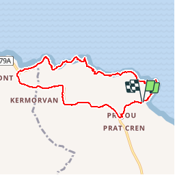
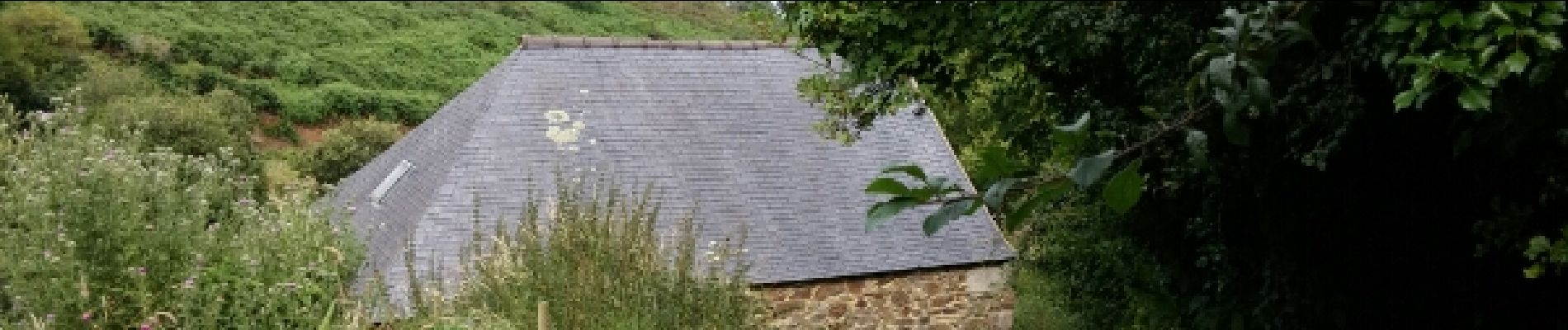
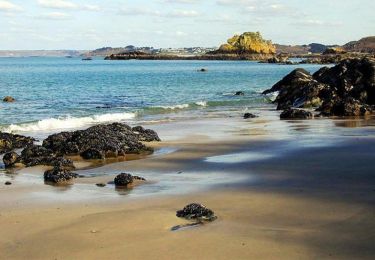
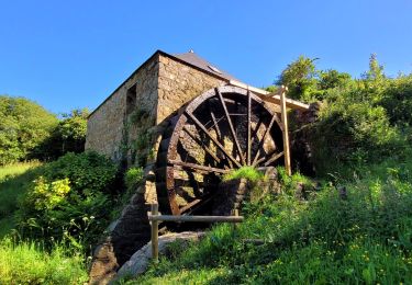
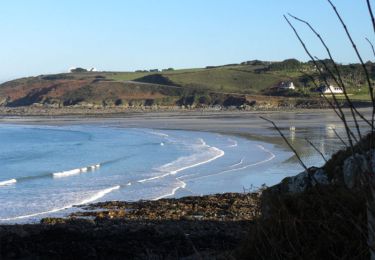
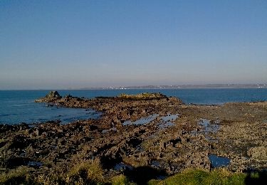
Tour Wandern von 8,2 km verfügbar auf Bretagne, Finistère, Guimaëc. Diese Tour wird von Dervalmarc vorgeschlagen.
Beschreibung
Randonnée avec une alternance de paysages et de montées et descentes.
Nombreux panoramas sur la partie côtière. très belle balade.
Ort
Land:
France
Region :
Bretagne
Abteilung/Provinz :
Finistère
Kommune :
Guimaëc
Standort:
Unknown
Gehen Sie:(Dec)
Gehen Sie:(UTM)
447027 ; 5394467 (30U) N.
Kommentare
Touren in der Umgebung
![Tour Wandern Saint-Jean-du-Doigt - St Jean du Doigt et la Côte de l'Armorique - Photo](https://media.geolcdn.com/t/375/260/ext.jpg?maxdim=2&url=https%3A%2F%2Fservices.sitytrail.com%2FGeolivesWS%2FDownloadMedia.ashx%3FTrailID%3D109363%26Media%3D3656_1.jpg)
![Wandern Wandern](https://static1.geolcdn.com/sitytour/trail-icons/101.png)
St Jean du Doigt et la Côte de l'Armorique
Wandern
Sehr schwierig
(1)
Saint-Jean-du-Doigt,
Bretagne,
Finistère,
France
![](/images/other/stat-length.png)
18,4 km | 24 km-effort
4h 30min
![](https://static1.geolcdn.com/siteimages/upload/files/16400158638029165_repeat_loop_refresh_sync_direction_icon.png)
Ja
![Tour Wandern Guimaëc - Bretagne nord j6 am : De Guimaec à Locquirec - Photo](https://media.geolcdn.com/t/375/260/c4189ae4-9454-4066-aed2-a7f11feda25a.jpg&format=jpg&maxdim=2)
![Wandern Wandern](https://static1.geolcdn.com/sitytour/trail-icons/101.png)
Bretagne nord j6 am : De Guimaec à Locquirec
Wandern
Sehr leicht
Guimaëc,
Bretagne,
Finistère,
France
![](/images/other/stat-length.png)
10,5 km | 13,2 km-effort
3h 14min
![](https://static1.geolcdn.com/siteimages/upload/files/16400158638029165_repeat_loop_refresh_sync_direction_icon.png)
Nein
![Tour Nordic Walking Guimaëc - guimaec loquirec - Photo](https://media.geolcdn.com/t/375/260/ext.jpg?maxdim=2&url=https%3A%2F%2Fstatic1.geolcdn.com%2Fsiteimages%2Fupload%2Ffiles%2F1545311037marcheuse_200dpi.jpg)
![Nordic Walking Nordic Walking](https://static1.geolcdn.com/sitytour/trail-icons/102.png)
guimaec loquirec
Nordic Walking
Sehr leicht
(1)
Guimaëc,
Bretagne,
Finistère,
France
![](/images/other/stat-length.png)
8,7 km | 11,2 km-effort
2h 30min
![](https://static1.geolcdn.com/siteimages/upload/files/16400158638029165_repeat_loop_refresh_sync_direction_icon.png)
Nein
![Wandern Wandern](https://static1.geolcdn.com/sitytour/trail-icons/101.png)
GR 34 de Velizella à plage de St Jean du doigt
Wandern
Medium
Guimaëc,
Bretagne,
Finistère,
France
![](/images/other/stat-length.png)
7,2 km | 11,5 km-effort
2h 51min
![](https://static1.geolcdn.com/siteimages/upload/files/16400158638029165_repeat_loop_refresh_sync_direction_icon.png)
Nein
![Wandern Wandern](https://static1.geolcdn.com/sitytour/trail-icons/101.png)
Gr34 Poul Rodou à Venizella
Wandern
Einfach
Guimaëc,
Bretagne,
Finistère,
France
![](/images/other/stat-length.png)
3,3 km | 4,3 km-effort
55min
![](https://static1.geolcdn.com/siteimages/upload/files/16400158638029165_repeat_loop_refresh_sync_direction_icon.png)
Nein
![Tour Wandern Guimaëc - GR 34 étape 22 - Photo](https://media.geolcdn.com/t/375/260/ext.jpg?maxdim=2&url=https%3A%2F%2Fservices.sitytrail.com%2FGeolivesWS%2FDownloadMedia.ashx%3FTrailID%3D318887%26Media%3Dfix__20140512155040.jpg)
![Wandern Wandern](https://static1.geolcdn.com/sitytour/trail-icons/101.png)
GR 34 étape 22
Wandern
Medium
Guimaëc,
Bretagne,
Finistère,
France
![](/images/other/stat-length.png)
27 km | 36 km-effort
8h 37min
![](https://static1.geolcdn.com/siteimages/upload/files/16400158638029165_repeat_loop_refresh_sync_direction_icon.png)
Nein
![Tour Wandern Saint-Jean-du-Doigt - Randonnée de Saint Jean du Doigt à Primel Trégastel - Photo](https://media.geolcdn.com/t/375/260/ext.jpg?maxdim=2&url=https%3A%2F%2Fservices.sitytrail.com%2FGeolivesWS%2FDownloadMedia.ashx%3FTrailID%3D191603%26Media%3D15241_4.jpg)
![Wandern Wandern](https://static1.geolcdn.com/sitytour/trail-icons/101.png)
Randonnée de Saint Jean du Doigt à Primel Trégastel
Wandern
Medium
Saint-Jean-du-Doigt,
Bretagne,
Finistère,
France
![](/images/other/stat-length.png)
13 km | 16,2 km-effort
3h 0min
![](https://static1.geolcdn.com/siteimages/upload/files/16400158638029165_repeat_loop_refresh_sync_direction_icon.png)
Ja
![Tour Wandern Saint-Jean-du-Doigt - De St Jean du Doigt à Plougasnou - Photo](https://media.geolcdn.com/t/375/260/ext.jpg?maxdim=2&url=https%3A%2F%2Fservices.sitytrail.com%2FGeolivesWS%2FDownloadMedia.ashx%3FTrailID%3D191395%26Media%3D14969_5.jpg)
![Wandern Wandern](https://static1.geolcdn.com/sitytour/trail-icons/101.png)
De St Jean du Doigt à Plougasnou
Wandern
Einfach
Saint-Jean-du-Doigt,
Bretagne,
Finistère,
France
![](/images/other/stat-length.png)
4,9 km | 6,5 km-effort
1h 15min
![](https://static1.geolcdn.com/siteimages/upload/files/16400158638029165_repeat_loop_refresh_sync_direction_icon.png)
Ja
![Tour Wandern Locquirec - locquirec - Photo](https://media.geolcdn.com/t/375/260/ext.jpg?maxdim=2&url=https%3A%2F%2Fservices.sitytrail.com%2FGeolivesWS%2FDownloadMedia.ashx%3FTrailID%3D175929%26Media%3D20130218170054.jpeg)
![Wandern Wandern](https://static1.geolcdn.com/sitytour/trail-icons/101.png)
locquirec
Wandern
Sehr leicht
Locquirec,
Bretagne,
Finistère,
France
![](/images/other/stat-length.png)
7,2 km | 8,9 km-effort
1h 59min
![](https://static1.geolcdn.com/siteimages/upload/files/16400158638029165_repeat_loop_refresh_sync_direction_icon.png)
Ja