![](/images/other/stat-length.png)
![Tour Fahrrad Chartres - Dynamobile 4 (Lundi 18) : Chartres - Condé sur Huisne - Photo](https://media.geolcdn.com/t/1900/400/ext.pjpeg?maxdim=2&url=https%3A%2F%2Fstatic1.geolcdn.com%2Fsiteimages%2Fupload%2Ffiles%2F1524743154velo.jpg)
Dynamobile 4 (Lundi 18) : Chartres - Condé sur Huisne
pinkzebra
Benutzer
![Länge](/images/other/stat-length.png)
Länge
83 km
![Maximale Höhe](https://static1.geolcdn.com/siteimages/upload/files/1508320355ic_sort_altitude_max_24dp.png)
Maximale Höhe
284 m
![Positive Höhendifferenz](https://static1.geolcdn.com/siteimages/upload/files/1508320355ic_sort_den_pos_24dp.png)
Positive Höhendifferenz
751 m
![Km-Effort](/images/other/stat-length.png)
Km-Effort
93 km
![Min. Höhe](https://static1.geolcdn.com/siteimages/upload/files/1508320355ic_sort_altitude_min_24dp.png)
Min. Höhe
105 m
![Negative Höhendifferenz](https://static1.geolcdn.com/siteimages/upload/files/1508320355ic_sort_den_neg_24dp.png)
Negative Höhendifferenz
761 m
![Boucle](https://static1.geolcdn.com/siteimages/upload/files/16400158638029165_repeat_loop_refresh_sync_direction_icon.png)
Boucle
Nein
Erstellungsdatum :
2016-07-14 00:00:00.0
Letzte Änderung :
2016-07-14 00:00:00.0
![Fahrrad](https://static1.geolcdn.com/sitytour/trail-icons/200.png)
8h20
Schwierigkeit : Medium
![Scannen Sie diesen QR-Code, um die Tour in der SityTrail-Anwendung zu öffnen](https://capi.geolives.com/qq0zvz2zws4bq2lad0pu/sitytour/trails/597997/qr.png?size=200)
Kostenlosegpshiking-Anwendung
Über SityTrail
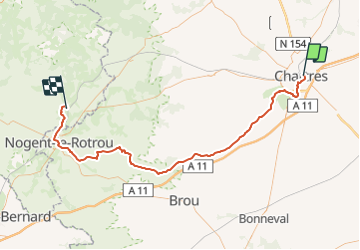
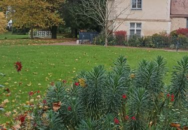
Tour Fahrrad von 83 km verfügbar auf Zentrum-Loiretal, Eure-et-Loir, Chartres. Diese Tour wird von pinkzebra vorgeschlagen.
Beschreibung
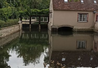
Dynamobile 2016 - Etape 4 (Lundi 18/07) : Chartres - Condé sur Huisne.
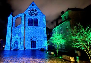
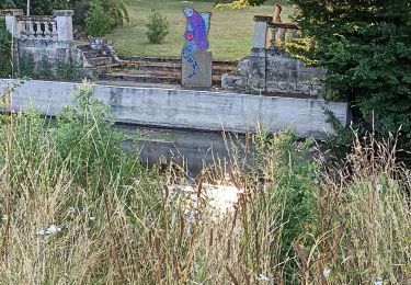
POI: Illiers-Combray (Proust)
Ort
Land:
France
Region :
Zentrum-Loiretal
Abteilung/Provinz :
Eure-et-Loir
Kommune :
Chartres
Standort:
Unknown
Gehen Sie:(Dec)
Gehen Sie:(UTM)
388789 ; 5366680 (31U) N.
Kommentare
Touren in der Umgebung
![Tour Wandern Chartres - Parcours historique Chartres en Lumières - Photo](https://media.geolcdn.com/t/375/260/5af69804-d751-4429-87e4-2de41d93a942.jpg&format=jpg&maxdim=2)
![Wandern Wandern](https://static1.geolcdn.com/sitytour/trail-icons/101.png)
Parcours historique Chartres en Lumières
Wandern
Einfach
Chartres,
Zentrum-Loiretal,
Eure-et-Loir,
France
![](/images/other/stat-length.png)
6,7 km | 7,8 km-effort
1h 42min
![](https://static1.geolcdn.com/siteimages/upload/files/16400158638029165_repeat_loop_refresh_sync_direction_icon.png)
Nein
![Tour Wandern Chartres - Parcours de la ville historique de Chartres - Photo](https://media.geolcdn.com/t/375/260/5e4a7e3c-abb5-42c8-8b44-13932b698f48.jpg&format=jpg&maxdim=2)
![Wandern Wandern](https://static1.geolcdn.com/sitytour/trail-icons/101.png)
Parcours de la ville historique de Chartres
Wandern
Sehr leicht
Chartres,
Zentrum-Loiretal,
Eure-et-Loir,
France
![](/images/other/stat-length.png)
7,7 km | 8,9 km-effort
2h 13min
![](https://static1.geolcdn.com/siteimages/upload/files/16400158638029165_repeat_loop_refresh_sync_direction_icon.png)
Nein
![Tour Wandern Chartres - balade autour cathédrale de Chartres - Photo](https://media.geolcdn.com/t/375/260/589e1a6c-9aee-41e4-b0c1-21e1dc04e42e.jpg&format=jpg&maxdim=2)
![Wandern Wandern](https://static1.geolcdn.com/sitytour/trail-icons/101.png)
balade autour cathédrale de Chartres
Wandern
Einfach
Chartres,
Zentrum-Loiretal,
Eure-et-Loir,
France
![](/images/other/stat-length.png)
5,3 km | 6,1 km-effort
2h 31min
![](https://static1.geolcdn.com/siteimages/upload/files/16400158638029165_repeat_loop_refresh_sync_direction_icon.png)
Ja
![Tour Wandern Gasville-Oisème - proj 2020_20190716Oiseme - Photo](https://media.geolcdn.com/t/375/260/ext.jpg?maxdim=2&url=https%3A%2F%2Fstatic1.geolcdn.com%2Fsiteimages%2Fupload%2Ffiles%2F1553511878bg_sport_marche.png)
![Wandern Wandern](https://static1.geolcdn.com/sitytour/trail-icons/101.png)
proj 2020_20190716Oiseme
Wandern
Sehr leicht
(1)
Gasville-Oisème,
Zentrum-Loiretal,
Eure-et-Loir,
France
![](/images/other/stat-length.png)
10,8 km | 12,7 km-effort
2h 35min
![](https://static1.geolcdn.com/siteimages/upload/files/16400158638029165_repeat_loop_refresh_sync_direction_icon.png)
Ja
![Tour Mountainbike Mainvilliers - Les planeurs de la base des planeurs d''Armenonville - Chartres - Photo](https://media.geolcdn.com/t/375/260/ext.jpg?maxdim=2&url=https%3A%2F%2Fservices.sitytrail.com%2FGeolivesWS%2FDownloadMedia.ashx%3FTrailID%3D172818%26Media%3D14251_6.jpg)
![Mountainbike Mountainbike](https://static1.geolcdn.com/sitytour/trail-icons/202.png)
Les planeurs de la base des planeurs d''Armenonville - Chartres
Mountainbike
Medium
(1)
Mainvilliers,
Zentrum-Loiretal,
Eure-et-Loir,
France
![](/images/other/stat-length.png)
53 km | 60 km-effort
4h 0min
![](https://static1.geolcdn.com/siteimages/upload/files/16400158638029165_repeat_loop_refresh_sync_direction_icon.png)
Ja
![Tour Nordic Walking Chartres - 2024 MB Jardin d'horticulture, Lèves - Photo](https://media.geolcdn.com/t/375/260/0e4f5937-b923-45b6-86aa-21a4f2d5122d.jpg&format=jpg&maxdim=2)
![Nordic Walking Nordic Walking](https://static1.geolcdn.com/sitytour/trail-icons/102.png)
2024 MB Jardin d'horticulture, Lèves
Nordic Walking
Einfach
Chartres,
Zentrum-Loiretal,
Eure-et-Loir,
France
![](/images/other/stat-length.png)
9,4 km | 10,5 km-effort
1h 55min
![](https://static1.geolcdn.com/siteimages/upload/files/16400158638029165_repeat_loop_refresh_sync_direction_icon.png)
Ja
![Tour Wandern Chartres - 2023 Chartres tour de ville - Photo](https://media.geolcdn.com/t/375/260/dc0d9c93-9da7-45cc-94c6-fd51d08d97c6.jpg&format=jpg&maxdim=2)
![Wandern Wandern](https://static1.geolcdn.com/sitytour/trail-icons/101.png)
2023 Chartres tour de ville
Wandern
Einfach
Chartres,
Zentrum-Loiretal,
Eure-et-Loir,
France
![](/images/other/stat-length.png)
11,3 km | 12,4 km-effort
1h 58min
![](https://static1.geolcdn.com/siteimages/upload/files/16400158638029165_repeat_loop_refresh_sync_direction_icon.png)
Ja
![Tour Wandern Luisant - 2023 poney club Luisant - Photo](https://media.geolcdn.com/t/375/260/f79cf83c-4943-43a3-b8fd-6c24cb55f677.jpg&format=jpg&maxdim=2)
![Wandern Wandern](https://static1.geolcdn.com/sitytour/trail-icons/101.png)
2023 poney club Luisant
Wandern
Schwierig
Luisant,
Zentrum-Loiretal,
Eure-et-Loir,
France
![](/images/other/stat-length.png)
10,8 km | 12,3 km-effort
2h 48min
![](https://static1.geolcdn.com/siteimages/upload/files/16400158638029165_repeat_loop_refresh_sync_direction_icon.png)
Ja
![Tour Nordic Walking Chartres - Chartres Stade GP vers St prest - Photo](https://media.geolcdn.com/t/375/260/38bd2996-8114-4e41-ad68-81ce046a739f.jpg&format=jpg&maxdim=2)
![Nordic Walking Nordic Walking](https://static1.geolcdn.com/sitytour/trail-icons/102.png)
Chartres Stade GP vers St prest
Nordic Walking
Einfach
Chartres,
Zentrum-Loiretal,
Eure-et-Loir,
France
![](/images/other/stat-length.png)
12,9 km | 14,4 km-effort
2h 27min
![](https://static1.geolcdn.com/siteimages/upload/files/16400158638029165_repeat_loop_refresh_sync_direction_icon.png)
Ja