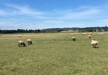

F.DuceyStMalo37H89.369.VTT0

francois58
Benutzer

Länge
89 km

Maximale Höhe
51 m

Positive Höhendifferenz
551 m

Km-Effort
96 km

Min. Höhe
0 m

Negative Höhendifferenz
539 m
Boucle
Nein
Erstellungsdatum :
2016-08-10 00:00:00.0
Letzte Änderung :
2016-08-10 00:00:00.0
6h25
Schwierigkeit : Medium

Kostenlosegpshiking-Anwendung
Über SityTrail
Tour Mountainbike von 89 km verfügbar auf Normandie, Manche, Ducey-les-Chéris. Diese Tour wird von francois58 vorgeschlagen.
Beschreibung
Jour 8/9 d'une randonnée Verviers - Bretagne. Aussi souvent que possible sur petites routes et chemins. Certains passages seront plus confortables en VTT.
Pneus lisses possibles si le temps est sec.
Ort
Land:
France
Region :
Normandie
Abteilung/Provinz :
Manche
Kommune :
Ducey-les-Chéris
Standort:
Unknown
Gehen Sie:(Dec)
Gehen Sie:(UTM)
625677 ; 5386589 (30U) N.
Kommentare
Touren in der Umgebung

Au fil de la Sélune


Wandern
Medium
(1)
Ducey-les-Chéris,
Normandie,
Manche,
France

8,6 km | 9,5 km-effort
2h 0min
Ja

Pontaubault - Roche de Thorin


Wandern
Medium
Pontaubault,
Normandie,
Manche,
France

12,6 km | 13,8 km-effort
3h 38min
Ja

Pontaucault - Mont-Saint-Michel


Radtourismus
Sehr schwierig
Pontaubault,
Normandie,
Manche,
France

39 km | 42 km-effort
4h 14min
Ja

Véloscénie Ducey Mont St Michel


Radtourismus
Sehr leicht
Ducey-les-Chéris,
Normandie,
Manche,
France

33 km | 36 km-effort
2h 51min
Nein

Courtils


Wandern
Sehr leicht
Poilley,
Normandie,
Manche,
France

14,9 km | 15,9 km-effort
3h 46min
Nein

Ducey


Wandern
Einfach
(1)
Ducey-les-Chéris,
Normandie,
Manche,
France

11,5 km | 12,6 km-effort
2h 47min
Ja

Autour de la Roche qui Boit


Laufen
Sehr schwierig
Saint-Laurent-de-Terregatte,
Normandie,
Manche,
France

12,4 km | 16,7 km-effort
1h 30min
Ja

Autour de la Roche qui Boit


Wandern
Sehr schwierig
Saint-Laurent-de-Terregatte,
Normandie,
Manche,
France

12,4 km | 16,7 km-effort
3h 30min
Ja

Le Val de l'Oir


Fahrrad
Medium
Ducey-les-Chéris,
Normandie,
Manche,
France

28 km | 35 km-effort
2h 0min
Nein


 SityTrail


