![](/images/other/stat-length.png)
![Tour Mountainbike Montjustin - Liaison VTT Grande Traversée de Vaucluse - Grande Traversée Alpes-Provence - Photo](https://media.geolcdn.com/t/1900/400/ext.pjpeg?maxdim=2&url=https%3A%2F%2Fservices.sitytrail.com%2FGeolivesWS%2FDownloadMedia.ashx%3FTrailID%3D573988%26Media%3D1e3ef8b9-efbf-4b54-ac48-d194f4fb15d4.jpg)
Liaison VTT Grande Traversée de Vaucluse - Grande Traversée Alpes-Provence
Vélo Loisir Provence
Randonnées de Vélo Loisir Provence GUIDE+
![Länge](/images/other/stat-length.png)
![Maximale Höhe](https://static1.geolcdn.com/siteimages/upload/files/1508320355ic_sort_altitude_max_24dp.png)
![Positive Höhendifferenz](https://static1.geolcdn.com/siteimages/upload/files/1508320355ic_sort_den_pos_24dp.png)
![Km-Effort](/images/other/stat-length.png)
![Min. Höhe](https://static1.geolcdn.com/siteimages/upload/files/1508320355ic_sort_altitude_min_24dp.png)
![Negative Höhendifferenz](https://static1.geolcdn.com/siteimages/upload/files/1508320355ic_sort_den_neg_24dp.png)
![Boucle](https://static1.geolcdn.com/siteimages/upload/files/16400158638029165_repeat_loop_refresh_sync_direction_icon.png)
![Kennzeichnung](https://services.sitytrail.com/GeolivesWS/DownloadMedia.ashx?TrailID=573988&Media=balise.png)
![Mountainbike](https://static1.geolcdn.com/sitytour/trail-icons/202.png)
1h26
Schwierigkeit : Schwierig
![Scannen Sie diesen QR-Code, um die Tour in der SityTrail-Anwendung zu öffnen](https://capi.geolives.com/qq0zvz2zws4bq2lad0pu/sitytour/trails/573988/qr.png?size=200)
Kostenlosegpshiking-Anwendung
Über SityTrail
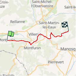
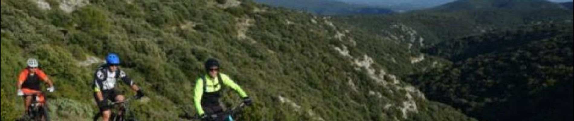
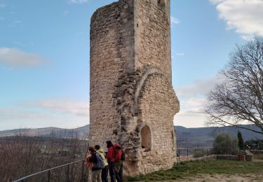
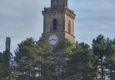
Tour Mountainbike von 16,2 km verfügbar auf Provence-Alpes-Côte d'Azur, Alpes-de-Haute-Provence, Montjustin. Diese Tour wird von Vélo Loisir Provence vorgeschlagen.
Beschreibung
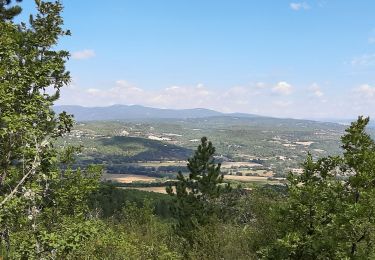
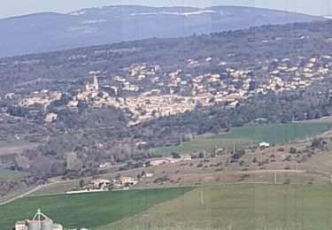
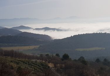
By a succession of tracks which snake along the rounded ridge and wooded crest of the eastern Luberon, with beautiful views to the north and the south, this link can be taken in both directions: On leaving “La Grande Traversée de Vaucluse” via the Luberon at Manosque or on extending the “La Grande Traversée Alpes-Provence” and “LaTransverdon” across the Luberon.
Ort
Kommentare
Touren in der Umgebung
![Tour Wandern Céreste - CERESTE .PRIEURÉ DE CARLUC N - Photo](https://media.geolcdn.com/t/375/260/831b0a2c-7338-4c58-839a-49cbe3dc2550.jpg&format=jpg&maxdim=2)
![Wandern Wandern](https://static1.geolcdn.com/sitytour/trail-icons/101.png)
Wandern
![](/images/other/stat-length.png)
![](https://static1.geolcdn.com/siteimages/upload/files/16400158638029165_repeat_loop_refresh_sync_direction_icon.png)
![Tour Wandern Reillanne - reillane. carluc - Photo](https://media.geolcdn.com/t/375/260/a5a55962-1bef-44bc-99af-6edbc297f6a6.jpg&format=jpg&maxdim=2)
![Wandern Wandern](https://static1.geolcdn.com/sitytour/trail-icons/101.png)
Wandern
![](/images/other/stat-length.png)
![](https://static1.geolcdn.com/siteimages/upload/files/16400158638029165_repeat_loop_refresh_sync_direction_icon.png)
![Tour Wandern Reillanne - 2024-03-01 Tour de Reillanne - Photo](https://media.geolcdn.com/t/375/260/71fa3e0d-dd40-4573-92ce-a7ebbe393b9d.jpg&format=jpg&maxdim=2)
![Wandern Wandern](https://static1.geolcdn.com/sitytour/trail-icons/101.png)
Wandern
![](/images/other/stat-length.png)
![](https://static1.geolcdn.com/siteimages/upload/files/16400158638029165_repeat_loop_refresh_sync_direction_icon.png)
![Tour Wandern Céreste - Colline de la Gardette-Céreste-08-05-23 - Photo](https://media.geolcdn.com/t/375/260/a8b4d2c3-aa6a-406b-8845-5eda9206752a.jpg&format=jpg&maxdim=2)
![Wandern Wandern](https://static1.geolcdn.com/sitytour/trail-icons/101.png)
Wandern
![](/images/other/stat-length.png)
![](https://static1.geolcdn.com/siteimages/upload/files/16400158638029165_repeat_loop_refresh_sync_direction_icon.png)
![Tour Wandern Céreste - Cereste - Photo](https://media.geolcdn.com/t/375/260/207a6c62-29ec-454a-a989-b91a6e9da588.jpg&format=jpg&maxdim=2)
![Wandern Wandern](https://static1.geolcdn.com/sitytour/trail-icons/101.png)
Wandern
![](/images/other/stat-length.png)
![](https://static1.geolcdn.com/siteimages/upload/files/16400158638029165_repeat_loop_refresh_sync_direction_icon.png)
![Tour Wandern Vitrolles-en-Luberon - Mascas Mourre negre - Photo](https://media.geolcdn.com/t/375/260/ec51df23-2df3-41b4-a86b-282bb2a3d7ef.jpg&format=jpg&maxdim=2)
![Wandern Wandern](https://static1.geolcdn.com/sitytour/trail-icons/101.png)
Wandern
![](/images/other/stat-length.png)
![](https://static1.geolcdn.com/siteimages/upload/files/16400158638029165_repeat_loop_refresh_sync_direction_icon.png)
![Tour Wandern Vitrolles-en-Luberon - vitrolles en Lubéron. aire des mascas - Photo](https://media.geolcdn.com/t/375/260/0ccb0f0d-bff8-46ee-add9-4b453c363566.jpg&format=jpg&maxdim=2)
![Wandern Wandern](https://static1.geolcdn.com/sitytour/trail-icons/101.png)
Wandern
![](/images/other/stat-length.png)
![](https://static1.geolcdn.com/siteimages/upload/files/16400158638029165_repeat_loop_refresh_sync_direction_icon.png)
![Tour Wandern Montfuron - 1Montfuron, Villemus via la Colle et le Moulin. - Photo](https://media.geolcdn.com/t/375/260/27afe6be-9881-4392-aab5-e827ee1d3dcc.jpg&format=jpg&maxdim=2)
![Wandern Wandern](https://static1.geolcdn.com/sitytour/trail-icons/101.png)
Wandern
![](/images/other/stat-length.png)
![](https://static1.geolcdn.com/siteimages/upload/files/16400158638029165_repeat_loop_refresh_sync_direction_icon.png)
![Tour Wandern Montfuron - 1Montfuron, le relais de Villemus - Photo](https://media.geolcdn.com/t/375/260/7ddb72e4-9bc2-4baa-9c88-e280c15c9339.jpg&format=jpg&maxdim=2)
![Wandern Wandern](https://static1.geolcdn.com/sitytour/trail-icons/101.png)
Wandern
![](/images/other/stat-length.png)
![](https://static1.geolcdn.com/siteimages/upload/files/16400158638029165_repeat_loop_refresh_sync_direction_icon.png)