


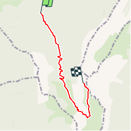

8,1 km | 18,5 km-effort


Benutzer


Kostenlosegpshiking-Anwendung
 SityTrail
IGN / Geografische Institute
SityTrail World
Die Welt öffnet sich für Sie
Tour Wandern von 4,7 km verfügbar auf Auvergne-Rhone-Alpen, Hochsavoyen, Alex. Diese Tour wird von McDft vorgeschlagen.
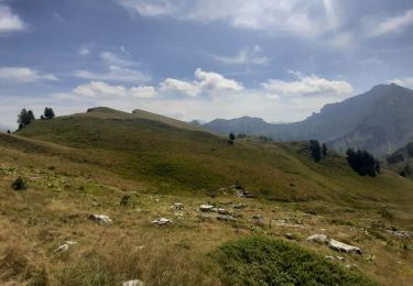
Le début de cette randonnée est soutenu jusqu'à ce qu'on atteigne le chalet de l'Aulp dessous. La traversée des alpages qui suivent est agréable.

Wandern
Wandern

Wandern

Wandern

Wandern

Wandern
Wandern
Wandern

Radtourismus